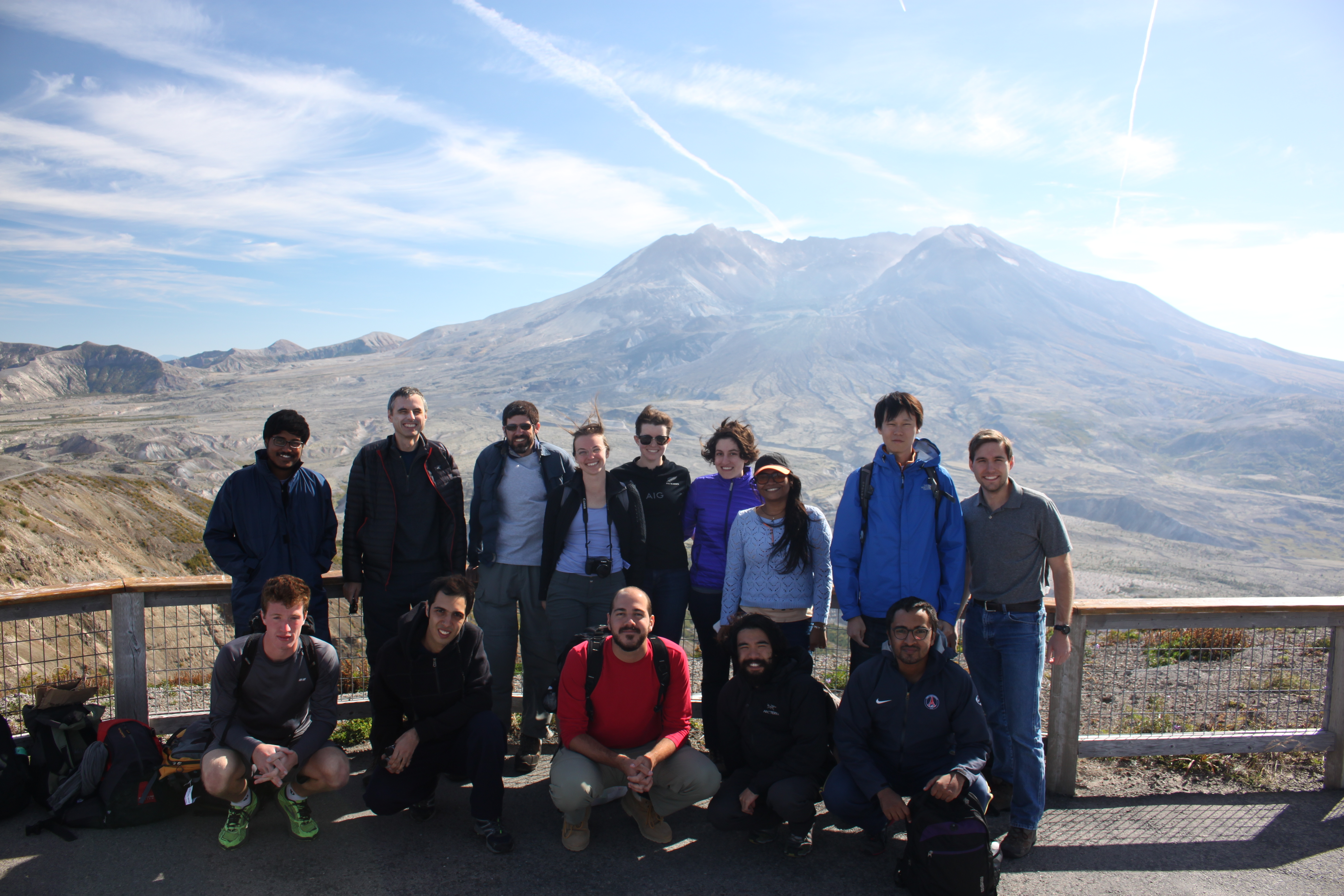
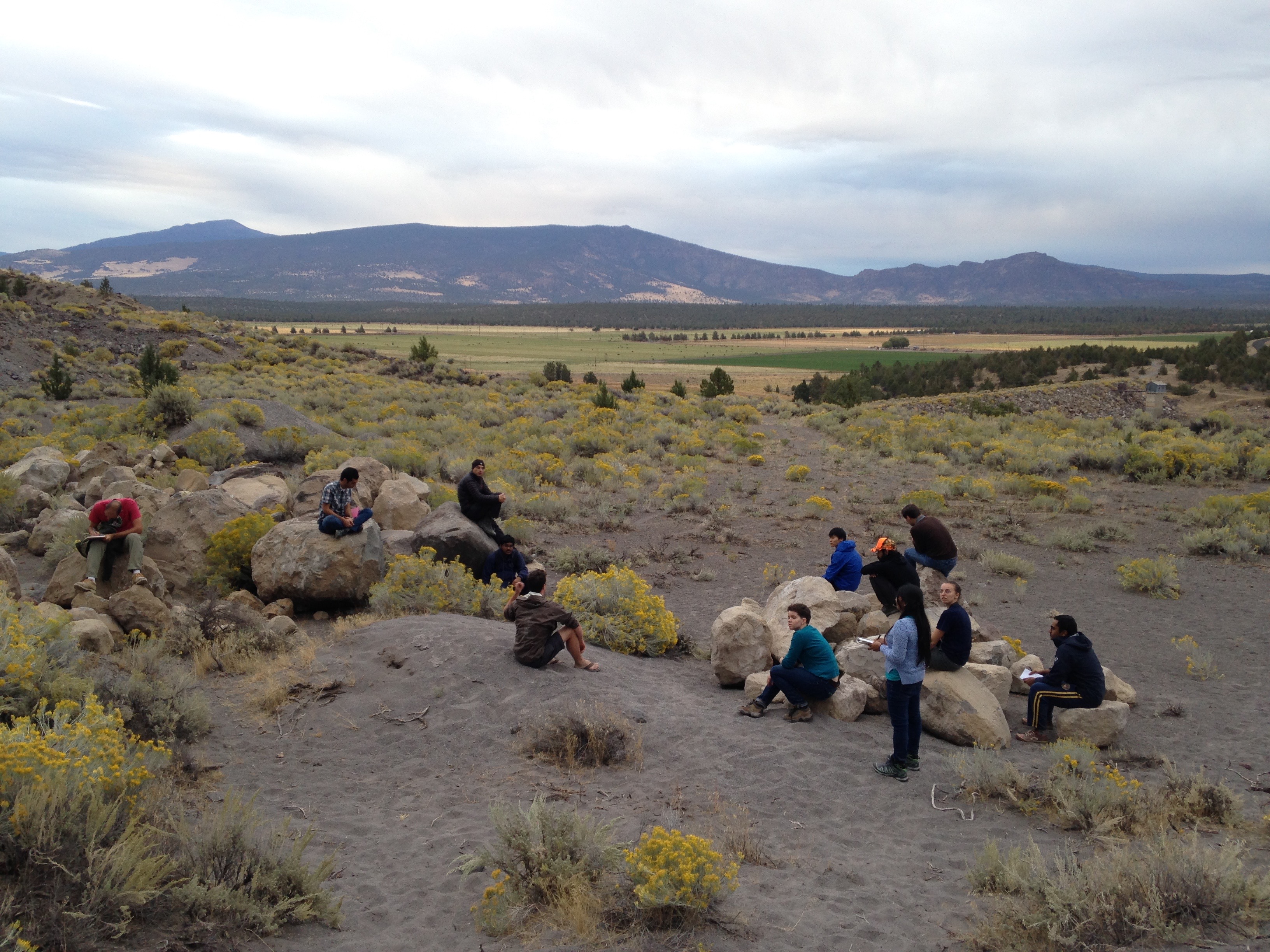
Earth Structure and Deformation: Field Trip 2016

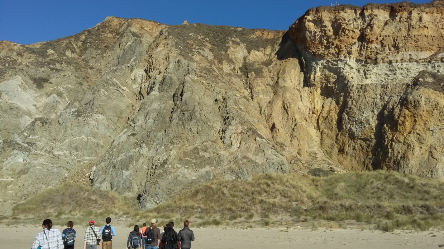
It was a nice and sunny Saturday when we started our journey on I-10 going west of Houston. We crossed Pleistocene and thin Pliocene rocks until we were near the Little Low Miocene Hills of Columbus, a very small strip. Finally, we arrived at our first stop where lower Cretaceous rocks onlap onto basement rocks. We noticed that Oligocene rocks were missing.


Day 1:

Walnut Formation Road Cut (Stop 1)

Location N 030.29947 W 097.82767

Elevation: 297 m

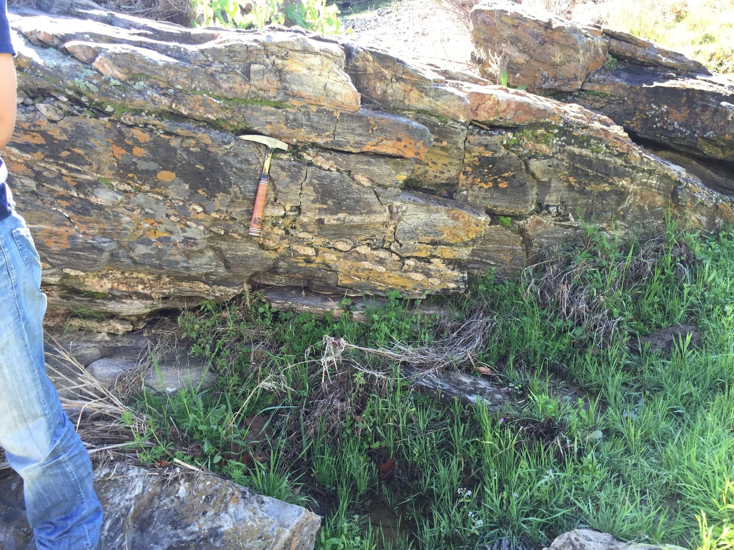
At this stop, we saw Glenrose basement rock overlain by Walnut Formation (110 Ma). The lithology of the Walnut Formation is a lime mud marl (limestone), and the beds seen are horizontal and fissile. The beds contain fossils and some of the fossils found include the famous Devil’s toenail (exogyra), oyster, snails and warm burrows. The worm burrows are indicative of a depositional environment with ubiquitous bioturbation. Since it was quiet enough for worms to burrow and mud to be deposited, we speculated that the depositional environment was lagoonal. If this is the case, it could be an indicator of paleo sea level.
There is an enigma surrounding the Walnut formation. If it was formed close to sea level, how is it that the elevation is now 297 m today? The question of when and how the Llano Uplift (part of the Edwards Plateau) occurred is still a mystery in geology. Some researchers have pinned it to Oligocene time. As far as how it occurred, several theories exist: (1) magmatic underplating from ultramafic intrusions along the Balcones Escarpment; (2) a flexural response from forebulge to the coastal basin; and (3) Jurassic salt moving to the surface, causing Cretaceous rocks to slide and creating offset.


000


Transition from Glen Rose to Walnut Formation moving upwards. Glen Rose has harder, regular bedding, where Walnut has muddy Cretaceous limestone.

001


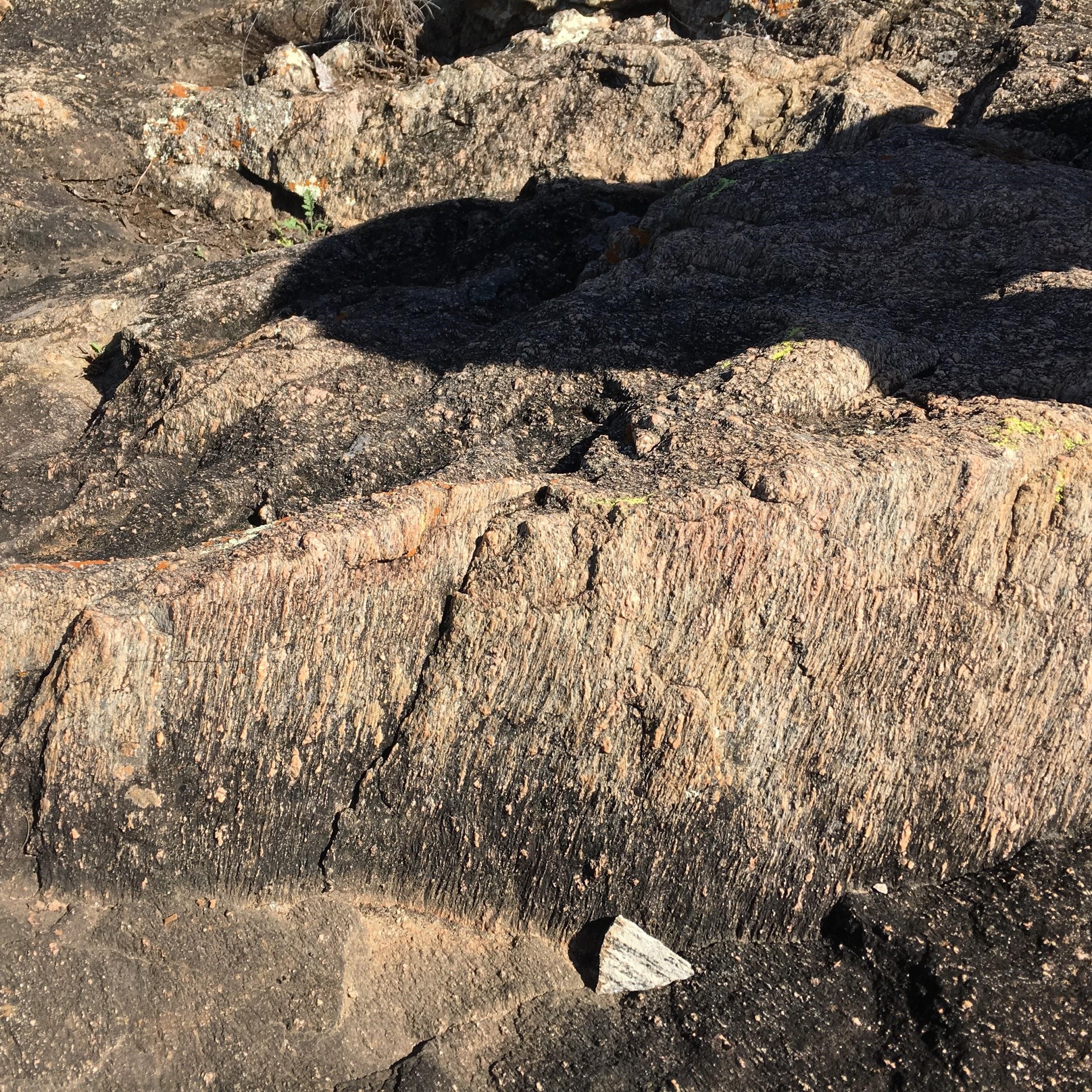
Close-up of the Walnut Formation. Contains visible shelled organisms and exhibits diffuse bedding.


Ellenberger Group, Honeycut Formation (Stop 2)

Location: N 030.553777 W 098.26020

Elevation: 246 m

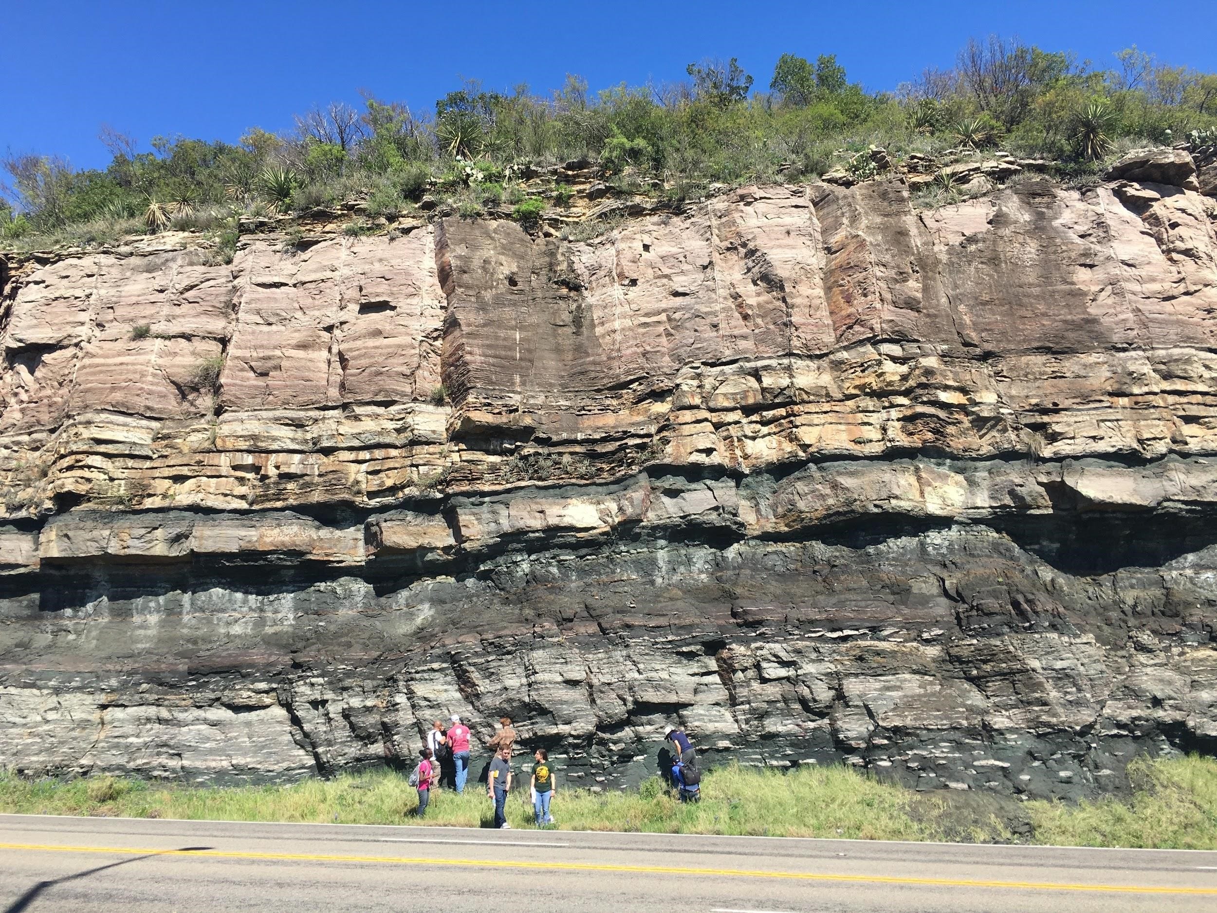
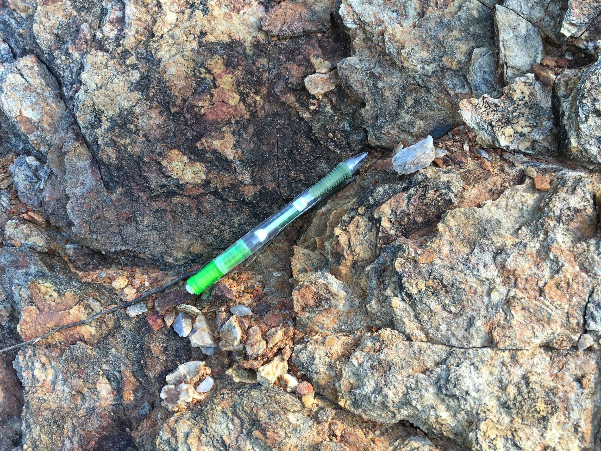
The Honeycut Formation is Ordovician in age. About 100 m of limestone has been eroded here in comparison to the Walnut Formation, and this is reflective of the erosional window of the Llano Uplift. The formation is highly laminated and contains bacterial mats (stromatolites which grow on tidal flats). There might also be some stylolites although it is not certain. Barnett Shale, which is Mississippian-Devonian in age, can also be seen at this outcrop, but it is very thin.
In West Texas, the Ellenberger limestone is a major carbonates reservoir where it was exposed, karsted, faulted, and later sealed. The faults here are related to the Ouachita orogeny (which is younger than 300 Ma) and analogous to the Alleghanian orogeny of North America. Although the Honeycut marble is the downthrown side of the fault while the granite is upthrown side, the granite appears to be eroding faster than the marble. The result of this is a reverse topography instead of what we would expect from faulting.


002


Stromatolite in the Honeycut Formation.


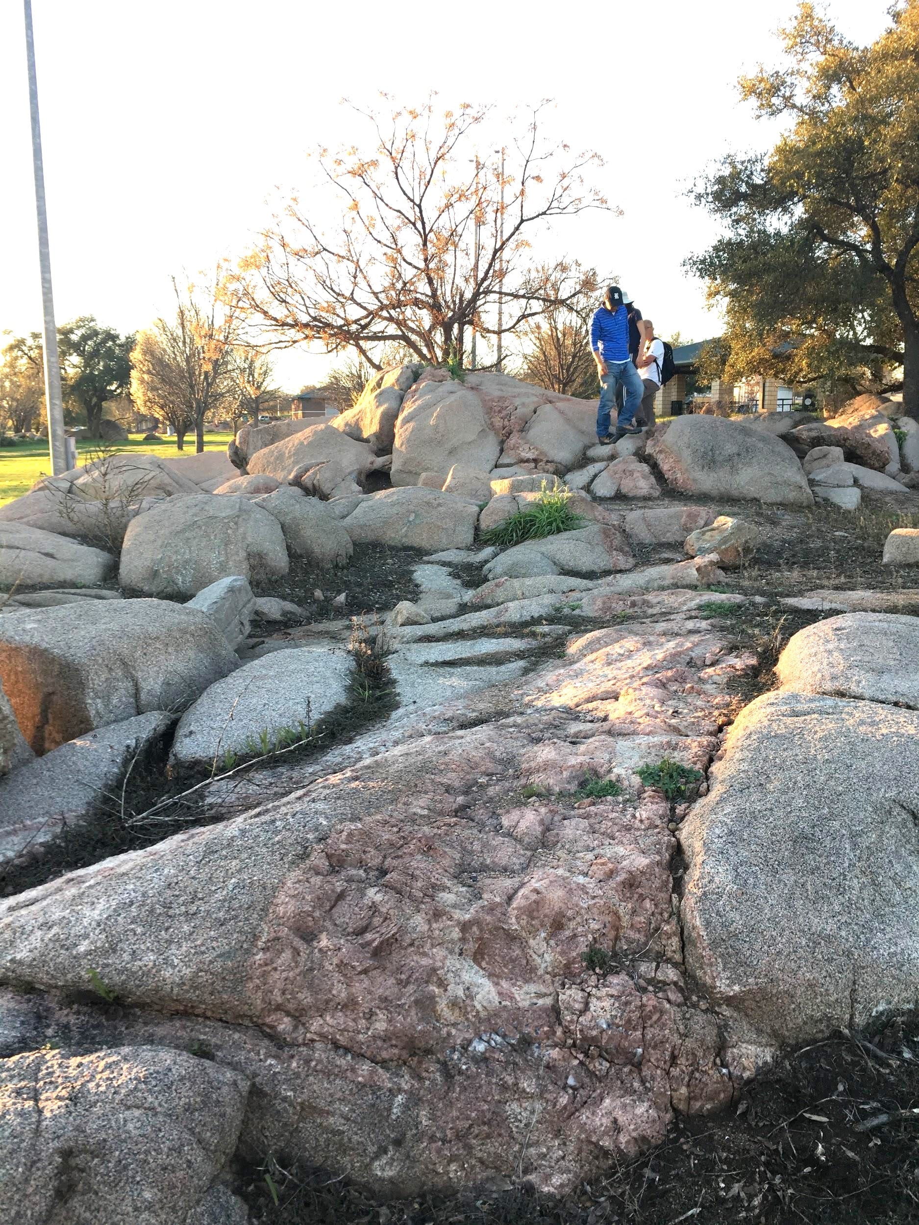
Backbone Ridge (Stop 5)

Location: N 030.64519 W 098.41574

Elevation: 289 m

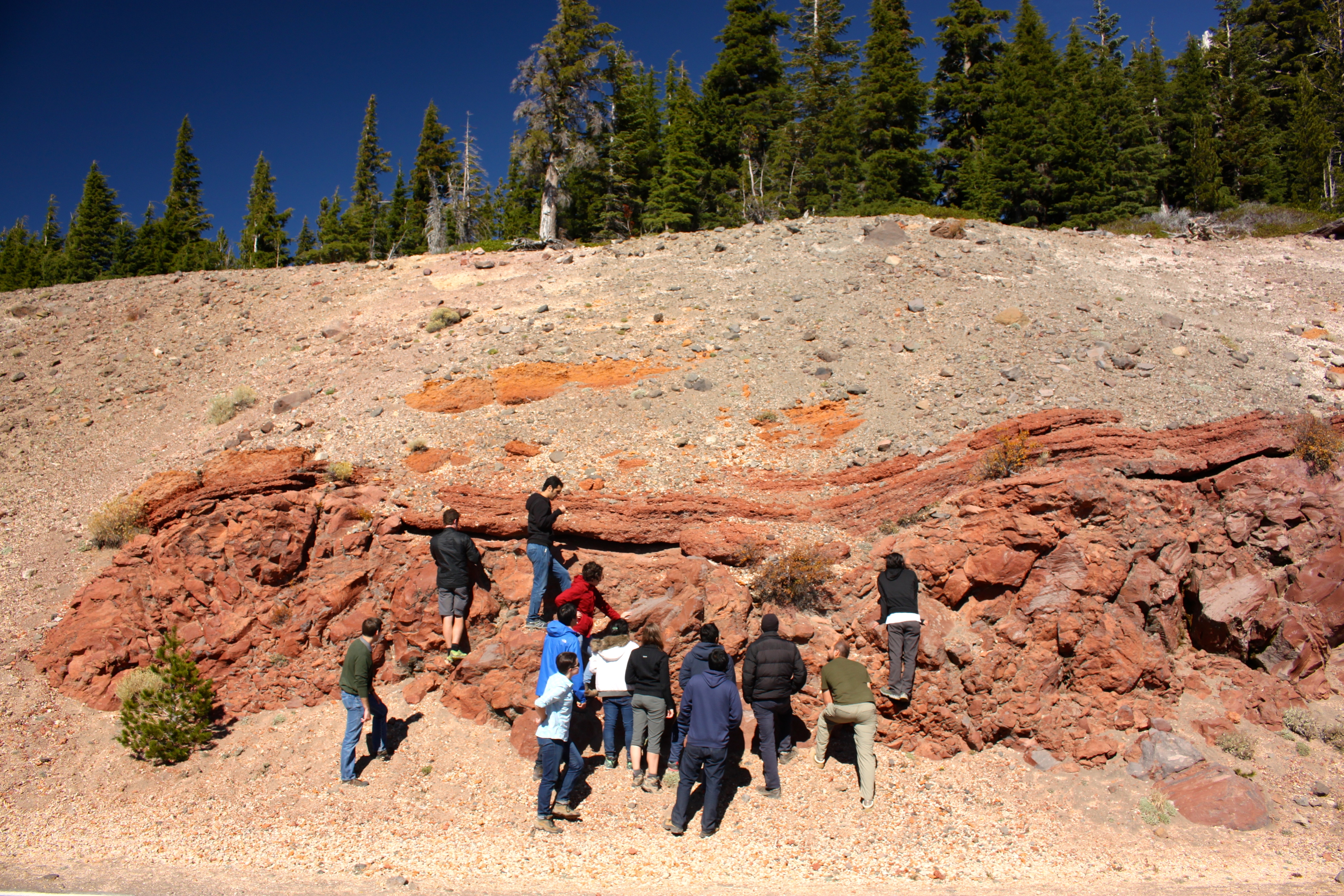
The Cambrian rocks are beneath the Town Mountain Granite, so we should have been in a graben (central downdrop block), but instead we were standing at a local high point. This is another instance of inverted topography due to erosion of the granite which has relatively low resistance. At this stop, we were standing on normal fault with two more faults running perpendicular in the Cambrian rocks before us. The Lion Mountain green sandstone across the road was formed by worm droppings in an anoxic environment, creating a mineral called glauconite. The sandstone is pelletal in texture and contains white lenses that we identified as trilobite hash. There are little muscovites on the surface of the trilobite deposits suggesting past metamorphism. Underlying the Lion Mountain is the upper Hickory Sandstone containing iron oolites, indicating a ferriferous depositional environment. Above the dark green sandstone we observed a color change to whitish-green and a compositional change to coarser grains containing more quartz. This is indicative of the depositional environment moving inland up the strata with the upper rock likely deposited in a shoreface to backshore setting. The whitish-green then transitions upward into a pink and green rock. The presence of herringbone bedding within this upper section signifies a tidal phase, perhaps an offshore to lagoonal environment. Overall the Lion Mountain Sandstone is less resistant than the overlying strata. Within the whole body we found an oxidized strike slip fault with mellow plunge in the slickenlines.

003


Predominately strike-slip fault (with some thrusting) in Lion Mountain Sandstone. Directionality indicated by slickenlines on red Fe-stained parts of glauconite on right side of fault.


004

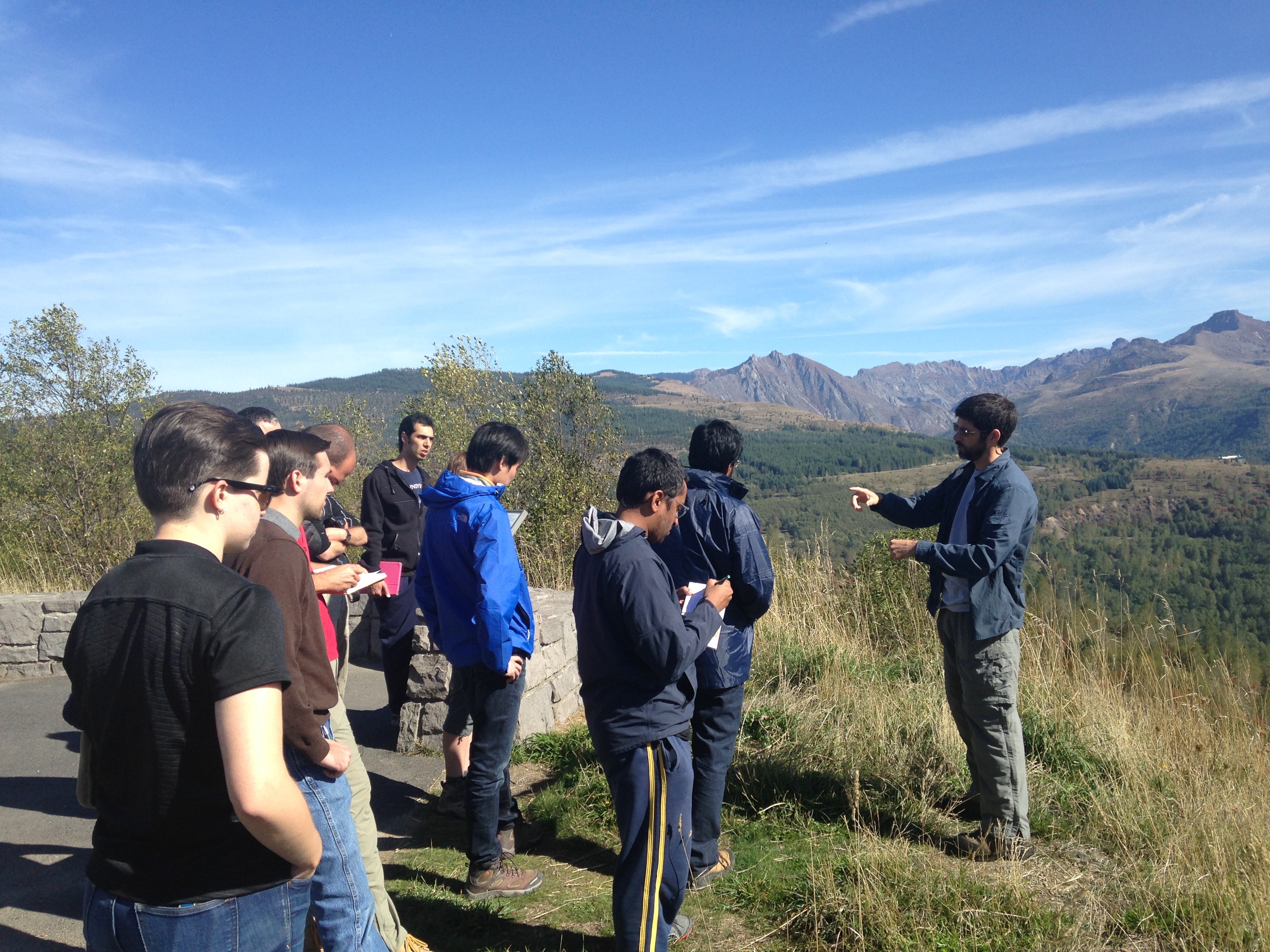
Students looking at the Lion Mountain Sandstone.


Valley Spring Gneiss and Granite, Inks Lake State Park (Trip 6 PC Guide Stop 3)

Location: N 030.74855 W 098.35748

Elevation: 278 m

Here we saw heavily deformed quartzofeldspathic gneiss among other schists and gneiss. Up to four generations of folds and five associated foliations were able to be identified, all of which except the last were penetrative and seen through the whole area. Granitic dikes and intrusions were present and responsible for local metamorphism.

                                                                                005                                                                                                                                                                                                   


Granitic dike cutting through the Valley Spring Gneiss.

006


Distinct F3 fold in the Valley Spring Gneiss.


Valley Spring Gneiss (Trip 6 PC Guide Stop 2)

Location: N 030.75404 W 098.67634

Elevation: 281 m

For our last stop on Day 1, we examined a synform in the Valley Spring Gneiss by the Llano River. We measured the attitudes for several mineral foliations, plotted them on a stereonet, and attempted to match the data to our observations. At another spot by the river, we observed a Valley Spring pluton dated approximately 1250 Ma with a dynamothermal overprint dated 119 Ma. We noted that there was not much foliation in the country rock. The texture of the rock suggests that it was not highly metamorphosed.


007


Old Valley Spring pluton by the Llano River.


Day 2:

Highway 71 Outcrop (Mosher Day 1 Stop 4)

Location: N 030. 63010 W 098.52912

Elevation: 296 m

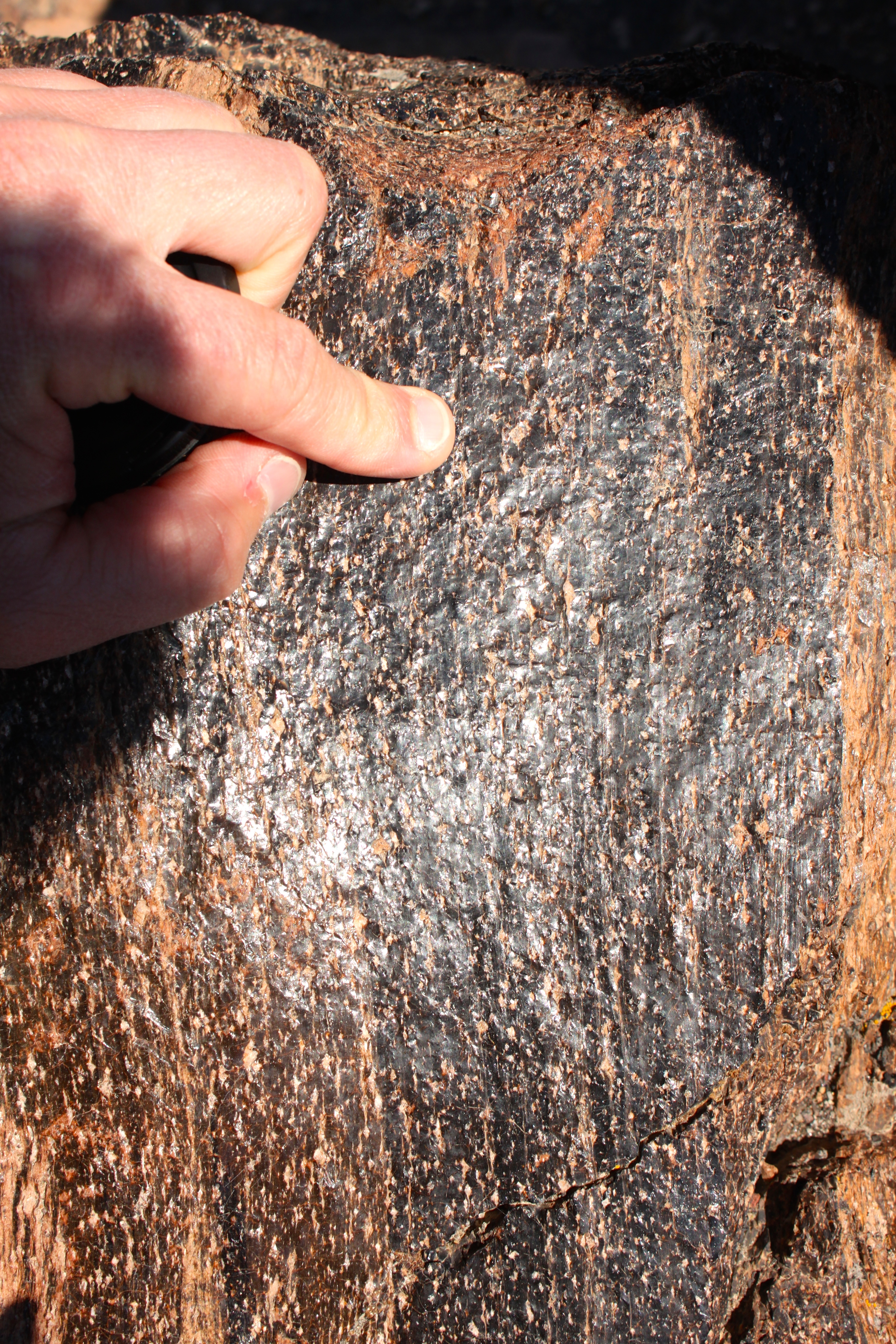
At this stop we observed the graphitic Packsaddle Schist. Lightened zones indicate the graphite was volatilized during intrusion, oxidizing the rock along the boundary and bleaching it. Overall the schist is blue in color with white folded quartz veins. It is fairly resistive and contains S1 and S2 folds. Little knots of quartz represent the old fold axis of the formation, and the initial folds appeared to be very ductile. We measured the trends and plunges of various foliations. The folds are typically isoclinal with some shearing, and the plunges of the fold axes range from steep to shallow. Within the schist we observed some vestige of the sedimentary protolith, a dark shale stacked atop a light sand. We noted sheaf folds and contemporaneous multi-directional folding, unique kinematic indicators for shear. The timing of the main assembly of the schist dates to 1140 Ma, predating the intrusion of the Town Mountain Granite. These schists are roughly the same grade as the gneiss we saw the previous day; both were metamorphosed at the amphibolite facies.

Some trends and plunges of fold axes:

  1. N50ºW, 43º
  2. N20ºW, 34º
  3. N40ºW, 15º
  4. N55ºW, 31º
  5. N15ºW, 39º
  6. N60ºW, 12º


008


Packsaddle Schist containing graphitic layers (dark banding) and folded quartz veins (white).


Cordierite (Added Stop)

Location: N 030.53540 W 098.44107

Elevation: 282 m

The next roadcut we stopped at was notable because of the presence of cement-like cordierite nodules which statically overprint the rock’s foliation. Cordierite is characteristic of high temperature, low pressure contact metamorphism associated with later stage plutonism. It contains no clear crystal structure and is only visible in thin section. Since the cordierite overprints foliation but exhibits none itself, we know that this stage of plutonism postdates folding. The Packsaddle rock here is more schist-like than what we saw at the last stop; the protolith is less obvious.

009


Packsaddle Schist with cordierite indicated by the weathering pattern. The cordierite is more resistant than the schist.


White Creek Ford (Mosher Day 1 Optional Stop 3)

Location: N 030.45692 W 098.482931

Elevation: 255 m

At this stop, we had an opportunity to see a rock specific to Texas, llanite. Llanite typically has blue quartz phenocrysts and K-feldspar. We saw some of these diagnostic characterics in the rocks surrounding the llanite dike that cut through the area. This dike is dated at 1098 Ma and indicative of late-stage rhyolitic igneous activity. Due to the lack of metamorphic overprint, the area is estimated to be at least 20 million years younger than the Town Mountain Granite not far from there. Further, the surrounding rocks had an aphanitic texture due to being injected into the mix at a shallower depth. They had to formed near the surface to avoid crystal growth and develop this texture.

An interesting feature we observed in this area included veins that were folded. First, in order for the veins to be formed, the rocks had to exhibit brittle behavior by cracking, and then later on exhibit ductile behavior for the veins to then be folded. This brought up the transition between brittle and ductile behavior which can occur due to changes in temperature, overburden pressure, or strain rate. The boudinage of the veins also indicated flow after formation. We also saw some crenulation folding that indicates a later extensional event due to its lack of offset from the main formation.

010


Classic “boudinage” feature.


Sandy Creek Shear Zone (Mosher Day 1 Stop 3a)

Location: N 030.54169 W 098.56100

Elevation: 292 m

The Sandy Creek Shear Zone is home to unique rocks that were crushed at high pressure and low temperature. We inferred these conditions from the crushed rock grains that lack evidence of recrystallization. At this stop we could also see another rock very specific to Texas, the Town Mountain Granite. This felsic granite appears to have orthoclase, hornblende, K-feldspar, quartz, and mica. The granite owes its pink color to abundant K-spar. In some places, the rock looks very “beat up” in that it has discrete fractures and seems to have undergone violent deformation at temperatures much lower than the solidus of the rock. Very little of the protolith was left untouched. The granite has been sheared but not recrystallized due to its location at shallow depths in the crust.

This formation brought up the brittle vs. ductile deformation question again when we observed that the sheared granite was brecciated to a fine-grained texture. Does the cataclastic but cohesive nature of the rock mean that there was some sort of cataclastic flow? This formation was a prime example of the blurred and ill-defined boundary between brittle and ductile deformation and could perhaps represent some sort of boundary condition between these two categories. The fact that there are mylonites half a kilometer down the road from this formation and its relative location indicates that the Sandy Creek Shear Zone is a point of contact between the Coal Creek and Packsaddle domains.

011


Brecciated sheared granite exhibiting cataclastic flow.


Augen Gneiss (Mosher Day 1 Stop 3b)

(Approximate)

Location: N 030.54169 W 098.56100

Elevation: 292 m

The gneiss here is similar in lithology to the rock at the Sandy Creek Shear Zone. Unlike the previous stop, this rock has been recrystallized after flowing. High-temperature ductile flow and partial melting occurred. This outcrop is a mylonite, meaning that grain size was reduced by plastic deformation during recrystallization. Minerals more resistant to grain size reduction, such as orthoclase feldspar, were rolled during deformation, resulting in clear mineral lineations and classic augen gneiss eye-like feldspar features. These rocks were clearly hotter than at the previous site, yet sit topographically higher, indicating that they likely did not undergo contemporaneous deformation.

012


Augen gneiss outcrop with mineral lineations lying on a foliation plane.


Red Mountain Ranch (Mosher Day 1 Stop 3c)

Location: N 030.51822 W 098.55237

Elevation: 312 m

Here the cataclastic flow and mylonite from the previous two stops (4 and 5 respectively) are interwoven. This leads us to believe that the two different flow features at their respective sites must represent the early and late stage of the same shear zone. Additionally, this locality is near the transition into the Packsaddle Schist, sitting at the base of the Coal Creek domain.

013


Interwoven cataclastic flow and mylonite.


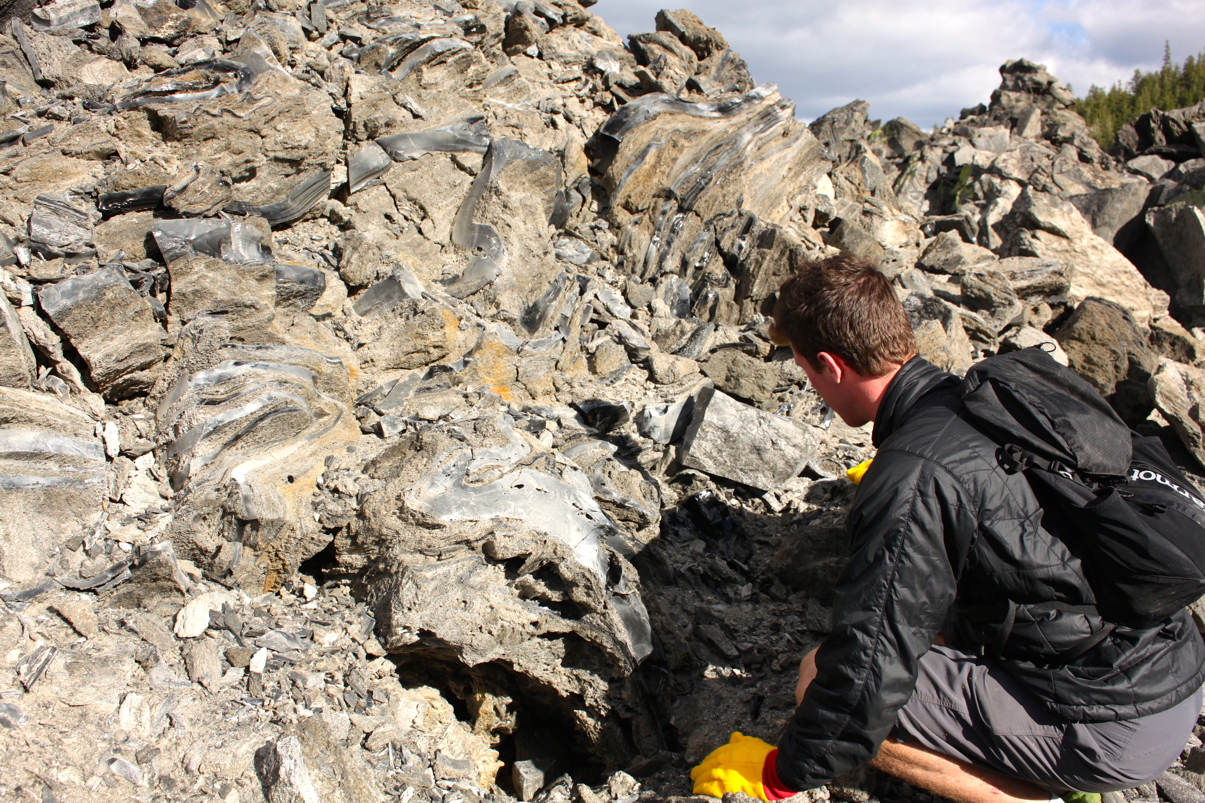
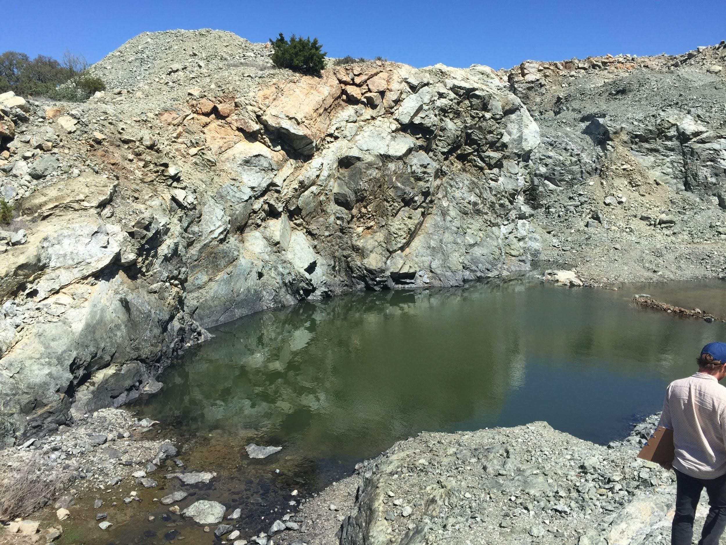
Serpentinite Quarry (Mosher Day 1 Stop 2)

Location: N 030.47915 W 098. 63175

Elevation: 332 m

The serpentinite seen at the quarry here is a 6 km long section of the Coal Creek Domain. Derived from ultramafic, low crustal rocks, the serpentinite records a complex history of multiple instances of metamorphism, serpentinization, and deformation. It is thought that the serpentinite was deposited originally as a olivine-rich harzburgite and was subsequently serpentinized during tectonic emplacement. Following emplacement, the unit underwent regional deformation and metamorphism during which it was de-serpentinized. Finally, as granites were emplaced in the area, associated metamorphism anthophyllite grew and, as temperatures fell, serpentinization happened again due to hot water from the granite.

014


Serpentinite quarry at the final stop.

ESCI 322 Field Trip: Mysterious Visitors from the Deep

Pic1

Photo credit: Hehe Jiang

This blog describes the 3-day field trip that the Fall 2015 ESCI 322 class took to northern California with Professors Cin-Ty Lee & Rajdeep Dasgupta and TA Laura Carter, as told by the undergraduate students: Sofia Avendano, Anthony Foster, Alexandra Homes, Garrett Lynch, Oliver Lucier, Ian Mellor-Crummey, Leila Wahab, Shannon Wang, and Sam Zapp.

Day 1:

Marin Headlands (chert):

Pic2

Garrett Lynch in front of deformed cherts

This site overlooked San Francisco Bay directly across the Golden Gate Bridge. During the Jurassic period, following Pangaea, the Farallon plate subducted underneath the western North American plate.

At this stop we saw silica-rich cherts on top of ancient oceanic crust. The cherts were once laminated sedimentary deposits formed from diatoms and during subduction were scraped off as part of the accretionary prism. These specific cherts formed near the equator, probably during the Jurassic era. In composition, these cherts are 99% silica, but also contain some iron and manganese. This composition arose as iron and manganese were dispelled from the mid-oceanic ridges and deposited within the silicic ooze that becomes chert. We also noticed fractures filled with quartz in the form of white veins. Over to the right we saw darker, older, green bands, which had not been oxidized.

Marin Headlands (pillow basalts):

Pic3

Students Oliver Lucier and Sam Zapp looking at a pillow basalt outcrop with Garrett Lynch and Alexandra Holmes looking on from above and TA Laura Carter from below.

The pillow basalts here formed from magma that upwelled due to the divergent boundary at the mid-ocean ridge and was erupted underwater. Zoned phenocrysts of plagioclase feldspar were visible, indicating that they grew intrusively before eruption. The surrounding fine grained matrix was extruded on the seafloor where it cooled quickly. The edge of each pillow featured a glassy rind where the surface of the lava body cooled even quicker with direct contact with the water. Layers of chert were deposited on top of these pillows in a marine setting.

Pic5

Professor Dasgupta discussing pillow basalts with the students


Tiburon Peninsula (Eclogite, blueschist, and peridotite, boulder outcrops):

Pic6

Eclogite. Photo credit: Prof Cin-Ty Lee

Here we saw a number of boulder outcrops. Eclogite needs high pressure and high temperature conditions to form, so its presence was indicative of subduction zone setting. Chemically, it is very similar to the pillow basalts we saw earlier at the Marin Headlands, suggesting this may be the protolith. However, the eclogite samples we saw were also enriched in sodium, probably from hydrothermal processes, giving a special form of pyroxene: jadeite. In eclogite, the aluminum in the protolith plagioclase is now held in garnet. As it moved back up through the crust, some of the eclogite retrograded into blueschist, greenschist and amphibolite. The heterogeneity of the metamorphic grade may have been caused by uneven distribution of fluids. The kinetics of retrograde metamorphism can be slow, but the presence of fluids makes retrograde metamorphism occur faster.


Pic7

Students looking at a peridotite xenolith


The last outcrop we saw here was composed of peridotite. It contained orthopyroxene and olivine, so it would be classified as harzburgite. Peridotites with a much greater amount of orthopyroxene are lherzolite. These peridotite xenoliths had a slightly brown / tan coloring due to the weathering at the Earth’s surface. We also saw some serpentinite—altered peridotite—in the area.


Bolinas Lagoon (San Andreas fault, SEALS!):

We observed a rookery of seals accompanied by a lone sea lion as if he meant, through his presence, to elicit an ironical play upon a Danish children’s story. Abreast of these seals, two shovelers swam, feeding, and one merganser swooped through, low, tantalizing the water.

Point Reyes Visitor Center / Earthquake Museum:

Here we did a short nature walk travelling along the path of the San Andreas fault. We saw a fence that was displaced several feet due to previous movement along the fault, which is evidence of an ongoing right lateral strike slip fault.

The beach, the cliffs:

Pic8

Students looking at an unconformity on the beach at Point Reyes. Photo credit: Laura Carter

Along Point Reyes on the Pacific Ocean there was a series of cliffs with igneous outcrops that were the roots of a magma chamber from the Cretaceous next to marine sediments from the Miocene, representing a large unconformity. Here, we could see cross cutting relations in the igneous outcrops where magmas of different compositions interacted. The parental magmas were more basaltic, while the more felsic magmas were much more evolved. The intruding felsic magmas were much more viscous, so they mixed in some places but stayed clearly separate in others, and then froze in place. Mixing of the magmas indicated that the surrounding rock was still magmatic mush when they mingled.

Sharper boundaries between two magmas is also visible. This was likely due to the fact that basalt has a higher melting point, so when it cooled, it contracted and pulled some of the surrounding liquid in. These intrusions occurred further inland from the subduction zone, around 10 km below the surface.

Day 2:

Sedimentary Road Cuts, Ione Formation:

In the foothills of the Sierra Nevada, we saw an outcrop on the exposed shoulder of a highway. Sediments had been collected from the Sierra Nevadas and compacted into layers. The layers originated from granodiorite which lost much of its magnesium and iron, leaving behind what became predominantly kaolinite (Al2SiO5). The lower layers of laminated deltaic sediment gave way to cross-bedding features as a fluvial system moved through the area. At the edges of the formation, there was evidence of soft sediment deformation.

Silver Lake:

We also stopped at Silver Lake for lunch. Beside the lake there were these interesting boulders which appeared to contain clasts of petrified wood. Across the lake we saw large lava flows of andesitic magma, now part of an imposing mountainside.

Pic9

Andesitic lava flows overlooking Silver Lake. Photo credit: Prof Cin-Ty Lee

Mono Lake:

The edge of Mono Lake contains massive collections of tufa deposited in towers. We learned that these tufa deposits are a result of the very alkaline water from the lake mixing with calcium rich spring water from the Sierras, which precipitates calcium carbonate (CaCO3). The tufa deposits become visible and form large columns due to the water level of Mono Lake lowering over time. In the past, the springs feeding Mono Lake were drained to provide water for places like Los Angeles and other urban areas, which made more and more of the tufa deposits visible. Only in recent years has this been slowed and Mono Lake protected.

Pic10

Tufa towers at Mono Lake. Photo credit: Ian Mellor-Crummey

Day 3:

Long Valley Caldera:

The Long Valley Caldera is in the Basin and Range region, which underwent extension. The Caldera was active 2 million years ago, but the last eruption occurred 700,000 years ago and erupted 700,000 m3 of rhyolite. The eruption style was Plinian, which is very explosive, caused by magma fragmentation, and characterized by fine ash. The ash of the eruption spread throughout the western US. There were also resurgent domes with the same magma composition, but with effusive style eruptions since the magmas had already been degassed.

The youngest lava flows were 7,000 years old.  Under the Basin and Range extension, decompression allows the mantle to cross the solidus, which leads to alkalic basaltic magmatism. Basalts that re-melt the crust fractionate and form rhyolites, so there are both extremes here: basalts and rhyolites. It is still unclear how basalts skip to rhyolites with no intermediate composition.

Pic11

Glacial moraine in front of the Sierra Nevadas on the edge of Long Valley Caldera

The actual magma body was 10 km below the surface. The magma body builds up pressure, creating fractures, and, when the pressure exceeds the yield stress of the rock above, the system evacuates and the roof collapses. This has left a low, flat ~10 x 20 km area. Fumaroles, where magmatic gases were still escaping due to residual heat, were also visible.

Around the caldera, there were also moraines, large sediment mounds moved by glaciation, visible along the outskirts in front of the Sierras.

Pic14

Long Valley ignimbrite deposit at Owen’s Gorge. Photo credit: Prof Cin-Ty Lee

Owen’s Gorge:

Pic12

Long Valley ignimbrite containing pink pumice and granitic lithics

At the base of the gorge, we saw evidence of a huge rhyolitic ignimbrite, which must have erupted over an incredibly short period of time (estimated at around 6 days). There were three different layers denoting sequential eruptions. The lowest layer was more porous, with many lateral fractures and no evidence of compaction, which indicates that the lowest layer cooled before the weight of the next eruption could deform it. The texture of this tuff was friable, easily breakable, and it was more silicic than the upper layers. The first layer was probably an initial pulse of small eruptions right before the large eruption. Weak precursor eruptions tend to have ashfall rates slower than cooling rates.
The middle layer had a very clear fabric with small pumice ejecta elongated and oriented in the same direction, which shows that the layer was compacted. Thus it cooled slower than the layer below. The strain of the rock can be found from the aspect ratio of the elongated clasts, perpendicular to the bedding. This layer was welded ignimbrite, which contained fiamme, and was formed under high temperature and pressure. Jointing occurred after cooling due to contraction.

Pic13

Long Valley ignimbrite containing pink pumice and granitic lithics


The upper layer was mostly ash with pre-existing metamorphic, Paleozoic clasts caught in the ash (lithics). There were also pink pumice clasts that also have an individual fabric, which probably came from a different eruption, and had elongated vesicles caused by compaction. There was no larger scale fabric because there was not enough overpressure to deform the material, so the last eruption must have cooled quickly.


Panum Crater:

Pic15

Flow textures in banded obsidian layers

Panum Crater is what remains of a rhyolitic plug-dome volcano. Volcanic eruptions in this area began around 40,000 years ago. Panum Crater itself is approximately dated at 650 years old and is the youngest in the area. The explosion occurred as a magma bubble heated the water table into instant, high-pressure steam. Pumice was the first to be expelled from the volcano, and deposited around the outside of the crater. Following, breccia formed a dome over the crater, followed by lava flows that cooled to obsidian, which dominate the landscape.

Pic16

Vesicles in the pumice at Panum Crater. Car keys for scale. Photo credit: Prof Raj Dasgupta

Pic17

Highly zoomed image of the vesicle walls in the Panum Crater flows. Photo credit: Prof Cin-Ty Lee

The rhyolitic eruptions in the crater produced very silicic lava (roughly 76% SiO2), which is highly viscous and created the two main types of rock we saw: pumice and obsidian. The pumice was very low in density and highly vesicular. The vesicles formed from trapped air bubbles, indicating that the lava solidified quickly. Obsidian had little to no bubbles, but is the same composition as pumice. The obsidian cools quickly forming a glass, evidenced by the black rock’s conchoidal fracturing we saw.

A curious sample of rock we found looked like obsidian but had what looked like mud cracks on its surface. This was actually a breadcrust bomb formed from molten lava chunks flung into the air. The outer surface cooled rapidly, but the inside was still molten, so the gases inside continued expanding. This cracked the surface of the rock, causing it to look like the crust of a bread loaf.

Geologically speaking, obsidian never lasts very long. Devitrification causes glass to be more like rock and less like glass, so It is difficult to find glassy obsidian older than 10 thousand years old. The more vesicular the obsidian is, the faster the rate of devitrification since water gets in the vesicles. Thus, the rock samples at Panum were much younger than the samples at other formations we studied.

Basaltic Phreatic Deposit:

Pic18

Deformation and bedded phreatic ash deposits with Alexandra Homes for scale

On our way from Panum Crater, we stopped to examine an omega-shaped formation on the side of the road. Upon close inspection, we found the rock to be very fine-grained and soft, with cross-bedding evident on the folds. This was formed when a basaltic flow erupted underwater. When basalt hits groundwater, it fragments and becomes very, very fine-grained, creating the soft texture that we observed instead of the texture we saw in previous basalt deposits. The deformation is very similar to soft-sediment deformation, and most likely occurred when the rock was still warm and ductile. Cross-bedding was likely a result of basaltic ash settling in bodies of water nearby, creating the sloped deformation, and cross-bedding typical of river systems.

PetroChallenge 2015

Some Rice Earth Science students participated in PetroChallenge, an event sponsored by Schlumberger’s NExT. It is a two day, simulation-based, exploration and production-themed game where you are partnered with people from other backgrounds. There were a lot of Rice Earth Science PSM students. On the regular-track thesis program side, it was just me and my office mate Gary.
   It was a lot of fun! I hope it becomes an annual event and more people participate in years to come. To give a short summary: Each team looks at some simplified geophysical data and comes up with an offshore block that they want to drill and produce. They bid on this block and start paying for more expensive geophysical data such as 3-D seismic reflection and exploration wells. Then comes the costly part of building infrastructure (production platforms, pipelines and whatnot). The team with the highest net worth wins!

   The pros with OilSim, the game software, involved:
– For a person with no geoscience background, it’s a great way to cover what geophysical signs to look for in gravity, magnetic and seismic reflection data. Our speaker did a very good job fastly going over what basins, traps, reservoirs are.
– Teams are rewarded points for spending money on schools, orphanages, sports teams, clean energy constructions (and even bribery!) in the country they are operating at which is biased in the overall scores. Teams who go the extra mile and spend money on safety and environment (using blow-out preventers, buying data on environmentally-sensitive areas to avoid them) are rewarded extra points.
– It becomes highly amusing as some of your actions can cause negative or positive points. You choose to do an action to earn these credibility points and end up with less than what you had initially had. It is randomized and the gambling makes it more fun.
– Teams are encouraged to partner up with one another to lessen their own costs and maximize their profits. It was surprising to see how most teams wanted to keep 70-80% of their shares. This is exactly the opposite of what super majors would do in such an expensive exploration setting.

   The cons with OilSim were:
– The geophysics part… was so very simple. It all came down to “look for small numbers”, “look for anticlines”, “your well test was a success/failure”. There were no logs, there were no cores… Overall, it gave me the impression that the game was designed for economy majors.
– Some of the actions seemed out of order. Teams should look at risk maps the same time they are looking at geophysical maps. OilSim takes you through to the building a production platform segment and then shows you that your facility might be in grave danger of a hurricane/earthquake. Or… Why would I build infrastructure in a country where I haven’t made money yet? That should come after the production has begun.
– The first day was very fast-paced and the second day just sort dragged on. Our presenters tried to keep everyone interested, but you could easily determine which teams will end up in the top three category on the decisions based on the first day.

   I still recommend anyone to attend if they see PetroChallenge being hosted in their school. It was a fun and interactive experience. NExT did a very good job of making diverse teams. My team had a chemical engineer major, an economist, a statistician and me, the geophysicist.
petro_chequeBackstage shenanigans during dinner. We found these large checks for the winner and the runner up. I think all of the people in this photo (save Jennifer and Jessie) knew they certainly weren’t winning, hence the goofy expressions.  From left to right: Tina, Jennifer, Gary, me, Jessie. Photo taken by Zac Zhai.

   Everything aside, our PSM students, Caitlin’s team, won first place, and, Jessie’s team, won second place (Go Rice Earth Science!) and received $1000 and $500 as an award! Schlumberger also gave each member a small gift bag and an internship or a full-time job interview promise. I believe all of those are good incentives to do the PetroChallenge if the experience isn’t enough.

12th Annual Women’s Energy Network YWE Event

As two other undergrads and four grad students, we helped out at the Women’s Energy Network’s (WEN) 12th annual Young Women Energized (YWE) event. A lot of acronyms…
   We set up a small booth and then later broke into small discussion panels to talk to some Houston high school girls about getting a degree in STEM, going to grad school, working in the oil and gas industry, etc. Most of the students I personally talked to were graduating in 2017 and had little or no clue what they wanted to do. Most think they will declare a single major without having the option to change it, get stuck in that particular field and have anxiety and guilt over not already knowing what this major is going to be. I could hear myself from 9-10 years ago, going through the same feelings. I hope we all helped some students. Two of the girls from the first panel approached me in the end to tell me that they somewhat felt better about not having a clear idea yet, and both are now considering geosciences as their major!
adeeneAdeene, our double-majoring versatile undergrad, did a great job.
girls_WENThis is what hundreds of high school girls all screaming at the same time, trying to answer trivia questions for prizes looks like.
wen_volunteersOur volunteers for the Earth Science table and the panel discussions. From left to right: Sriparna, Ruth, Adeene, Kelsey.

WEN_panel

Us waiting for girls to ask about the well logs, seismic data or the very dirty orange coveralls in the background.

Cascades Field Trip: A Volcanic Blast!

Sept 30th: Dr. Helge Gonnermann’s Volcanic, Magmatic, and Hydrothermal Processes class set off dark and early Wednesday morning from Houston to the Cascades of California, Oregon, and Washington. We ventured across this varied volcanic terrain interpreting and learning about local and regional geologic events. The Cascades are an active continental volcanic arc resulting from the subduction of the Farallon plate beneath North America. Our first day consisted mostly of driving from Portland to Mt. Shasta and setting up at our lodging, a sweet house called Falconhurst (I still can’t get over the Bronte-ness of that name).

Oct 1st: Thursday, we drove through Mt. Shasta’s expansive debris flow deposits; these volcanic remains used to be mapped as glacial due to their poor sorting and extensive coverage. This is the largest subaerial debris flow on earth with an expanse of 450 km2. The huge hills we saw at every roadside stop were bits of ancestral Mt. Shasta’s flanks, deposited during the landslide 300,000-360,000 years ago.

Mt. Shasta and hummocks, pieces of its ancestral edifice deposited during a landslide.


Helge lectures on Mt. Shasta and debris flows

After dinner, several trip members were feeling peaky, so I made some medicinal grade ginger honey lemon maple tea, which was said to have “quite a kick”, and to be “reviving” (kind euphemisms for how spicy it was). The official recipe is as follows, but may be adjusted to taste.

Water                      1500 mL
Peeled ginger        150 g
Lemons                   2
Honey                    45 mL
Maple syrup         45 mL

Crush ginger and boil for 20 minutes. Squeeze lemons and strain into a jug. Add honey and syrup to your liking. (Personal notes: more ginger and longer boiling time results in a stronger, spicier brew.)

Nightly discussion featured vibrant political debate. Dr. Thomas Giachetti, who was Helge’s post-doc at Rice and is now a professor at the University of Oregon, joined us for dinner.

Oct 2nd: I awoke Friday morning to the dulcet tones of the smoke alarm wailing as the breakfast bacon burned. If you can’t handle thermodynamics, stay out of the kitchen! As we embarked, Sriparna noticed that every person in our car was from a different country (India, China, Iran, France, Brazil, USA), which I think is unique almost anywhere.

We hiked up Mount Lassen at Lassen Volcanic National Park. Lassen Peak is a dacitic dome, with pyroclastic dacite deposits containing phenocrysts and mafic enclaves, and dacitic pumice away from the peak. From the top, you can see Mount Shasta and the U shaped valleys carved out by glaciers in the last ice age.

View from Lassen Peak with Mt. Shasta in the background. Photo credit Thomas Giachetti.

View from Lassen Peak with Mt. Shasta in the background. Photo credit Thomas Giachetti.

Andesitic enclave within dacitic matrix at Lassen Peak

Andesitic enclave within dacitic matrix at Lassen Peak

We continued on to an a’a flow! I could hear the stratification of bubbles within the solidified flow as we trod over it, from the deep clunk of fragments of the dense inner core to the high-pitched glassy crunch of the sharp and vesicular upper crust. The flow had angular shards, round bubbly blobs, and solid dark fragments with visible feldspar phenocrysts.

At 8:15 pm we pulled the cars onto a side road on the way back to Mt. Shasta in the pitch dark to see the stars. The Milky Way was a full, bright arc directly above us, all the way across the sky. Satellites and shooting stars burned tiny white trails through the dark velvety firmament. I made a wish. It seemed impossible to take pictures of the sky, and we all decided it was best to experience the moment without needing to take it back home to show anyone else.

Oct 3rd: Our first stop Saturday was a basaltic pahoehoe and a’a lava flow, featuring a network of lava tubes. Flow direction was evident in the ropy pahoehoe sections by concentric surface flow features. Across the road was a scoria deposit; its clasts had smaller vesicles on the outside, smoothed from air fall, while their insides had larger bubbles where bubbles had enough time to coalesce.

Scoria airfall clast. Note the small vesicles on the outside (from airfall smoothing) and the larger ones inside (due to bubble consolidation).

Scoria airfall clast. Note the small vesicles on the outside (from airfall smoothing) and the larger ones inside (due to bubble consolidation).

We ate lunch at one of the highest points in the Medicine Lake volcanic area, with a great view of Little Glass Mountain (which is not so little) and Mt. Shasta’s head in the clouds. LGM is an effusive (non-explosive volcanic) obsidian rhyolite flow from 1000-1100 years ago. It is pancake-shaped with steep sides and a small dome in the middle near the vent.

Little Glass Mountain . Mt. Shasta in the clouds in the background. Photo credit: Thomas Giachetti.

Little Glass Mountain . Mt. Shasta in the clouds in the background. Photo credit: Thomas Giachetti.

Our next stop was Big Glass Mountain, another obsidian dome featuring glossy black volcanic glass banded with reticulite (a frothy, lace-like obsidian glass) in complex folds and beautiful flows. The banded textures are thought to result from magma exsolving dissolved gases; during eruption the shearing motion and pressure causes concentration of the gas in some layers but not others, or, alternately, shearing causes volatile exsolution and concentration. It was impossible to take enough pictures. We found beautiful folds that looked almost like fabric, and red layers intermingled with black obsidian. We discussed whether the reddish colors are iron oxidation, sericite from plagioclase microlite alteration, or some other alteration product.

Exsolution bubbles and textures at Big Glass Mountain, CA

Exsolution bubbles and textures at Big Glass Mountain, CA. Photo credit: Thomas Giachetti.

Josh with obsidian
My carmates were exceedingly kind about my eclectic music taste, with only minimal teasing about how ridiculously miscellaneous it is.

Oct 4th: Sunday morning we drove up to Portland via the magnificent volcanic Crater Lake and Mt. Mazama. The ash flow tuffs at the bottom of Mt. Mazama’s flanks are from the climactic eruption; their composition changes stratigraphically, indicating compositional changes of the magma chamber from which they erupted. This climactic event produced 40 times the eruptive volume of Mt. St. Helens. We estimated that the lake in the caldera could fit about 45 Rice campuses on its surface.

The layered flows on the cusp of the crater tell stories of the cataclysmic eruption. A red, weathered dacite lava flow on bottom is overlain by an orangey layered welded tuff flow, with a white pumice air fall deposit on top. Volcanic glass is not stable at atmosphere temperature and pressure, so it has begun to devitrify, crystallizing into spherulites over time.

Layered flow deposits on the rim of the Mazama caldera. Photo credit: Thomas Giachetti

Layered flow deposits on the rim of the Mazama caldera. Photo credit: Thomas Giachetti.

Volcanic glass alteration. Photo credit: Thomas Giachetti

Volcanic glass devitrification (spherulites). Photo credit: Thomas Giachetti.

Today in the car, while sharing music, we learned that the word ‘zindagi’ means life in both Hindi (जिंदगी) and Persian (زندگی). Persia and India have previously shared a border and continue to share culture, which persists in the language. Further north we began to see the Columbia River Flood Basalts, thick and hilly due to erosion, and golden from the grain fields covering each surface.

Columbia River Flood Basalts, eroded and with a splash of alpenglow.

Columbia River Flood Basalts, eroded and with a splash of alpenglow.

Oct 5th: Monday we had breakfast on the road; Helge told us stories of growing up on a farm in Germany with his favorite dairy calf, Sputnik.

We had uncommonly clear weather for our visit to Mount St. Helens. Small rock falls in the crater released bright dust clouds visible from kilometers away. Dr. Mike Poland, geophysical researcher for the USGS and expert on remote deformation measurement, was our guide. Mt. St. Helens is a member of the Cascades, famous for its catastrophic 1980 eruption. A cryptodome of pressurized magma began to build, pushing up the rock above it. When the rock above became gravitationally unstable, it fell, depressurizing the magma and causing the eruption and pyroclastic surge. All was quiet until 2004-2008 when a spine of hot crystalline rock, called the “whale back,” emerged within the crater.

As Dr. Poland discussed the things we can and cannot explain about eruptions, I’m struck again by a recurring thought of how young geology is as a science. People have been observing natural phenomena for millennia, but really understanding what they mean is an art. Seeing eruptive phenomena in person clarifies processes that are otherwise obfuscated by time or preservation bias. One can piece together that hummocks downhill of Mt. Shasta are pieces of the edifice, but until you see Mt. St. Helens erupt and move material in the same way, you can only guess. Geologists have time working both for and against us; eons are preserved in the rock record, but we only have our own perceptions, experiences, and conceptual limitations to guide us.

Mt. St. Helens. Slight dust visible at the top of MSH from gravitationally unstable rockfall.

Mt. St. Helens. Slight dust visible at the top of MSH from gravitationally unstable rockfall.

Our group in front of Mt. St. Helens with Dr. Mike Poland, who was kind enough to guide us. Photo credit: Thomas Giachetti.

I get the sense that losing volcanologists to volcanoes still stings. The way Mike and Helge reminisced about Dr. David Johnston, a geologist who died in the 1980 eruption, and Gerry Martin, the radio operator on the ridge behind him, there was a persistence of loss, and a solemnity underlying the oft-retold stories. Volcanology is scientifically fascinating, which draws us to it, but its dangers must be taken seriously. Sometimes curiosity comes at a price.

Thanks so much for a fantastic day, Mike!

Thanks so much for a fantastic day, Mike!

Monday night we ate at Beaches, a beach-themed (not Bette Midler themed?!) restaurant on the water in Portland. Our waitress was sweet and bubbly. At the end of our meal, she gave us saltwater taffy, and handed us packages of stick-on mustaches, telling us to get crazy and have fun. We took a group photo wearing them, and I think we all looked very distinguished.

Distinguished and also possessed. You CAN have it all! Photo credit: Julin Zhang

Distinguished and also possessed. You CAN have it all! Photo credit: Julin Zhang

Oct 6th: Tuesday morning we left the house at 4 am to get to the airport. When we all arrived home and unpacked, the TSA had searched each of our bags. I guess there’s something suspicious about carrying home pounds and pounds of rocks as souvenirs? This trip greatly expanded my understanding of volcanic processes, and was a wonderful experience overall.

Turkey Field Trip May 2015

Mw 8.3 September 16, 2015 Illapel, Chile Earthquake

On September 16, 2015, a magnitude 8.3 earthquake occurred offshore of Illapel, Chile along the interface between the subducting Nazca and overriding South America plates. Here I’ve used seismic data recorded in North America to image the source distribution of high-frequency energy radiated during this event using a method called back-projection.  The initial 60 seconds of the rupture propagates near the Chilean coast and is the likely source of strong ground shaking in the region.  In contrast, the second half of the rupture that propagates near the Peru-Chile trench likely generated the tsunami waves observed following this event.

Movie Caption: Warm colors represent high energy release at a given time (upper left corner).  The star is the epicenter of the event and the white dots are aftershocks on Sept. 16 and 17.  The white line is the coastline of Chile and the black line with white sawteeth is the Peru-Chile trench.

Working for the Government: Nisqually Wildlife Refuge 2015

This summer, I left the warm embrace of Houston and embarked to work for the U.S.G.S. as part of a Field Intensive Summer Internship program at the Nisqually National Wildlife Refuge in Olympia, Washington. For three months, I experienced life in the northwest, and even got to try my hand at being an ecologist.

The project I was hired on as a field technician for was called the “ESRP” project, which was just one of many many acronyms I became familiar with over my time at Nisqually. ESRP stands for Estuary Salmon Restoration Project. Nestled in the Puget Sound, just south of Seattle, the refuge was established after privately owned farm land, which had been diked off to enable crops and livestock to grow, was given to the government. Part of the dike was then removed, in order to allow for the estuary to reestablish and the native wildlife to repopulate the area! The refuge was full of beautiful migratory birds and otters and, in the delta, harbor seals and even dolphins.On the refuge, the U.S.G.S. was given the opportunity to track one of these species — the Chinook Salmon.

Partnering with the Nisqually Indian Tribe, the U.S.G.S. conducted field surveys of different aspects of the Chinook Salmon ecosystem. We collected benthic cores to sample some of the invertebrates contributing to the Chinook food source, we did Neuston Net towing in order to collect water column plankton, we tracked vegetation growth near water sources and set up fallout traps to catch the flies that were flying and dying, (this was the quantitative equivalent from which we could extrapolate the flies that were falling into the river feeding the estuary, which the Salmon could eat). The Nisqually Indian Tribe, who has exclusive rights to the harvesting and sale of adult Chinook salmon, took samples of juvenile Chinook. The point of the project was to comparing the contents of the juvenile fish guts and the bugs that we collected, and create a map of the feeding habitats and behaviors of the salmon.

blog1blog2

The field work was beautiful and a lot of fun. Most days our work on the estuary involved driving around a little Alumaweld boat loaded up with our sampling gear. Though I was around a bunch of ecologists all summer, I found out that they aren’t really that different from geologists (although I still maintain that geologists have more fun). And working as a field technician definitely has its perks. Not only do you get paid for being outside (every selfish scientist’s dreams!!) but the hours were flexible and we got to do everything in teams. Having a partner in anything makes it more meaningful, and a better learning experience, and about 20x more enjoyable. Most field technicians are usually bachelor-degree level, and scientists with a higher degree are the ones who are responsible for actually interpreting and preparing the information about the samples collected.

blog3

My only regret of the summer is I didn’t get to focus much on the geology of the area I was working. However, I did highly value the chance to expand my comfort zone (moving to a new city where I didn’t know anybody and creating a community for myself there), being expected to come up with creative solutions to unexpected problems (such as dropping our equipment in the water and having to fish it out, or yanking out water level loggers from sediment-clogged PVC housing, or jerry-rigging a way to measure water volume flow, all the way down to having to wedge mouse traps in our trucks on the refuge to get rid of the infestation). I look forward to how this summer will prepare me for the long hours and personal sacrifices of grad school, or for working a job after graduation. Anybody who is interested in getting paid for field work should look into working for the U.S.G.S! Feel free to shoot me an email or ask me more if this sounds like something you’d like to hear more about!

blog6

Cambrian Stromatolites in Central Texas – video!

Watch Andre Droxler and his students talk about their research on Cambrian stromatolites out in Central Texas!

Rice Earth Scientists at CIDER 2015 Summer Program

Several Rice Earth Scientists (PhD students Laura Carter, Shuo Ding, Michael Farner, and Lacey Pyle, post-doc Julia Ribiero, and Professor Helge Gonnermann) have just returned from the month-long CIDER workshop hosted at UC Berkeley in California. CIDER (Cooperative Institute for Dynamic Earth Research) is a FESD-funded grant tasked with the ambitious goals of: 1) providing an optimal environment for transformative studies requiring a concerted effort of leading researchers from different areas of Earth Sciences: high pressure material science, geodynamics, seismology, geochemistry and geomagnetism, and 2) educating a new generation of Earth scientists with breadth of competence across the disciplines contributing to understanding of the deep earth.

This summer’s theme was “Solid Earth Dynamics and Climate—Mantle Interactions with the Hydrosphere and Carbosphere,” (http://www.deep-earth.org/summer15.shtml) focusing on interactions between the mantle and the major surface reservoirs of water and carbon influence sea level, icesheet dynamics, the volume of the ocean, magma production, the volcanic flux of CO2 to the atmosphere, and the loss of carbon via subduction into the mantle. The first 2 weeks were lecture-based. Lectures were given by various renowned senior scientists in various disciplines from all over the world, with topics including solid Earth dynamics, ocean/glacial loading driving volcanism, paleoclimate models and sensitivity. In afternoon tutorials, we learned how to use various computational, laboratory, and field based tools, including ASPECT (convection software),  SEATREE (seismic tomography software), MELTS (melting/crystallization software), cheese deformation (hands-on lab about rheology, see picture with Shuo and Mike in the upper left corner), and CO2 diffusive degassing (in-the-field measuring with CO2 IR sensor). The last 2 weeks we were broken up into student-run groups, each focusing on a different research question relating to what we’d learned in the first 2 weeks. Shuo was part of a group investigating the transport of carbon between atmosphere/ocean and the Earth’s interior in the Archean, Laura and Lacey calculated CO2 fluxes in the Eocene to explain anomalous global temperature curves, Mike and Helge explored the effects of glacial melting on Mount Mazama eruptions, and Julia looked into the fate of water in bend faulting during subduction.

10408150_838664739562704_6741302343743082326_n

We all thoroughly enjoyed our experience. We learned a lot about various aspects and in diverse disciplines within Earth Science, and networked with colleagues and well-established senior scientists. We presented our own research in poster sessions, and look forward to continuing collaborations started with CIDER projects. California was also a beautiful location, and many of us took advantage of the local mountains and ocean on the weekend, for example hiking at Yosemite National Park (see picture with Laura Carter and Lacey Pyle).

11218953_10204957587478938_4930392239282993656_n

Students in the Rice Earth Science department have a long-running tradition of attending this workshop each year. If interested, you can find more information about the fully-funded summer 2016 program, titled Flow in the Deep Earth at http://www.deep-earth.org/summer16.shtml  (applications end February 1, 2016). Additionally, CIDER hosts a 1-day pre-AGU workshop where summer 2015 participants will present their projects, and invited speakers will introduce the theme for summer 2016 (sign up to attend here: http://www.deep-earth.org/preagu2015.shtml).