
THWAITES Glacier: There and gone
On the afternoon of the 21st, The Palmer began its 13-knot transit from Rothera to Thwaites Glacier. All our fingers were crossed that the ice would not prevent the Palmer from getting close to the ice shelf. The captain maintained that weather and ice conditions would determine just how close we would get to the face of the calving front, which would in turn determine just how much data we could gather beneath the shelf front with our now very well tested array of instruments.
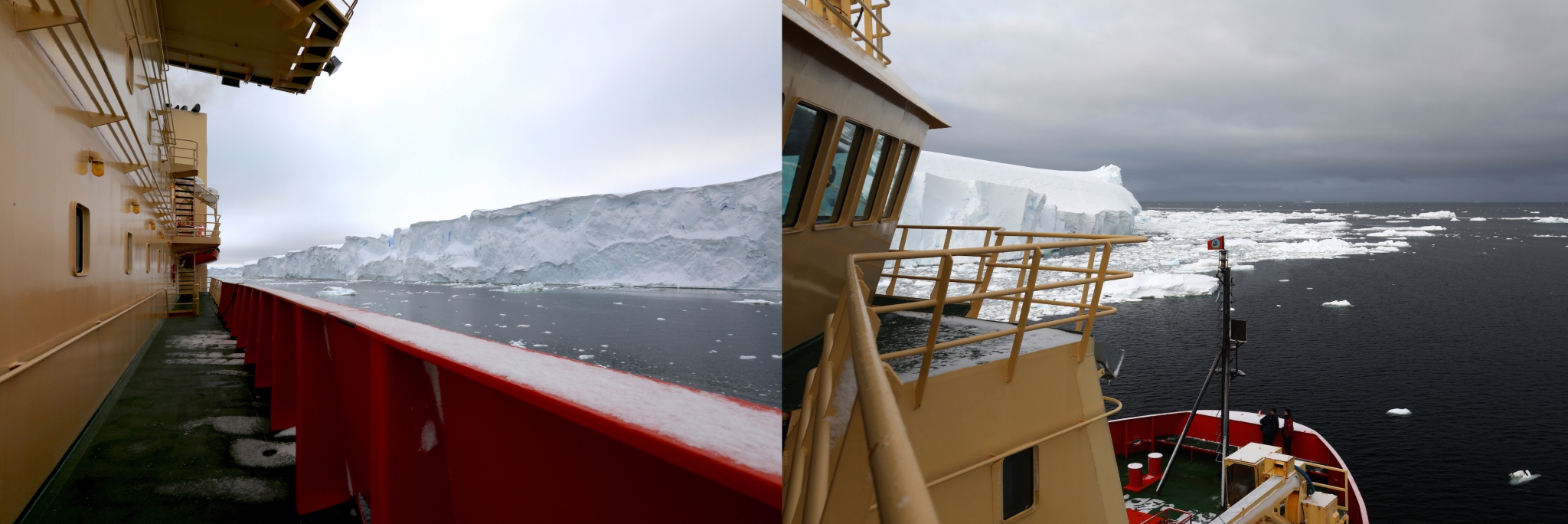
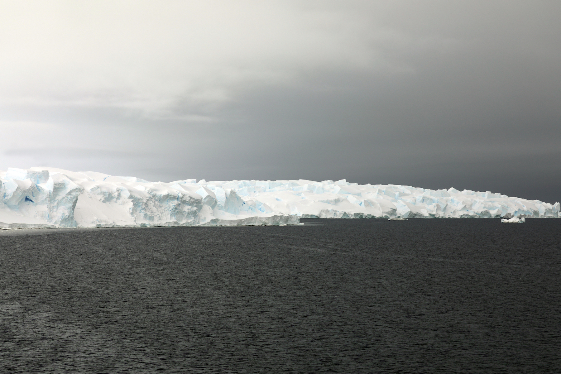
The unexpectedly calm waters enabled the Palmer to map at a quarter of a nautical mile of the calving front of the ice shelf. Peering down the face of the ice into the water, one can barely see the 90 percent of the ice that rests below the surface.
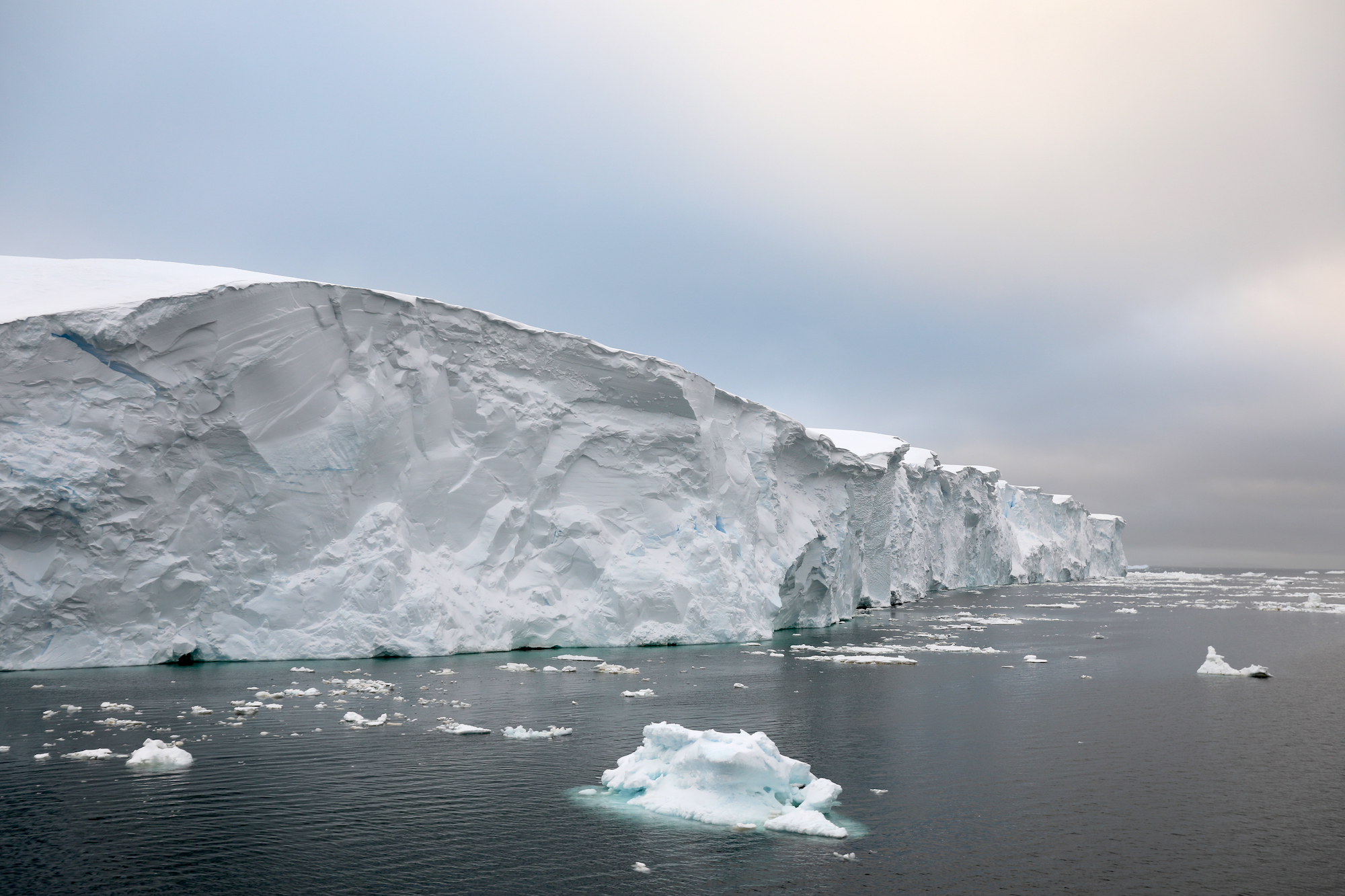
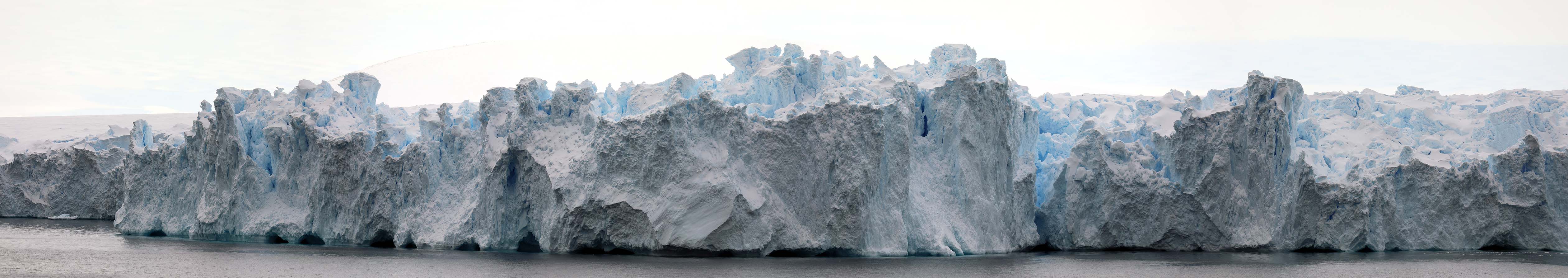
The 26th of February dawns gloomy but calm, a perfect backdrop for the towering 30-40 meter wall of the eastern ice tongue, the crystalline face fractured and glowing deep teal to cobalt in the fissures and cavities. The Palmer glides slowly, 400 meters from the face of the ice shelf in front of Thwaites Glacier.
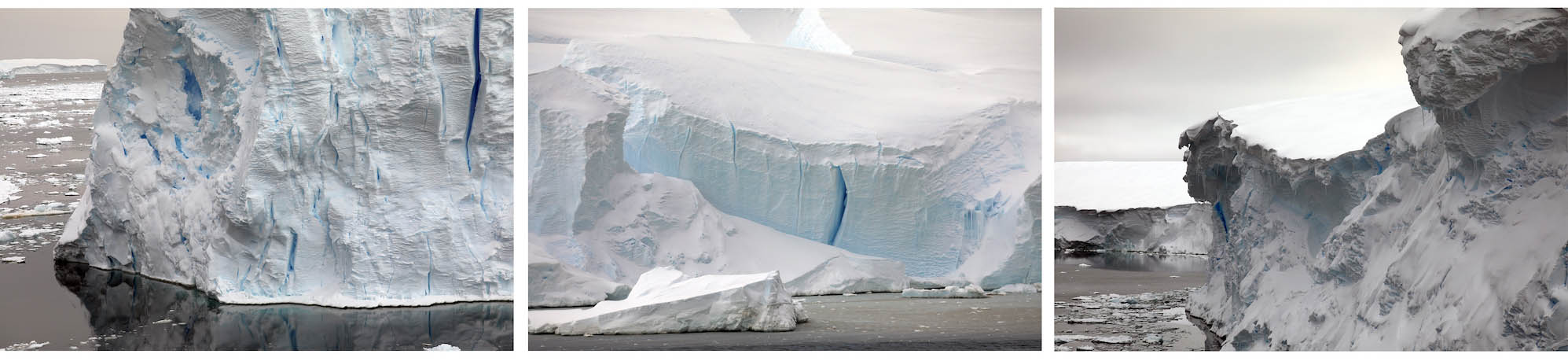
The many faces of Thwaites ice shelf.
Arriving around 5 a.m., the Palmer begins to map the uncharted perimeter, the multibeam simultaneously mapping the seafloor in front and as far under the shelf as the angle of the sound pulse could extend. The weather for the next two days was expected to worsen, so this day was the perfect day to get as close to the shelf terminus as possible.

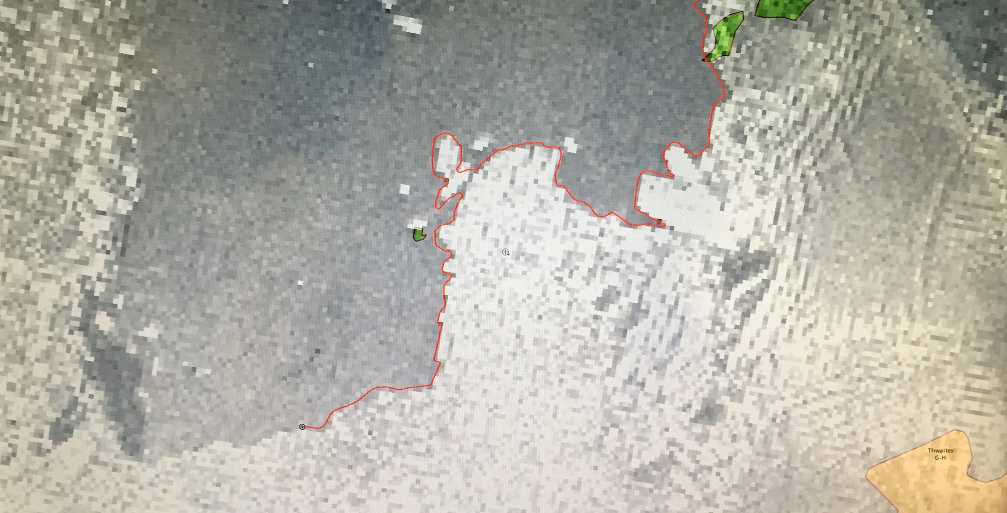
There was great hope, based on this mid-February satellite imagery, that the area in front of Thwaites would still be open when we arrived. Weather plays a significant role in the movement of sea ice. You can see the difference in the amount of cover on the western side of both images. MODIS images provided by Christopher Shuman and NASA Worldview
Thwaites Glacier ice shelf extends about 15 kilometers beyond the grounding line. The grounding line is where the glacier transitions from resting on the bedrock to a floating ice shelf in the Amundsen Sea. Along the 150-kilometer ice front, the satellite images show two different types of ice shelves. The eastern ice shelf looks like a large solid piece of ice. Moving west along the front (down in the image) the ice changes into what looks like alligator skin. That texture is created by crevassing of the ice as it moves past the grounding line. Once they move into the sea, the ice eventually breaks along the fracture lines.
The partial traverse of the Palmer at the edge of the ice shelf the morning of 26 February. Image courtesy of Johan Ronaldsson.
This is the first time since 2000 that the Palmer has been to Thwaites, with only one other more recent survey conducted by the Polar Stern in 2006. Neither mission made it south of 74o 50’ latitude. The Palmer mapped a new ice-free boundary that is 18 km further south than in 2006.
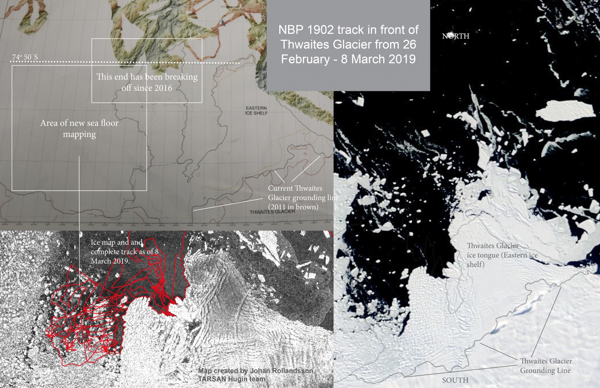
The ice shelf currently extends 15 km beyond the grounding line, which marks the transition from the land-based ice stream. The red track on 8 March 2019 ice data shows how quickly sea ice conditions can change over 5 days. Today, we would not be able to survey the seafloor in that sector. While the Palmer might be able to navigate it, the interferences caused by the ice would produce very little usable multibeam data.
This is what the western ice shelf looks like at its terminus. This section has been breaking up and retreating by about 10 kilometers since 2016.
As of the 3rd of March, the THOR team have surveyed more than 1,500 square kilometers of new seafloor. Upon reaching the eastern edge of the shelf, we gathered multibeam bathymetry and sub-bottom profiles. Sub-bottom profiles are pictures, almost like an x-ray view, of the first 10s of meters into the seafloor. Similar to the multibeam echo sounder, sub-bottom profiles are also created from sound, but using different frequencies and computer processing to generate an image that shows seafloor structure and sedimentary layers. These profiles are collected simultaneously with the bathymetry data to help the THOR team find places to collect core samples.

In addition to multibeam bathymetry, the THOR team collects complimentary sub- seafloor images that can reveal several meters of what lies directly below the surface. The image shows “reflectors”- created by sound waves of a particular frequency that can penetrate below the seafloor, are reflected back to the ship and then processed to create this image of the seafloor contours, the scale of which is greatly exaggerated, and sedimentary layers.
The other teams are also busy deploying the ocean water CTD’s (35 in total for all of Thwaites as of the seventh) and deploying gliders that collect ocean current and CTD information over a longer time period right next to the glacier. Lars Boehme and his team were gifted with a perfect day to look for seals on ice floes north of the eastern ice shelf, successfully tagging two of the four they found.
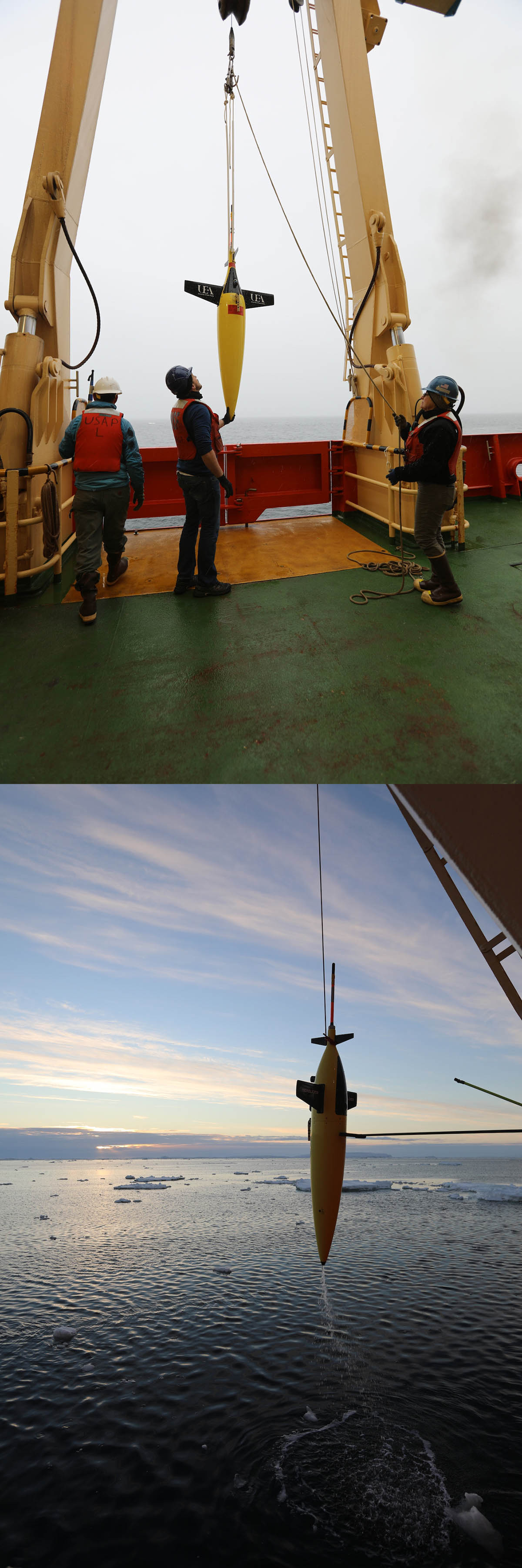
Bastien Queste manages the deployment and monitoring of gliders for California Institute of Technology and the University of East Anglia. The gliders, who are named for whales (both common and famous names), are guided remotely from their institutions through satellite transmitted commands. The gliders’ small size and lack of sophisticated moving parts allow collection of physical and chemical oceanographic information in hard to reach places for long periods at a time. They move up, down, and forward through the ocean by motorized internal mechanisms- oil bladders and weights which can be manipulated remotely. Their multi-day missions at Thwaites will gather ocean current direction and velocity, sea water temperature, salinity, water pressure (a depth equivalent), the amount of chlorophyll in the water, suspended sediment, and the amount of dissolved oxygen in the water for specific ocean depths.
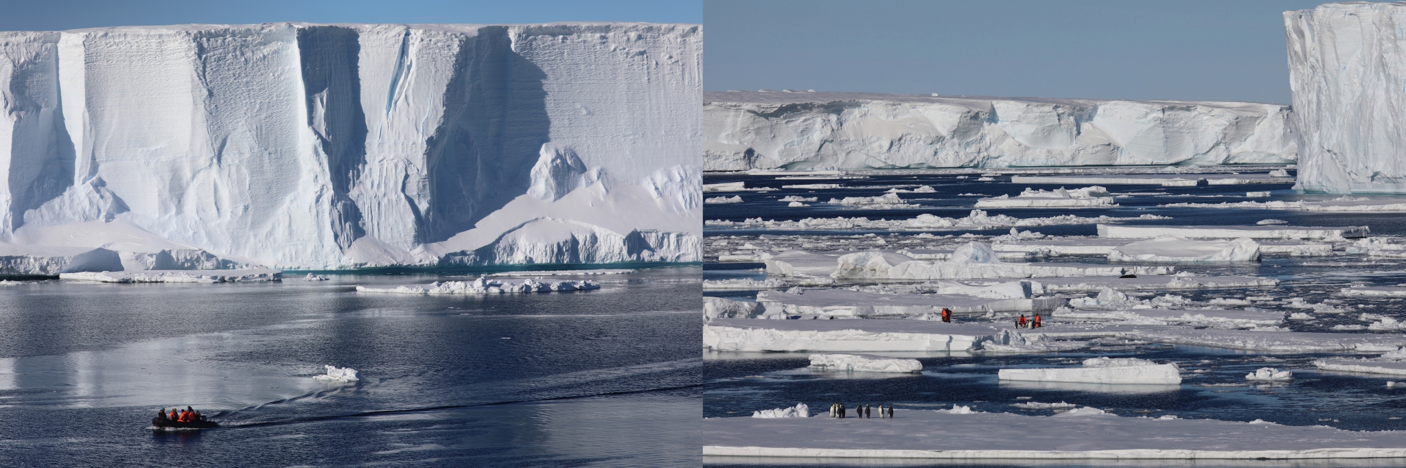
FOC/UK- permit No. 29/2018 Lars Boehme and his team tag two Weddell seals near Thwaites Glacier. Several groups of Emperor penguins that were feeding in the water nearby observe the proceedings.
The Hugin also deployed on a 13-hour mission to conduct a survey of the seafloor. Its mission was to look for features of recent glacial retreat and measure Circumpolar Deep Water properties near the glacier front. Following its recovery on the afternoon of March 1st, the Hugin’s multibeam data revealed meter scale seafloor features, finer-scale features that complement the regional scale imagery that the multibeam bathymetry collects.
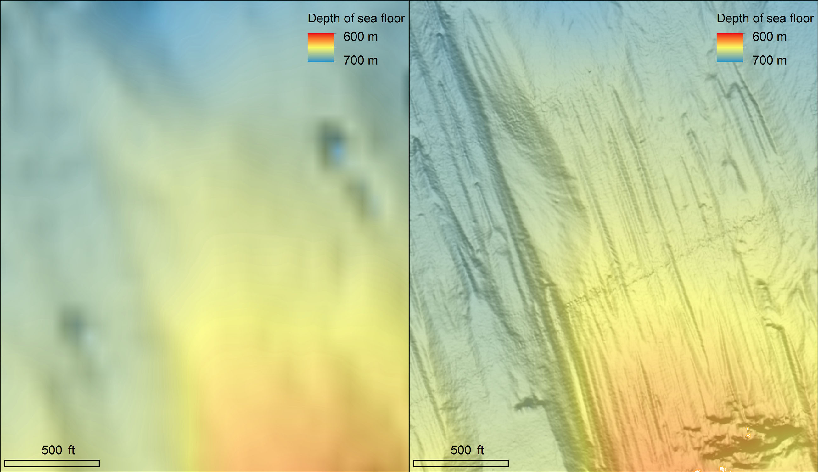
Comparison of the seafloor in front of Thwaites as seen by the EM122 multibeam echo-sounder and the Hugin’s multibeam.
As of the 6th of March, THOR collected 14 cores from six sites, with the first three gathered in the early hours of the 27th from a site that was identified from the initial multibeam survey line at the face of the ice shelf. This first site is near what is possibly a former pinning point at the tip of the remnant Thwaites Glacier Tongue.

Six coring sites and the 14 cores that were collected to try and sample a variety of depths and places that may record the past behavior of the ice shelf.

THOR team members Rob Larter, Becky Totten Minzoni, and Ali Graham look over the jumbo gravity core collected on the 28th of February.
We wake early on the 7th to find ourselves gone from Thwaites. The Palmer is sitting quietly in the ice-free waters of western Pine Island Bay. We are there to conduct additional physical oceanography measurements and to collect moorings. Moorings are stationary instruments that collect ocean data over several years. The instruments are tethered to a weight that sinks to the bottom of the ocean. They are recovered by triggering a release mechanism that will allow the instrumentation to float up to surface for retrieval. They are sometimes hard to find because their original location may be caught and moved by giant icebergs.
Perhaps not so surprising when we arrive is that the Pine Island calving face has also retreated several kilometers since the last survey in 2017, providing the opportunity to survey the newly exposed seafloor. The ice-free conditions ensure that we can complete the oceanographic tasks and head back to Thwaites for a few more days of surveying (and hopefully coring!) on the far east side of the Thwaites ice shelf in an area that has recently become ice free. There and gone….but going back again.


Leave a Reply
Want to join the discussion?Feel free to contribute!