Reach for the Stars STEM Festival 2018

The twelfth annual ‘Reach for the Stars Stem Festival‘ , co-sponsored by the Ride Family Foundation and Rice Space Institute, was held at Rice University on Saturday, April 21st. It was  a spectacular success. This festival, which targets middle school girls, includes a street fair, an inspiring talk by a woman astronaut, and roughly thirty women-led science and engineering workshops. The plenary talk was given by NASA astronaut Peggy Whitson, who also happens to be a Rice Alum. This event turned out to be another opportunity for the Rice Earth, Environmental and Planetary Sciences Department to showcase its commitment towards science outreach and education.


The EEPS exhibit table engaged young girls with fun, hands-on activities like the plate tectonics (using Oreo cookies), along with the tried and true rock and mineral identification.  Some of the modules presented were developed as a part of the EEPS Reach teaching program, and successfully kickstarted part of the workshop sessions. 


It was amazing to see that the young girls were ecstatic to learn about science- and geology in particular- even if some of the girls only cared about eating the Oreo cookie continents. Not just the young girls were engaged. Some of the teachers accompanying the girls actually took notes on the hands-on activities (the Oreo cookie plate tectonic activity was an instant hit with both young and old alike), telling us that they would incorporate them in their classroom teaching. Perhaps this is the beauty of public outreach activities, to be able to connect with people in such a way that they start to care about science.

Graduate students Alana Semple, Juliana Spector, Laura Carter and Sriparna Saha represented the department at this event and mentored two 45-minute workshops focused on the Earth’s Interior (Differentiation and Convection) and the Earth’s Exterior (Wet Texas: from Floodplains to the Coast).  Known formerly as the ‘Sally Ride Festival‘, this annual fair brings in hundreds of young girls to the Rice University campus, giving them a glimpse into the world of science in a way that excites them and encourages them to explore the world around them.

ESCI 321 &322 Field Trip: Tales of Mud Volcanoes, Evaporite Deposits and Lava Tubes.


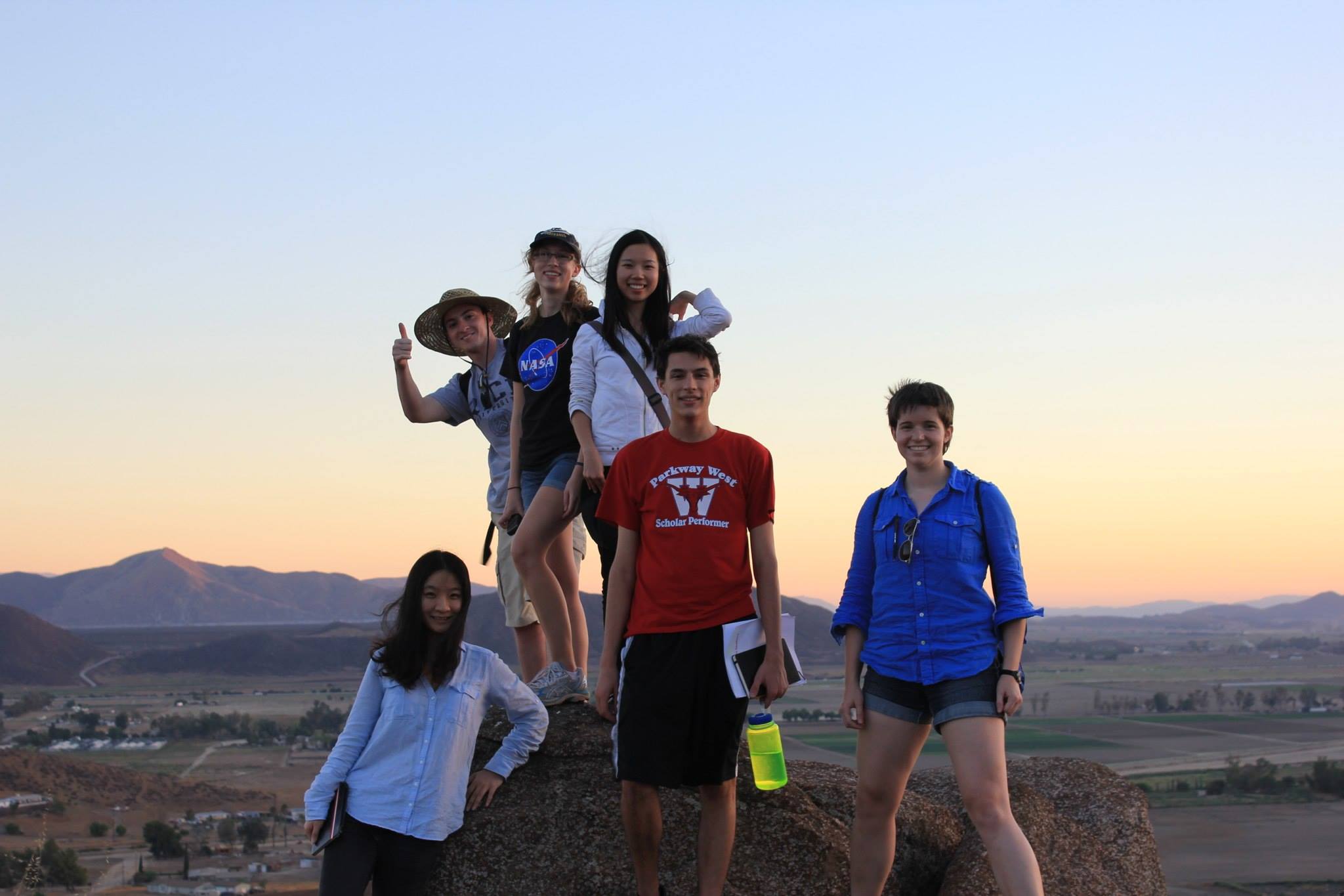
This blog describes the 5-day field trip for the Fall 2017 ESCI 321 and 322 classes to Southern California from October 6 and 10, 2017. The trip was led by professors Cin-Ty Lee and Rajdeep Dasgupta, and reported by undergraduate students Kendra Baldwin, Kyle Bartsch, Simon Chan, Aitash Deepak, Jennifer Kroeger, Jason Mendez, Jared Nirenberg, Sarah Silberman, and Jackson Stiles. The group was assisted by graduate students James Eguchi, Damanveer Grewal, Hehe Jiang, Sriparna Saha, Chenliang Wu, and Dr. Ming Tang.

The Southern California region has a complex geologic past with subduction, rifting and strike-slip motion, occurring along the major plates underlying the North American Continent. Most of California’s Paleozoic geologic history is evident in regions of the Mojave Desert and Death Valley. The Paleozoic era saw deposition of limestones, sandstones, and shales that were later eroded, displaced or uplifted during the tectonic activity that followed in the Mesozoic and Cenozoic. The rocks are primarily limestone with an abundance of fossils that indicate the evolution of early marine life forms. The region saw multiple periods of sea level fluctuation that led to the deposition of carbonate reefs along what is today’s Death Valley.

The Mesozoic was a period of increased geologic activity. During the middle to late Jurassic period, the Farallon Plate began subducting beneath the North American Plate, leading to the development of an extensive volcanic-arc system along the western coast of North America, and uplift of the Rocky Mountains in the late Cretaceous. Subduction also led to formation of the Southern California Batholith and other plutonic and extrusive volcanic regions in the Mojave Desert Region. An example of Mesozoic plutonic rocks can be seen in the Joshua Tree National Park, where the extensively exposed rocks exhibit uniformity in texture and grain size. The peak of volcanic activity occurred during the late Cretaceous in the southern Sierra Nevada region. The region was also covered by sedimentary deposits, with uplifting and metamorphism combined to create intertwined sedimentary and volcanic deposits.

During the early Paleogene period, while Farallon Plate subduction continued, volcanic activity in the peninsular region ceased. Uplift and erosion rates were continuous, which led to the deposition of vast amounts of sediments along the western continental shelf. Moving into the early Neogene period, the Farallon Plate disappeared into the subduction zone forming the San Andreas Fault; at an angle oblique to the western margin of the continent. As mountains began to rise along the coastline, marine sedimentary deposits became exposed. Eastward, crustal thinning and tectonic uplift along the Mojave desert region led to the development of the basin and range landscape. Additionally, Baja California started to move westward, away from Mexico.

In the quaternary period, the major driver of tectonic activity is the strike-slip San Andreas Fault, resulting in transverse ranges and extensional regions. Modern Rivers flowed through the basins while there was still volcanic activity in the Mojave region.

Day 1

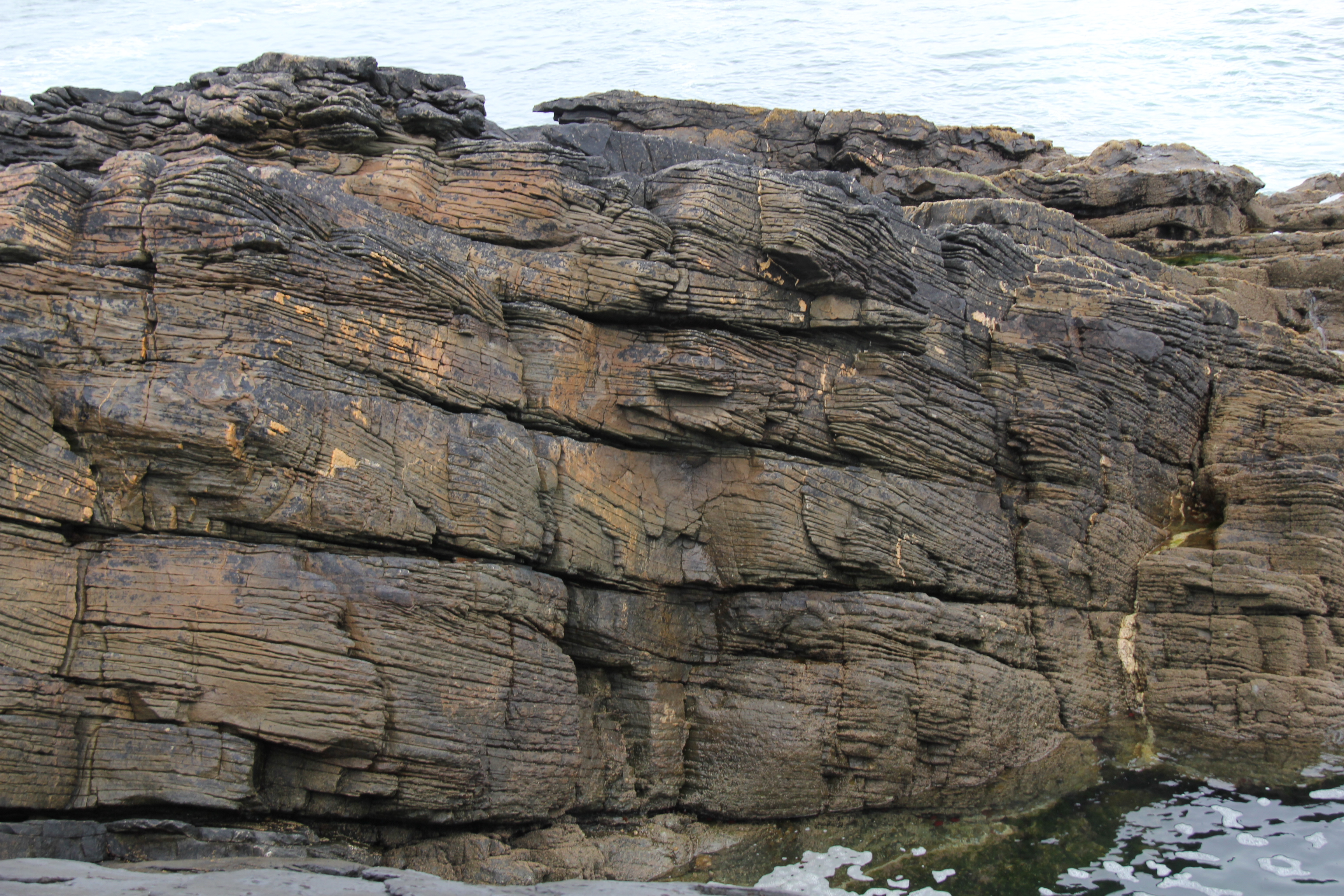
The first stop of our trip was at Tourmaline Beach in La Jolla, California. We looked at the Point Loma Formation, which consists of marine deposits of sandstone and siltstone, formed originally in the Sierra Nevada- Peninsular Ranges batholith during the late Cretaceous. These were eroded from the roof of the magmatic arc that rose quickly due to compression and magmatism. Rapid erosion and transport of the deposits can be implied from the poorly rounded igneous sand grains. The marine deposits of forearc sandstones are tilted; graded-bedding and small areas of soft-sediment deformation are visible here.

Day 2

Marine depositional layers at Tourmaline Beach Photo Credit: Jackson Stiles

San Diego River Upper Estuary

 After a breakfast of bagels we reached an overlook above the San Diego River. The river is slow moving, and while the water level was fairly low when we were there, we could tell that the water level is often much higher. The water here is estuarine and thus brackish, but does not have strong enough sediment discharge rate to create a full delta. The sediment load is mostly comprised of fine sands and silt.

Hospitality Point-San Diego River Mouth and Lower Estuary

 Following the San Diego river overlook, we made our way to where the river meets the sea. While the San Diego River has migrated along the coast over time, it is now contained by a jetty, cementing its path to the ocean at one spot. The engineered jetty also prevents beach sediments carried by currents along the shore from piling up in mission bay in favor of generating a large sandbar at the river channel. This piled up sediment is rarely breached by floods and suffers minimal erosion.

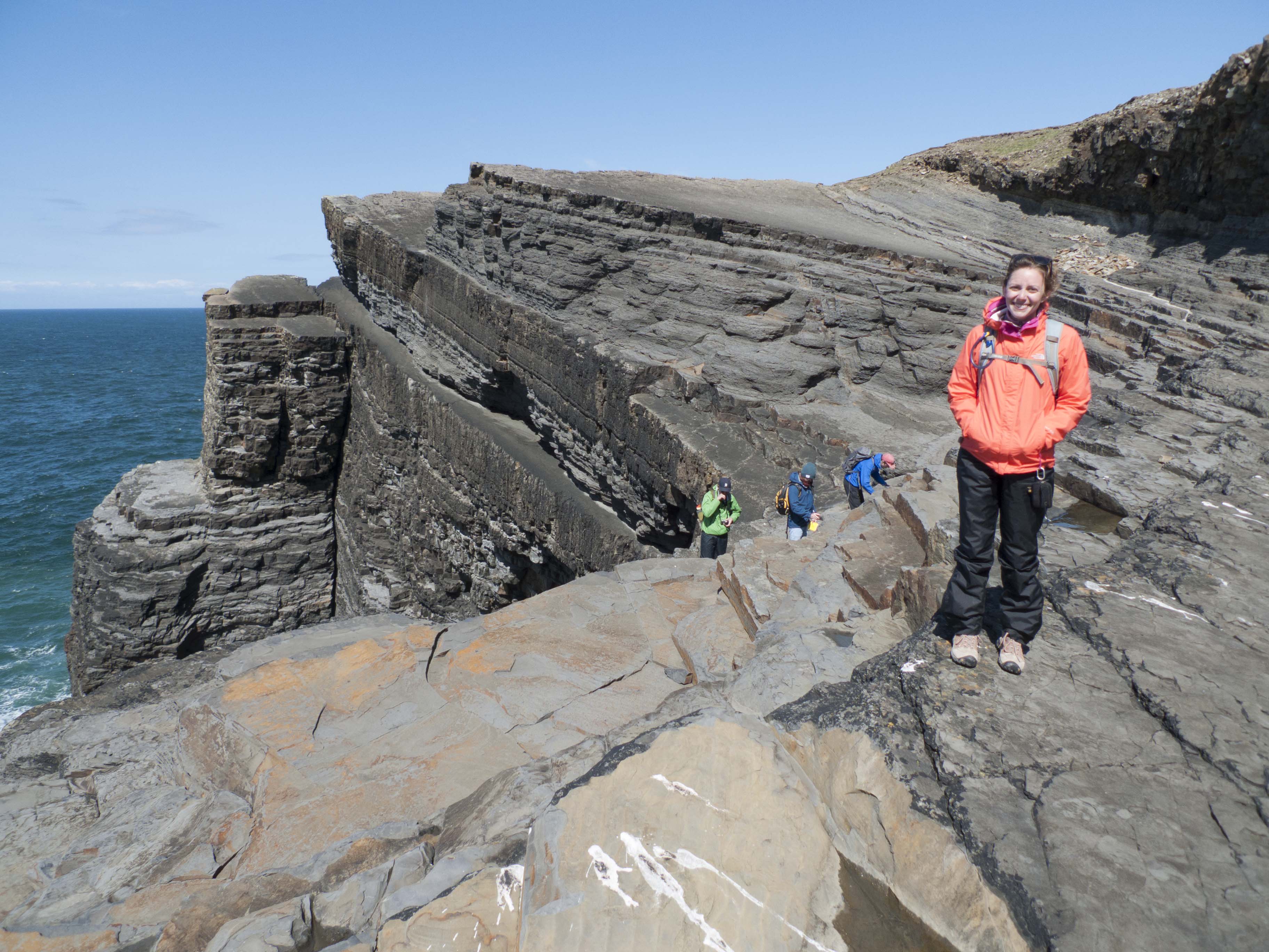
Sunset Cliffs Next, our group stopped at the cliffs overlooking the Pacific Ocean at Point Loma. These cliffs are an example of late Cretaceous sandstones (75ma) that have a high sand to mud ratio, making them fairly resistant to erosion. These sandstones belong to a forearc setting, exposed due to tectonic uplift, that enabled preservation and exposure of deep water sediments. Finely laminated layers at the bottom of the exposed strata are most likely the result of deposition in a calm depositional environment with high clay content. Overlying the thin laminated layers was a thicker layer of sandstone (indicating a much higher energy environment) and the white markings are erosional surfaces along the cliffs. Within this layer  large rip-up mud clasts were deposited. Further up in the outcrop we could see an old soil horizon and erosional unconformity that represents a 70 million year gap between the Cretaceous sediments and the more recently deposited sediments. We also identified sections of soft sediment deformation and local slumping from differential compaction of the overlying layers on the soft sediments. The entire outcrop was interlaced with faults.

Soft sediment deformation overlaying clay layers.  Photo Credit: Jackson Stiles

Coronado Overlook

 Our next stop was at the top of the Cabrillo National monument overlooking the San Diego Bay. The bay itself is a graben bound by faults on the west, and the Cretaceous mountains in the East. Coronado Island is a sand spit created by long-shore sediment pulses from the ocean. The sediment deposited on the coastal plains from the eastern mountains is manifest into turbidites and deep water deposits.

Peninsular Ranges Batholith-Cretaceous Plutonic Rocks

Outside of San Diego, we parked along the roadside to look at a large outcropping in the Peninsular Ranges batholith region, which is around 90 million years old. At the road cut the majority of the rocks were tonalite (a type of felsic granodiorite mostly made of plagioclase). This tonalitic outcrop was crosscut by large dark colored (mafic) and light colored (silica-rich) dikes. The dikes intruded after the tonalite batholith had formed and the brittle nature of the tonalite led to the development of extensive fractures.

Cuyamaca Lake

Cuyamaca Lake is underlain by Cretaceous gabbro composed mostly of plagioclase and orthopyroxene that are associated with the Cretaceous volcanic arc. Olivine was also present, but it was difficult to identify. The rocks around Lake Cuyamaca are also about 90 million years old, but is unique given it is one of the only sites in all of Southern California with layered gabbro deposits.

Jurassic Migmatites

 To reach this location we took a quick hike through the bush.  Exposed on the plain beyond were Paleozoic aged sedimentary rocks that had been melted and deformed during the Mesozoic era by through ductile underthrust in a subduction zone. During this process, many felsic (white colored) dikes formed through the rock, cross-cutting each other in several places. Within these dikes, we observed clusters of black coarse-grained tourmaline crystals; these are described as tourmaline pegmatites. Throughout the surface of the exposure, there were small, unnatural depressions which interestingly served as evidence that the outcrop was used by Native Americans to grind nuts.

View of Alluvial Fan
After leaving Julian (without having any of their famous apple pie), we stopped along the side of the road in a vast plain surrounded by mountains. The region showed a high quantity of brittle shear within fault gouges, and ductile shear visible in mylonite metamorphism resulting from high shear strain. Protomylonites from this intense ductile shear were quite prominent. The tonalite in this area was highly foliated, and there were few dikes present. The alluvial fans observed here had a high inclined gradient and contained many boulders and cobbles. The vast plain was actually a large coalescence of alluvial fans known as a bajada.

Two cross-cutting dikes in the Jurassic Migmatites.  Photo Credit: Chenliang Wu

 At the next stop, we were greeted by a small shack with the words “dead body inside” crudely painted on it. The stop was located at the base of the mountains near Anzo Borrego, with a view of a range across a playa. The mountains in the distance had reddish black sediment deposits along their hillsides. These were representative of fluvial sediments about 3 to 5 million years. The reddish black coating was likely a layer of iron-manganese oxide around 10 microns thick, and it indicates they were older than the incision. The rocks along the hillside we had stopped at were proto-mylonites. The shear stress during the mylonitization process caused various minerals in the rock to recrystallize that resulted in presence of clusters of garnet crystals forming throughout the matrix. The mylonitization was an inter-arc shear zone and most likely occurred during the late Cretaceous arc magmatism, and suggests a connection between the arc magmatism and a great amount of deformation of the upper plate.

Day 3

Salton Sea Area

 Our first stop on the third day was at the Salton Sea Pliocene deposits between the Salton Sea and the Gulf of California Basin. The deposits were fluvial, lake, and deltaic associated with the initiation of the rifting of the Gulf. We saw different surfaces, including tilted mudstones with sandstones on top of them. The canyon had large cobbles around the rim, likely transported there by large floods. Many of these cobbles were mylonites similar the ones we saw at the end of Day Two.

Our next stop was at the Salton Sea which is a landlocked water-body, formed as a result of northward extension of the Gulf of California, to accommodate the developing faults in the area. While the base of the Salton Sea is oceanic crust, the water itself is not that deep (~10s of meters). Interestingly, the Salton Sea is about 234 feet below sea level. Over the last 100,000 years or so, the water level has been decreasing continually. The restricted nature of sea lead to conditions with no upwelling, and therefore there is no thermohaline circulation that caused the sea to stratify and there is a good amount of bioactivity in the top layers. Every once in awhile this circulation will start up, and many of the fish die. The sea is now fed by agricultural runoff.

Obsidian Butte Outcrop

 Here we had the chance to see what was left of a rhyolitic, Pleistocene lava flow that quenched to obsidian. Rocks layered with obsidian and pumice and xenoliths were interesting features at this outcrop. These features indicate that an initially volatile-rich magma was subjected to decrease in pressure which led to the formation of these layered obsidian-pumice flows. As the volatiles began to escape, the magma was left with little/no gas and it quenched eventually to form glassy obsidian. The escape of bubbles was in fact facilitated by their size. The smaller bubbles that could not escape eventually formed the pumice layers. We also evidence of shearing and slow stirring of the magma at the surface. The rhyolites indicate that this area tends to have a high heat flow and a thin crust.

Presence of mud-volcanoes in the area, further establish the dominance of a high geothermal gradient in this area. These mud volcanoes are interesting because they are constantly migrating.The mud-volcano flows are essentially like basaltic lava flows, that flow slowly, traveling over larger distances owing to their low viscosity. The tops of the volcanoes were spurting out mud and bubbling out CO2.

Box Canyon

Tilted sandstone layers.  Photo Credit: Jennifer Kroeger

At Box Canyon, we observed tilted sandstone layers from the Pliocene with some conglomerates in the layers. These sandstones were tilted as the Gulf of California subsided during rifting. We saw evidence of cross-bedding and several channels indicating that most likely they formed in a braided river system. There was high grain size variability is the sandstones and conglomerates, so the depositional environment was likely close to the source. Also, we noted that gypsum was later precipitated in the fractures in the sandstone after deposition. Rip-up mud clasts were also found in both the sandstone and conglomerate indicating a high energy environment.

Mecca Hills

 At Mecca Hills, we stopped on the side of the road to observe a large anticline on the side of one of the hills. The sediment layers were most likely around 3 million years old, while the anticline was due to younger, active tectonics.

Pelona schist

 We stopped along the side of a highway dodging speeding vehicles, to observe the Pelona Schist that formed as part of the accretionary complex as the Farallon plate was subducting during the late Cretaceous period. The schist here underwent greenschist-facies metamorphism as is evidenced by the abundance of chlorite, biotite, and muscovite minerals. The rocks sections were well foliated and weathered on the top.

Joshua Tree – Jumbo Rocks

  At Joshua Tree National Park, we observed the Jumbo Rocks that are coarse-grained granites formed in the Cretaceous and Jurassic eras. Interestingly, the rocks are extremely homogeneous in composition and grain size without much texture. The rocks are jointed, that likely formed while the pluton was cooling to release stress. The joints were filled by dikes that had a very similar composition to the surrounding rocks, though we observed less biotite in the dikes. These dikes are possibly the remains of the magma that formed the pluton that came back up later to fill the joints after the joints formed during cooling.

Palms Canyon Oasis The last stop of the day was at Palms Canyon Oasis, where we observed Jurassic quartz monzonites with grey feldspar megacrysts. Here we observed large, single crystal alkali feldspars that were prominently larger than the surrounding grains. While it is not well-established how these megacrysts form, it has been proposed that fluid transport aided in the growth of these large phases.

Day 4

Salt Deposits
At this stop, we walked out on evaporite deposits. The evaporites were seemingly most NaCl but presumably had some amount of lithium and calcium chloride as well. The deposition of these evaporites is aided by the topography of the area.


Wind created evaporite formation. Photo Credit: Jackson Stiles

The area is a local low: structurally a small graben bounded by faults and mountains on either side drain into it. Water draining from the surrounding mountains enrich the water in minerals that then form evaporite beds as the water accumulates and evaporates in the graben. We also saw several interesting structures in the evaporite deposits including hair like structures formed by wind, beautiful halite crystals, and thin layers of evaporite formed on the surface of bubbles of briny water.


Vesicular rocks. Photo Credit: Jackson Stiles

Amboy Crater
At Amboy Crater, we looked at a cinder cone volcano and the associated extensive basalt lava flow. The cinder cone and basalt lava flow formed in the Pleistocene and their young age is reflected by the characteristic shape of the cinder cone as weathering has not changed its form much yet.  The extensive basalt flows seen here flowed over much larger areas than the rhyolite flows we previously saw due to the basalt having less silicate in it which lowers the viscosity allowing the lava to flow further. We examined bombs and other debris shot out from the cinder cone during its formation, although we did not actually walk up to the cinder cone itself.

The flow and pyroclasts were quite vesiculated and several flow indicators like ridges and folds visible. The cinder cone itself formed as lava was spit out of the vent as opposed to the usual flowing lava that would create other types of volcanoes. The cinder cone is formed as lava cools quickly after being launched into the air and falls back to the ground creating the characteristic conical shape made up of pyroclastics.  

Dish Hill

 Dish Hill was another volcanic cinder cone nearby; however, it was a few million years older. Due to weathering, and from mining for road fill, faces of this cinder cone had been dissected which allowed us to examine the interior structure of a cinder cone. Extensive weathering and oxidation also gave Dish Hill a reddish color rather than Amboy Crater’s black color.

Olivine and pyroxene xenoliths from the mantle. Photo Credit: Chenliang Wu (L: peridotite xenolith) and Jackson Stiles (R: pyroxenes)

At this stop, we saw more bombs and pyroclasts, both of which were larger for the most part. The dissected side of the cinder cone gave us access deeper into the cone where we found many peridotite xenoliths brought up from the mantle. We also saw granitic xenoliths from the crust that were brought up from the walls of the magma chamber and vent. Common in the rocks were olivine and pyroxene xenoliths.

Kelso Dunes

The Kelso dunes make up the largest field of windblown (aeolian) sand deposits in the Mojave Desert. The field is still active and includes migrating dunes, vegetation-stabilized dunes, sand sheets, and sand ramps. The grains are light-colored which leads to the conclusion that the protoliths are quartz and feldspar. A closer look at the grains themselves shows that they are fairly round and around 100 microns in the maximum dimension. These sand grains most likely originate from the Mojave River sink (west of the dune’s location). We also observed that the ripples on the dune face indicated wind direction, with the shadowed ripple portions on the lee face towards the wind. The south side of the dunes also held more vegetation than the lee side.

Cima Volcanic Field

Interior of a lava tube. Photo Credit: Chenliang

This volcanic field is made up of alkali basalt cinder cones and lava flows. These are associated with the development of the  Basin and Range. Most of the lavas in this area are younger than one million years.  The lack of erosion of the cinder cones and unweathered lava flows show the youth of these volcanoes. The lava tubes present in this field would have formed when a low-viscosity lava flow developed a hard crust (due to cooling of surface lava) that acted as a roof allowing the lava beneath to sustain high temperatures and continue flowing. Within the tube, marks, called flow ledges/lines, on the wall indicate different levels at which the lava flowed. Additionally, lavacicles (stalactites) and drip stalagmites are clearly visible inside of the tube. These could form when lava splashes onto the roof of the tube and slowly oozes down.

Mountain Pass Syenites

At this mountain pass, a carbonatite-syenite complex is approximately one billion years old. There is a mine nearby that extracts rare-earth elements from the carbonatite. Carbonatites are rare igneous rocks but have three models to explain their formation. Carbonatites are usually associated with undersaturated (low silica) igneous rocks; instead of silica tetrahedra, the anions are carbonate complexes. This rock can form directly by low-degree partial melts in the mantle, and melt differentiation. Another way is through liquid immiscibility between a carbonate melt and a silicate melt. Finally, extreme crystal fractionation may saturate CO2 levels in the magma, leading to the formation of carbonatites. Fun fact!: Mountain Pass used to be the largest rare-earth element mine in the world until China discovered large deposits which can produce up to 105,000 MT of rare earth minerals a year.

At this pass, we observed syenite (intrusive plutonic rock) with high amounts of orthoclase, along with minor amounts of hornblende and biotite.

Day 5
Red Rock Canyon State Park

The reddish rocks are Jurassic age sandstones that represent fluvial, lacustrine, and Aeolian environments, most likely having formed in a shallow, continental sea. The sandstones are overlain by gray Cambrian limestones. A closer look revealed that below the Jurassic sandstones lay Permian sandstones. These actually formed from large dunes, resulting in cross-cutting beds and dipping in a massive scale.

Aeolian Jurassic dunes. Photo Credit: Jackson Stiles

Late Cretaceous-early Tertiary back arc thrusting resulted in an inverted sedimentary sequence where older rocks are underlain by younger rocks during a retro-arc thrust event where the Farallon oceanic plate was being subducted beneath the North American plate.


Deepwater Paradise: Ainsa Basin- Spain

Laurence Yeung speaks at March for Science, Houston April 22, 2017

AAPG-RICE CANADIAN ROCKIES FIELD TRIP 2016

p4

The AAPG Canada Region welcomed Rice AAPG Student Chapter for a four day guided transect through the Canadian Rockies. This trip was supported in part by funds provided by SHELL.

Trip Leaders:

Dr. Clinton Tippett (Geoscience Leader), Dr. Kevin Root (Geoscience Leader) and Dr. Malcolm Ross (SHELL – Rice University)

Assistant trip leaders:

Lacey Pyle and Catherine Ross

Student Participants:

Alana Semple, Christopher Odezulu, Jingxuan Liu, Joyeeta Bhattacharya, Maryam Nasizadeh, Nancy Zhou, Wey Yi Foo, William Farrell,  Yue Yao and Zuyue Zhang

Day 1: Calgary to Lake Louise

Copithorne Ridge, McConnell Thrust at Mount Yamnuska, Lac des Arcs Region, Rundle Thrust Sheet Viewpoint (Harvey Heights), Grassi Lakes Devonian Section above Canmore, Kootenay-Fernie section, Mt. Norquay Overlook, Castle Mountain

IMG_1970

Leaders Clinton Tippett (R) and Kevin Root(L) explaining the regional geology of Jumping Pound Gas Field

The group at Grassi Lake

The group by the Grassi Lakes carbonates

The group looking at turbidites on a road cut section

The group looking at turbidites on a road cut section

13679991_10154973333043998_1386250187230286338_o

Alana is leaning on a fossilized log!

Day 2: Lake Louise to Fernie

Lake Louise, Cambrian Facies Change, Marble Canyon, Folds in the Cambrian Chancellor Formation, Redwall Thrust, Radium Hot Pool, Sinclair Canyon, Out-of-sequence Thrusts, Columbia River Overlook, Radium, Toby Formation, Windermere Lake Area,  Southern Rocky Mountain Trench, Fort Steele Area, Southern Rocky Mountain Trench, Elko Area

The tranquillity of Lake Louise in the morning

The tranquility of Lake Louise in the morning

A hike along the Marble Canyon offers a great view of sea green coloured glacial melt water streams

A hike along the Marble Canyon offers a great view of sea green-colored glacial melt water streams


8

Varied types of folds in the Cambrian Chancellor Formation

Enlarged view of fold in Chancellor formation

Enlarged view of fold in Chancellor formation

10

Kevin explaining the geology of Radium area while the whole group relaxes in lukewarm waters of the Radium hot water pool!

11

Clinton showing diamictites.

Day 3: Fernie to Waterton

Crowsnest Lake, Cardium Formation, Crowsnest Formation Volcanics, Frank Slide, Triangle Zone of the Outer Foothills

Picture1

Duplex in the Banff formation, highlighted in red colour outline

13

Crownsnest formation volcanics (A deer came here to pose as a scale for the geologists.)


IMG_2297

Canada’s deadliest rock slide known as Frank slide, devastated the town of Frank in 1903 when the overturned anticline made of carbonate rocks in the Turtle Mountain fell off probably due to extensive mining practices and alternate freeze-thaw of snow on the mountains which made incipient cracks propagate into vulnerable fractures and cause the mass wasting.

Day 4: Waterton to Calgary

Prince of Wales Hotel, Waterton Field, Triangle Zone structures in the Canyon of the Oldman River, Livingstone Gap, Okotoks “Big Rock” Erratic

16

St. Mary River formation dinosaur traces

Big Rock Erratic: The huge chunk of quartzite was transported by glacier in the Last Glacial maximum and is dissected longitudinally reason of which is still debated.

Big Rock Erratic: The huge chunk of quartzite was transported by glacier in the Last Glacial maximum and is dissected longitudinally, reason of which is still debated.


“End of the trip group photo” at the Big Rock Erratic From Left: Jingxuan Liu, Zuyue Zhang, Maryam Nasizadeh, Alana Semple, Catherine Ross, Joyeeta Bhattacharya, Nancy Zhou, Lacey Pyle, Wey Yi Foo, William Farrell, Christopher Odezulu, Clint Tipette, Yue Yao and Malcolm Ross. Behind the lens: Kevin Root

“End of the trip group photo” at the Big Rock Erratic

From Left: Jingxuan Liu, Zuyue Zhang, Maryam Nasizadeh, Alana Semple, Catherine Ross, Joyeeta Bhattacharya, Nancy Zhou, Lacey Pyle, Wey Yi Foo, William Farrell, Christopher Odezulu, Clint Tipette, Yue Yao and Malcolm Ross. Behind the lens: Kevin Root

Blog created by:Joyeeta Bhattacharya

Rice University scientists propose that life in the solar system could have been very different

Lenardic

The Solar System of Forking Paths: Bifurcations in Planetary Evolution and the Search for Life-Bearing Planets in Our Galaxy

Lenardic A., Crowley J.W., Jellinek A.M., and Weller M.. Astrobiology. June 2016, 16(7): 551-559. doi:10.1089/ast.2015.1378.

—From Rice News…

Rice University scientists propose that life in the solar system could have been very different
If conditions had been just a little different an eon ago, there might be plentiful life on Venus and none on Earth.

The idea isn’t so far-fetched, according to a hypothesis by Rice University scientists and their colleagues who published their thoughts on life-sustaining planets, the planets’ histories and the possibility of finding more in Astrobiology this month.

The researchers maintain that minor evolutionary changes could have altered the fates of both Earth and Venus in ways that scientists may soon be able to model through observation of other solar systems, particularly ones in the process of forming, according to Rice Earth scientist Adrian Lenardic.

The paper, he said, includes “a little bit about the philosophy of science as well as the science itself, and about how we might search in the future. It’s a bit of a different spin because we haven’t actually ­­­­done the work, in terms of searching for signs of life outside our solar system, yet. It’s about how we go about doing the work.”

Lenardic and his colleagues suggested that habitable planets may lie outside the “Goldilocks zone” in extra-solar systems, and that planets farther from or closer to their suns than Earth may harbor the conditions necessary for life.

Read more here


AAPG Annual Convention & Exhibition, Calgary (2016)

Students, staff, professors, and alumni  from Rice University, Department of Earth Science attended the AAPG, Annual Convention & Exhibition, Calgary 2016 from June 20th – June 23rd.

Faculty – André W. Droxler

Adjunct – Vitor Abreu, Paul M. (Mitch) Harris, Stephanie Shipp

Alumni –  Vitor Abreu, Martha Lou Broussard, Gary Couples, Gulce Dinc, Hunter Lockhart, Bob Milam, Jack Neal, Stephanie Shipp, Joan Spaw, Richard Spaw, Nana Xu, and Jim Tucker

Students – Heath H. Hopson and Pankaj Khanna


The list of talks and poster presentations given by Rice are mentioned below:

Talks –

  1. Transgressive Lag of Flat Rip-up Clasts – Substratum for Initial Growth of Upper Cambrian Large Microbial Bioherms.  André W. Droxler, Heath, H. Hopson, Pankaj Khanna, Jacob, M. Proctor, Daniel J. Lehrmann, Paul (Mitch) Harris. Session – Geobiology of Carbonate Systems (SEPM) IMG_0123
  2. Investigating Upper Cambrian Microbial Reefs (Mason, Texas) – Unconventional Approach in  Mapping and Quantifying their different scales.  Pankaj Khanna,  André W. Droxler, Heath, H. Hopson, Daniel J. Lehrmann, Paul (Mitch) Harris. Session – Unconventional Carbonate Reservoirs II (SEPM)


IMG_0116

Poster Presentations –

  1. Distinct Growth Phases of an Upper Cambrian Microbial Reef Complex; Depositional Environment Indicators (James River, Mason County, Texas).  Heath H. Hopson, Pankaj Khanna,  Meron, Fessahaie , André W. Droxler, Paul (Mitch) Harris , Daniel J. Lehrmann. Session – Additional AAPG Student Research Poster Session IIIMG_0062
  2. Uppermost Pleistocene Coralgal Reefs and Upper Cambrian Microbial Reefs: Morphologies and Sea Level-Induced Evolution (?).  Pankaj Khanna, André W. Droxler, Daniel J. Lehrmann, Jeffrey Nittrouer, Paul (Mitch) Harris. Session – Additional AAPG Student Research Poster Session II

IMG_0065

Highlights of the AAPG Annual Convention & Exhibition at Calgary –

1.  Adjunct Prof. Vitor Abreu (Rice University) – Taking charge as President of SEPM 2016-17


IMG_0082

 From Left to Right – Pankaj Khanna (PhD Candidate), Adjunct Prof. Vitor Abreu, Heath H. Hopson (Masters Candidate)

2. The Rice group also met few alumni during the meeting

IMG_0077

From Left to Right – Hunter Lockhart (Former Rice Student – current Associate Geologist at  BHP Billiton), Heath H. Hopson (Masters Candidate), Prof. André W. Droxler, Gulce G. Dinc (Former Rice Student – current  –  Geophysicist at ION Geophysical), and Pankaj Khanna (PhD Candidate)

      3. The Carbonate Research Group – Rice University

      IMG_0154

  From Left to Right – Pankaj Khanna (PhD Candidate), Prof. André W. Droxler, Heath H. Hopson (Masters Candidate)

         4. Dinner at an AAPG event

Department_1

Prof. Bill Fischer (UT) and Martha Lou

         5. SEPM meetings – Monday evening – 21st June

Department_2

From Left to Right –  Prof. Vitor Abreu (SEPM President) , Jack Neal (ExxonMobil), and Prof. A. W. Droxler

         6. SEPM Poster session – 22nd June

Department_3

Adjunct Prof. Paul M. (Mitch) Harris and Prof. A. W. Droxler

Additionally the Carbonate research group went to Canadian Rockies to visit some Cambrian Microbial outcrops as well as few other outcrops.

  1. On the way to Helen lake microbial outcrops – Rick Sarg (CSM) and wife Ana

Department_4

From Left to Right – Prof. Rick Sarg, Ana, Heath H. Hopson (Masters Candidate), and Pankaj Khanna (PhD Candidate)

   2. Helen Lake Cambrian Microbial Outcrop

IMG_0819    IMG_0810


3. Devonian Carbonate outcrops near Canmore, Alberta

IMG_0660

4. Sulphur Spring, Jasper National, Alberta

IMG_0489


5. Athabasca Glacier, Jasper National National Park

Department_5

If you would like to know more about the AAPG ACE meeting, Calgary, or about the field trip the Carbonate research group went on after the meeting then kindly let me know pk15@rice.edu.


ESCI 546 Basin Analysis: Field Trip to Ireland

Overview


ESCI 546 “Advance Topic in Basin Sedimentology and Stratigraphy ” participated in a field trip to County Clare, western Ireland, from May 2nd to May 12th, 2016. The class visited sea-cliff exposures of rocks found in the Western Irish Namurian Basin (WINB), which were deposited during the Upper Carboniferous (326 Ma – 317 Ma). The deposits represent a variety of sedimentary depositional environments, including fluvial-deltaic to deep water turbidites. The rocks were later obscured by fold-thrust related deformation associated with the Variscan (Hercynian) orogeny, brought on by rift-related deformation during the breakup of Pangaea. The WINB is an ideal location to evaluate the interconnectedness of the various sedimentary environments, in particular, linking the physical processes that shape the internal stratigraphy.

The first part of the class trip included a five day “basin overview” led by Professor Jim Best of the University of Illinois at Urbana–Champaign (UIUC), who has 30 years of experience working in the WINB. During this tour, students self-organized to develop research projects for the range of depositional environments. Students were then provided three days to work among the outcrops to pursue their respective projects. On the final day, these students led the class through the outcrops, presenting their specific findings.

Regional map of western Ireland (Lien et al., 2003; Kendall and Haughton, 2006)


Capture

Stratigraphic overview of the WINB (Tanner et al. 2011)

Participants


Professors: Jeffrey A. Nittrouer,  Jim Best (UIUC)

Post-doc: Hongbo Ma

Students: Andrew Moodie, Brandee Carlson, Sam Zapp, Simon Chan, Garrett Lynch, Brian Demet, Chenliang Wu, Pulkit Singh

Visiting Student: Matthew Czapiga (UIUC)

Teaching Assistant: Tian Dong

Day 1   Loop Head Cliffs: Ross Fm. (Deep Water Turbidite)


Cliff exposure of Ross Fm. at Loop Head Peninsula  (Photo Credit: Matthew Czapiga)

May 3rd

We arrived in Shannon, Ireland, on the morning of May 3rd. In the early afternoon, after settling into our rental home in Kilkee, we visited cliff exposures of the Ross Fm. near the Loop Head lighthouse. The Ross Fm. is a sandstone unit, interpreted as deep-water turbidite fan deposits. Among the lobes are a few channel features higher in the stratigraphic section. The Ross Fm. is the thickest near the Shannon Estuary (~380 m) and thins to the north, in the general direction of paleo flow.

_DSC1074

Ross Sandstone at the Bridge of Ross (Photo Credit: Matthew Czapiga)

 Day 2  Northern County Clare: Visean Fm. (Basement Limestone) and Clare Shale Fm.(Deep Water Shale)


May 4th

_DSC1051

Cliff exposure of Visean Limestone Burren Fm. near Galway Bay (Photo Credit: Matthew Czapiga)

We drove north for 2 hours from Kilkee to the south of Galway Bay at the northern end of County Clare. Here, we visited the Burren Fm., a Visean limestone unit that forms the basement of the WINB. This unit is interpreted to be a shallow-water carbonate deposit, likely associated with a shelf setting.  The unit contains variety of fossils, including rugosa corals and brachiopods.


IMG_0451

Clare Shale and Visean Limestone contact at St. Brendan’s Well (Photo Credit: Tian Dong)


Travelling to the south, we moved upsection to the “St. Brendan’s Well” outcrop to locate the contact between the Visean Limestone and the Clare Shale. The Clare Shale Fm. is the lowest unit of the WINB sedimentary fill, and consists of a deep marine black shale. At the contact of the Clare Shale and Visean Limestone is a phosphate rich bed, ~ 8 cm thick, interpreted to be a condensed section likely associated with an open marine environment, where sedimentation is extremely minimal.


Day 3    Point of Relief: Deep Water Deposit  (Ross Sandstone Fm.) and Slope Deposit (Gull Island Fm.)


May 5th

We visited the Bridge of Ross and the Ross Fm. to examine the sedimentary structures found within the turbidite deposits. One of the most famous structures here is the Ross Slide, a highly deformed, inter-bedded mudstone and sandstone unit, which contains various soft sediment deposition features, including sand volcanoes and syndepositional folds. The Ross Slide is more recently interpreted as a slump deposit, whereby external forces caused liquefaction of sand and mud and initiated motion that produced significant folding and deformation. The Ross Slump is very laterally extensive (10’s of kilometers long), and this significant size is considered to be associated with a seismic event as triggering the the deformation.

_DSC1066

Ross Slide near the Bridge of Ross (Photo Credit: Matthew Czapiga)

Moving up Section, we examined the contact between the Ross Fm. and the Gull Island Fm., identified by a thin layer of mud with a goniatite (ammonoid) band, which is likely associated with a condensed open-marine section.

The Gull Island Fm. is interpreted as a slope deposit, whereby numerous failures trigger mass transport of sediment that ultimately feed the Ross Fm. turbidite deposits. The Gull Island Fm. contains various styles of soft sediment deformation, including slides, slumps, growth faults, and mud volcanoes.

_DSC1099

Ross and Gull Island Contact near Point of Relief (Photo Credit: Matthew Czapiga)

At end of the day, we visited the Tullig Cyclothem, the formation atop the Gull Island. Here, this cyclothem represents alternating sequences of fluvial-delatic and near-shore, shallow marine deposits, indicated by a classic coarsening upward deltaic sequence of interfingering pro delta, interdistributary bay, and fluvial-deltaic deposits. The middle to upper Tullig Cyclothem is characterized by channels of various sizes, and the Upper Tullig sandstone possesses bedforms and terrestrial plant fossils, indicating a fully fluvial depositional setting.

_DSC1136

Cliff exposures of Tullig Cyclothem at Point of Relief (Photo Credit: Matthew Czapiga)

Day 4       Trusclieve: Fluvial-Deltaic Deposit (Tullig Cyclothem and Kilkee Cyclothem)


May 6th

We took a boat ride on the Shannon Estuary, in order to observe cliff exposures of the Middle to Upper Ross Fm., and the underlying Clare and and  Visean Limestone. The upper Ross Fm. contains numerous feeder channels that routed sediment to the fan lobe deposits of the Ross Fm.

L1050014

Upper Ross Formation (Photo Credit: Tian Dong)

L1050016

Large fold within the Ross Fm. (Photo Credit: Tian Dong)


Later, we drove to Trusklieve to visit the Tullig Cyclothem in detail, specifically, the changes in vertical stacking patterns. Stratigraphic Sequences of the Tullig Cyclothem at Trusklieve show that an overall coarsening upward trend is pervasive (as described above). Moving up section, there is an increase in the frequency of amalgamated channels bodies, which possess bedforms, barforms, and terrestrial plant fossils, all of which indicate a land-based fluvial-deltaic environment.


L1050045

Tullig Cyclothem at Trusklieve (Photo Credit: Tian Dong)

Overlaying this fluvial section is a thick transgressive mudstone that contains various types of marine fossils, including zoophycos, which is a trace fossil left behind by the movement of polychaete worms. Above this mudstone is a marine mud bed, rich with goniatites, and representing the final stage of the Tullig transgression. Overlying this is the Kilkee Cyclothem, which progrades overtop and marks of the onset of a new fluvial-deltaic progradation.

_DSC1201

Transgressive package within the Tullig Cyclothem overlain by the Kilkee Cyclothem (Photo Credit: Tian Dong)


Day 5       Killard: Fluvial-Deltaic Deposit (Tullig Cyclothem)


May 7th

We drove several kilometers north of Trusklieve to examine the Tullig Cyclothem at Killard Bay. We observed similar coarsening upward sand bodies, as well as sedimentary structures and plant fossils that are quite similar to those observed at Trusklieve. An interesting question arose regarding this outcrop: Why do the bedform foresets dip at such a shallow angle, much lower than angle of repose? Hongbo Ma is investigating this phenomenon, and has some interesting findings based on ongoing studies in the modern Huanghe River (China) which could be used to compare to the Tullig channel dunes.

IMG_0489

Foresets in Upper Tullig Cyclothem (Photo Credit: Tian Dong)


IMG_0474

Soft sedimentation deformation at Killard (Photo Credit: Tian Dong)


Day 6-8      Group Project 


May 8th – 10th

Students self-organized into four groups of two people each, and pursued independent research projects, conducted at various field sites for the range of depositional environments. On May 10th, each team presented the results of their individual projects to the class.  The following list describes the student groups and their respective project depositional environments:

Fluvial-deltaic (Trusklieve and Killard):                Brandee and Andrew

Pro-Delta/Shelf (Point of Relief and Killard):       Chen and Sam

Slope (Point of Relief):                                                Garrett and Brian

Turbidite (Bridge of Ross):                                         Pulkit and Simon

Day 9       Cliffs of Moher


May 11th

We visited the Cliffs of Moher on the northern end of County Clare. This location is distal part of the WINB, where it contains a condensed section of all the previously visited sedimentary formations. At the highest point of Cliff of Moher, stands the O’Brien’s Tower, an observation tower build by local landlord in the early 1800s. Standing by the tower, we had a spectacular view of the Loop Head peninsula and north Atlantic, which is a great way to conclude this wonderful trip.

L1050076

Cliff of Moher (Photo Credit: Tian Dong)


L1050086

O’Brien’s Tower at Cliff of Moher (Photo Credit: Tian Dong)

A Graduating Senior’s Geologic Retrospective

I am Adeene Denton, a senior in this Earth Science department, and that means I’m graduating in a very short time because Rice has decided that I am worthy even if I still feel like I have so, so much to learn. I want to thank the department and look back on what it did for me, and all of us.

There are not enough words to explain how grateful I am to this department, or to express what it has done for me. It was in my classes here that I learned how to think like a scientist, how to frame my questions and shape my logic. This department taught me how to think as it fed me information, and it gave me some of the best friends I’ve ever had in the cohort that I graduate with this year.

IMG_3499

Adeene Denton and Larisa LaMere at the Earth Science senior dinner (November 2015).

Very few of the Earth Science majors graduating this year came in to Rice as Earth Science. This is common – maybe it’s because most of us were barely taught earth science in high school, if at all. Maybe it’s because we thought we should be engineers – or lawyers, in my case – based on the people we knew were successful back home. I came in to Rice convinced that I would be a lawyer or a politician, and the metric of my success would be measured by the quality of the suits I would wear or the slickness of my vocabulary.

Then I discovered the Earth Science department, in a crazy turn of events that led to me taking Dr. Alan Levander’s ESCI 324 as a freshman – a class that turned out to be incredibly hard for a humanities major who hadn’t taken physics since freshman year of high school, but also incredibly rewarding. When Alan traced the Earth’s formation back to the Big Bang, vividly describing how the swirling dust of the planetary disk formed the hot, wobbly Earth, I knew I was hooked for life. I wanted to understand the Earth more than anything – from how the mountains rise and fall to the stratification of its interior to its rapidly changing atmosphere and everything in between.

Sitting on salt wash sandstone on the 334 field trip.

Adeene Denton and Elli Ronay sitting on salt wash sandstone on the ESCI 334 field trip (2014).

Since then, I’ve taken as many classes in this department as possible, and gotten to know so many absolutely amazing, inspirational people. I want to thank the professors of this department for teaching and inspiring me, for instilling all of us with knowledge and making it fun at the same time. Thank you to Dr. Alan Levander, who taught my first Earth Science class, and ensured that I would one day write this. To Dr. John Anderson, Dr. Jerry Dickens, and Dr. Jeff Nitrouer, for introducing us to sedimentation, to rivers and oceans and keeping us from drowning in our workloads. To Dr. Juli Morgan for teaching us that rocks, like college students, are also subject to stress and strain. To Dr. Cin-Ty Lee and Dr. Raj Dasgupta for teaching us our rocks and minerals, so hopefully I will never misidentify a brick as a rock again. To Dr. Helge Gonnermann for taking us out into the field where we learned how to make theoretical knowledge really, really practical, and that geology does not mean one right answer. To Helge and Dr. Adrian Lenardic for helping with my senior thesis and making sure I produce good scientific work and can explain it well. Thank you to all the other professors I have met and worked with – Dr. Dale Sawyer, Dr. Carrie Masiello, Dr. Colin Zelt, and everyone else.  If I am a good scientist at all, it is because all of you were there to teach and help me.

It was with this department and its people that we learned that science is not bright and shiny and we pushed onwards anyway – that science sometimes means spending five hours in the lab only to realize that you set the wrong spot size on the laser, or trying to find the bug in your code and see that it’s a missing semicolon in the third line. But that breakthrough moment – that moment is worth everything. That moment when you are standing in the middle of nowhere, looking at the notes on your field map that is so worn it’s tattered, and suddenly the pieces fall together and you know.

Also on the 334 field trip (2015).

Clockwise from bottom left – Stephanie Zou, Emily Paine, Beineng Zhang, Jeffrey Piccirillo and Kelsey Crocker on the 334 field trip (2015).

We joined this department because we all wanted to know, deep in ourselves, how the earth works. How to map it, how it shapes itself, how it was born and where it will go. Now, we go to grad school or to jobs or to keep figuring ourselves out, still not entirely sure of our passions, but so much surer of our directions than when we came in. I am who I am because of the incredible people in this department, and I am forever grateful that I found this place and these rocks and these humans who love rocks right along with me. There are eleven undergrads leaving Rice, but we are coming out as capable scientists, ready to pursue completely different life paths. We came here looking to understand how the earth works. Maybe an era or an eon from now, we’ll know.

NM-134

Kelsey and Jeffrey on the 2015 ESCI 334 field trip. Thank you both for being such amazing friends.

Kelsey and Jeffrey on the 2015 ESCI 334 field trip. Thank you both for being such amazing friends.

Rice Guadalupe Mountains Field Trip – April 22-27, 2016