THWAITEing….At Rothera Station
text and images by Linda Welzenbach
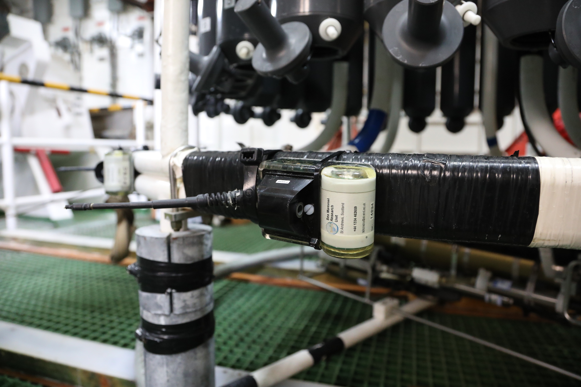
![]()
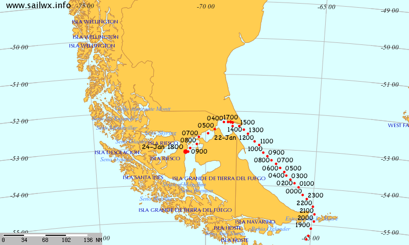
On the 15th of February, the Palmer had to make an emergency transit to the closest base for a medical evacuation. Although EMT trained ASC staff can work remotely with doctors to solve many issues, some ailments require higher order facilities and care. So off to the British Antarctic Surveys’ (BAS) Rothera Station we go, located some 1,000 nautical miles north on the Antarctic peninsula.
“Grease” ice forms at the sea surface. This type of ice forms by direct freezing of seawater and is one of the first stages for formation of drift ice.
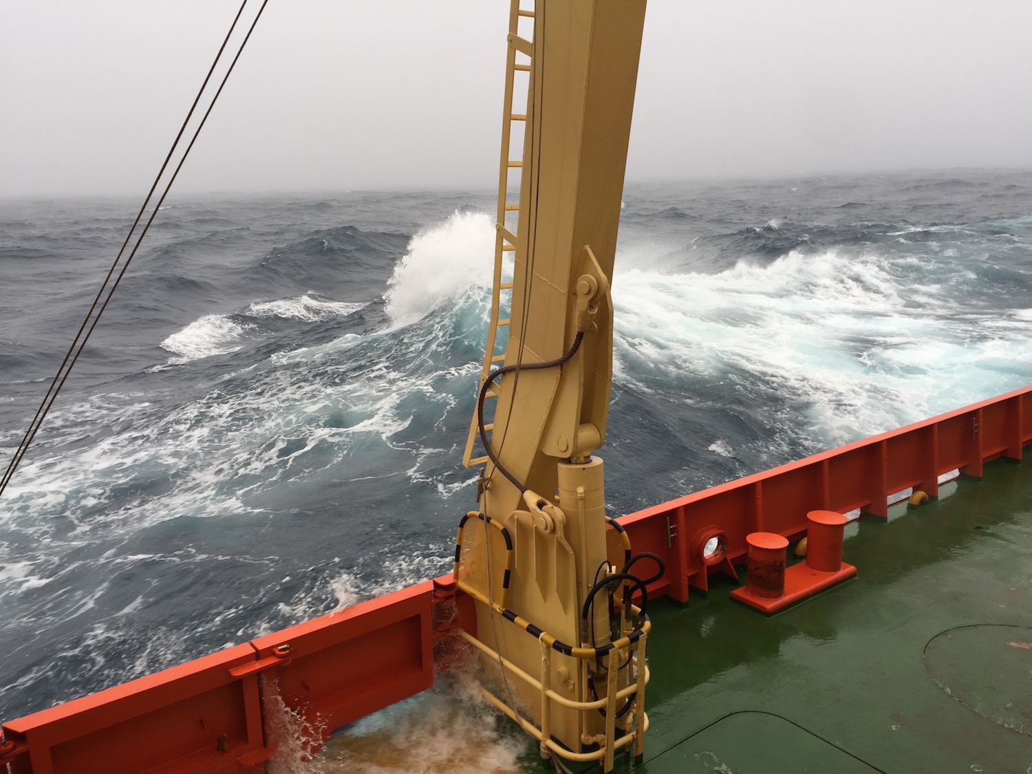
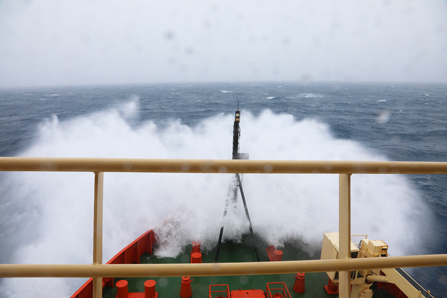
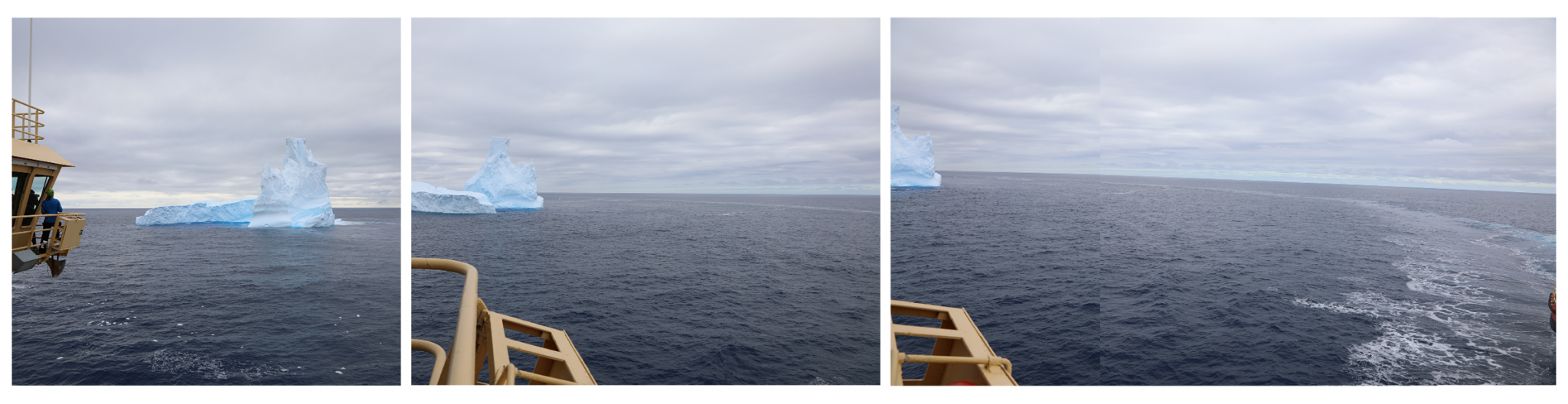
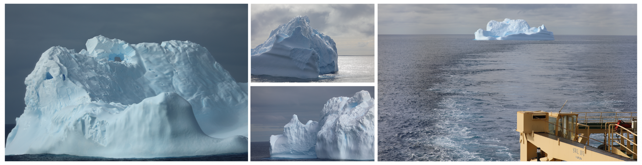
Rothera station is a four-day journey at 13 knots (the fastest the Palmer can go), back through sea ice festooned with seals, penguins; breaching whales who taunted the photographers with their brief and distant appearances; and more icebergs whose myriad shapes and sizes continue to fascinate. But it is essentially an end to Thwaites glacier science for about 8 days if all goes as planned. During these days, the scientists slowly wind down from the intense energy associated with round the clock science, as if they are going into hibernation until we can return.
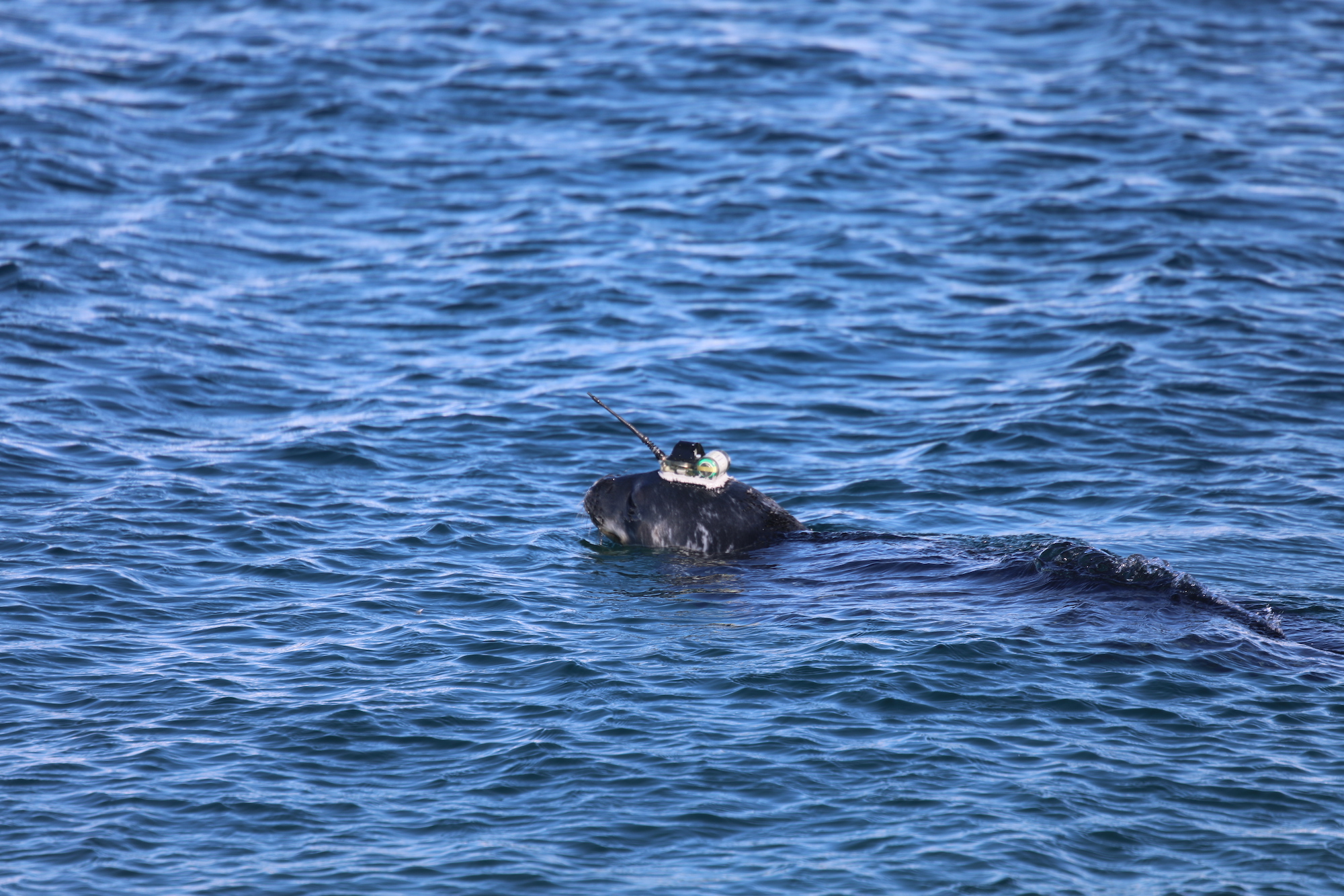
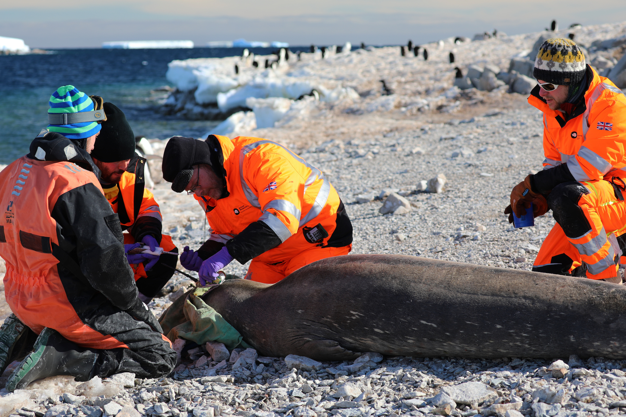
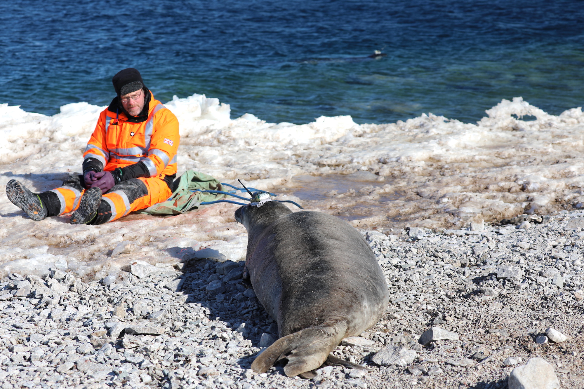
Emperor penguin, Weddell seals, and Humpback whales
![]()
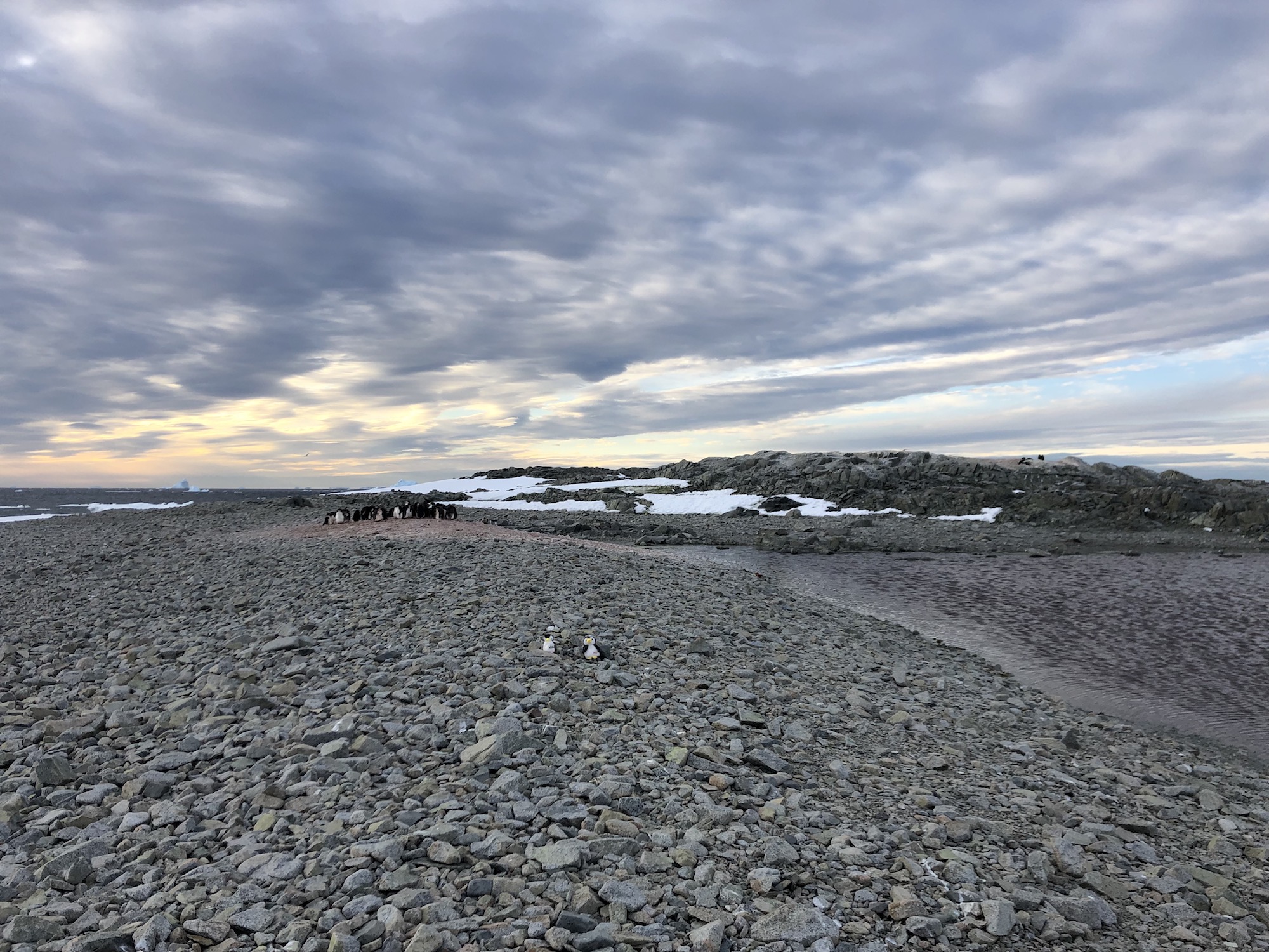
Adélie penguins
Peter I Island, an uninhabited Norwegian dependency
![]()
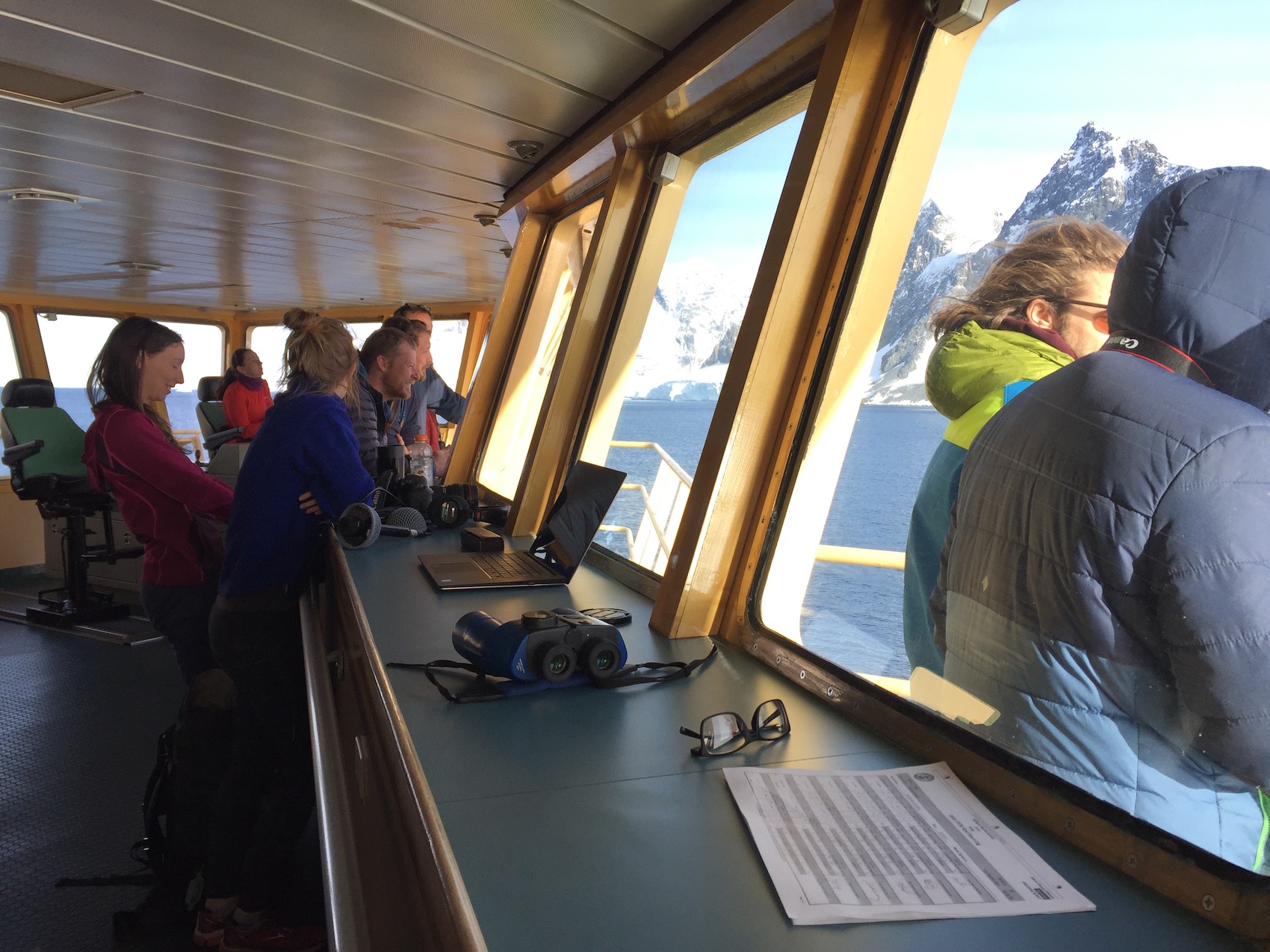
The morning of our arrival (the 19th) my roommate, THOR team lead scientist/coring expert Dr. Becky Minzoni, bursts in exclaiming that she would never forgive herself if she didn’t wake me (I am on the noon-midnight shift, so tend to go to bed late and not wake until mid-morning). Anticipating that what I might see is best viewed outside, I throw on everything I can think of, grab my 10-pound bag of camera gear and run up the 60 stair steps to the bridge. Out of breath already, the view literally finishes off what little is left. No matter, the view keeps me standing.
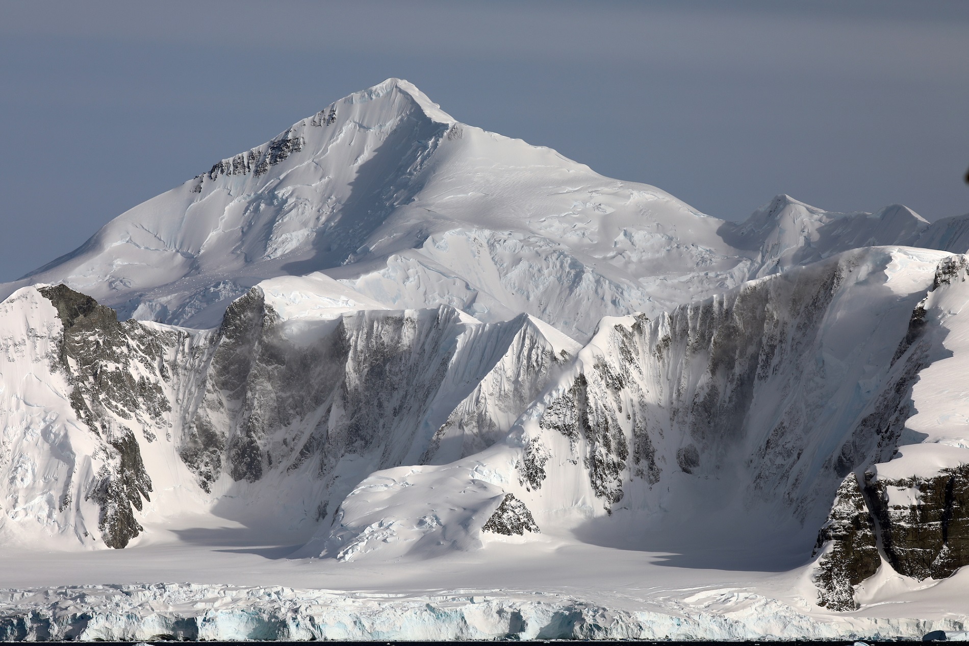
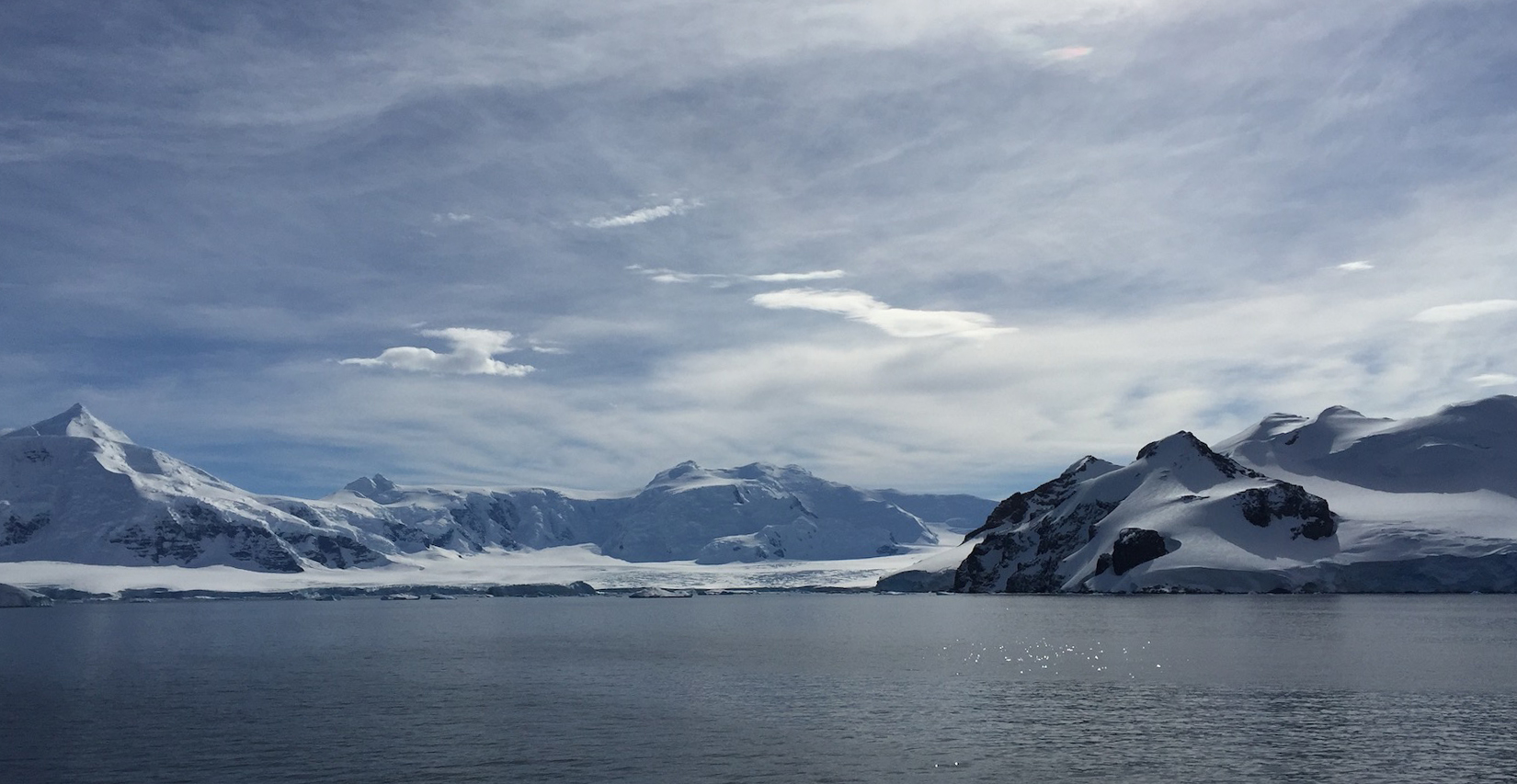
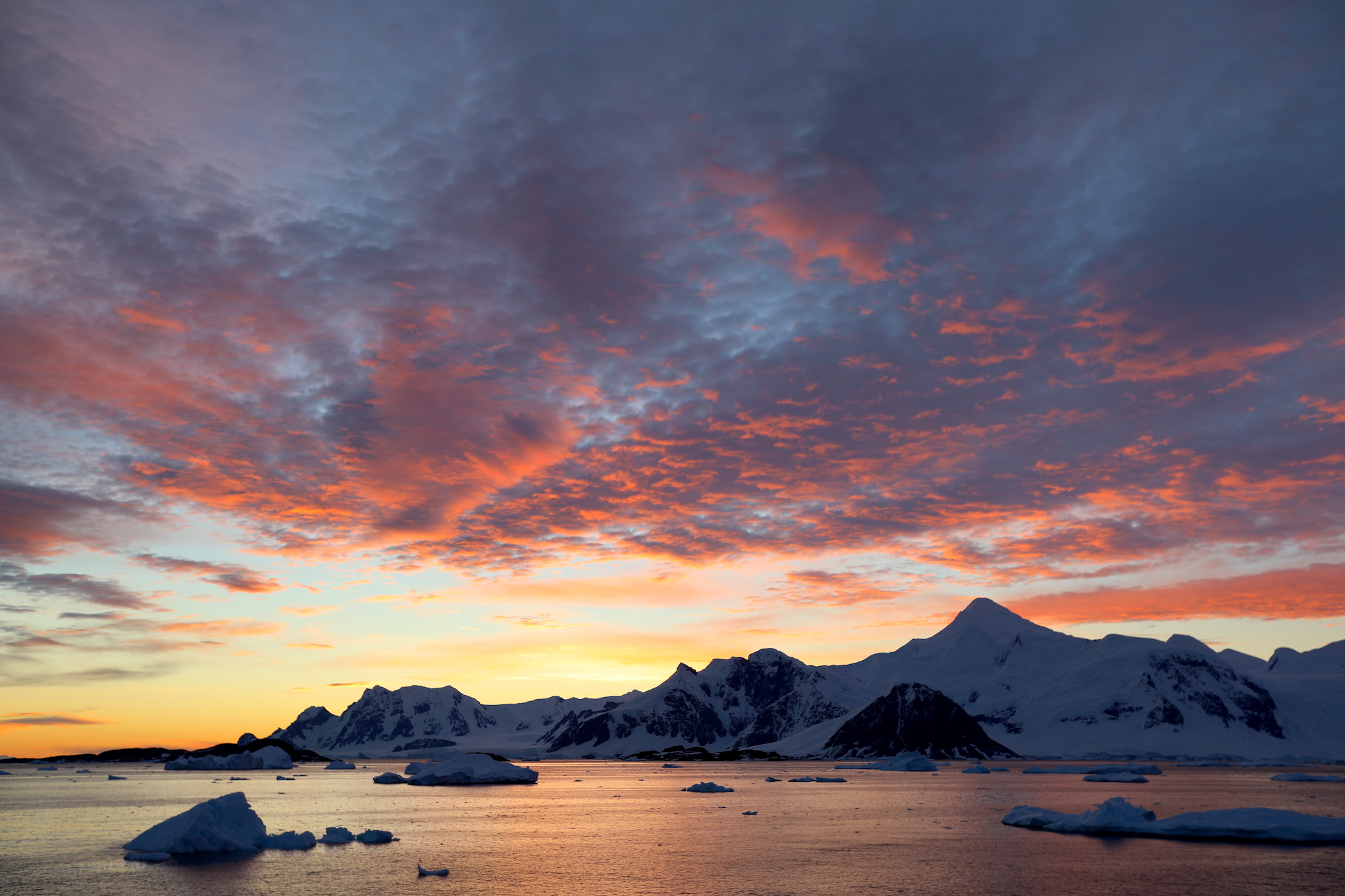
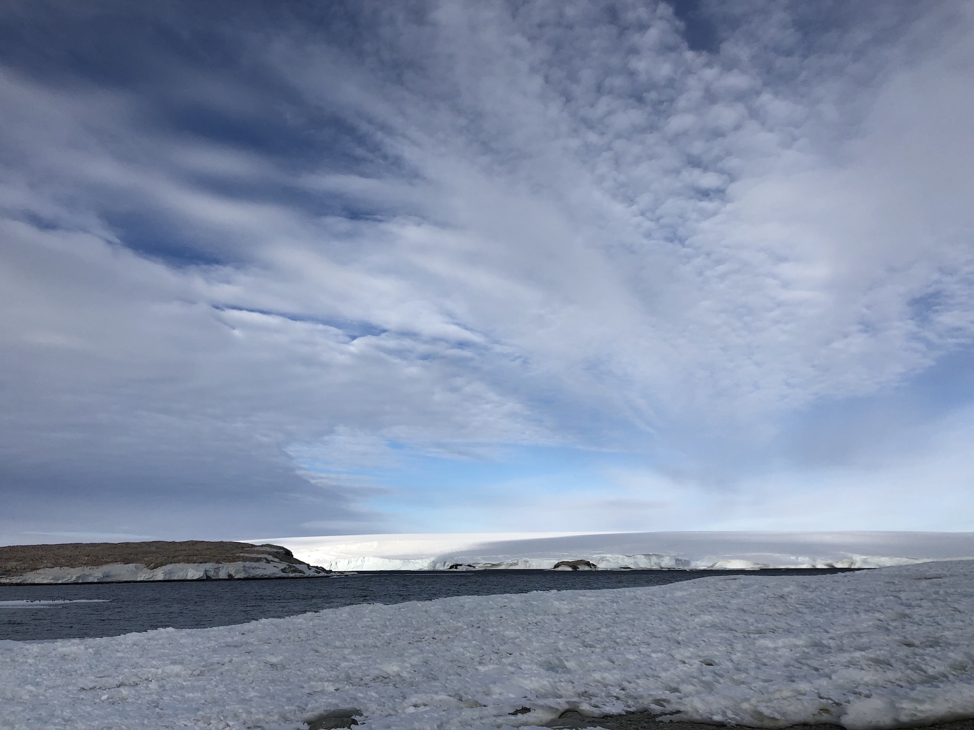
Mountains rising straight out of the water of Marguerite Bay, snow like smoke whispering away from the highest peaks and edges. Streams of ice, sinuous with hints of blue bending through the valleys between, the terminating glaciers cracked and crevassed where they make their way over the final bedrock hurdle into the sea.
Everyone is on the bridge.
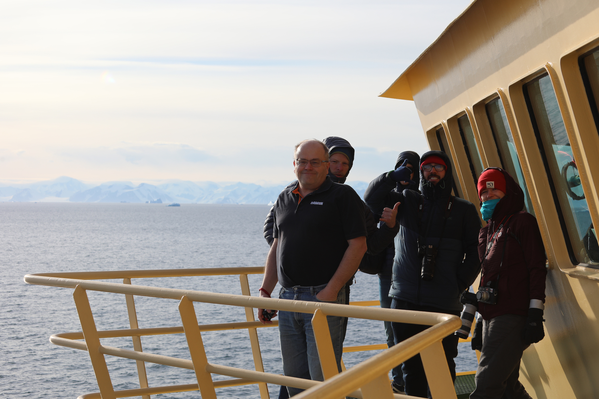
The morning sun, low on the horizon and directly ahead, creates intense shadows on the mountains which fill the port side view as we round the eastern side of Adelaide Island. They seem close enough to touch.

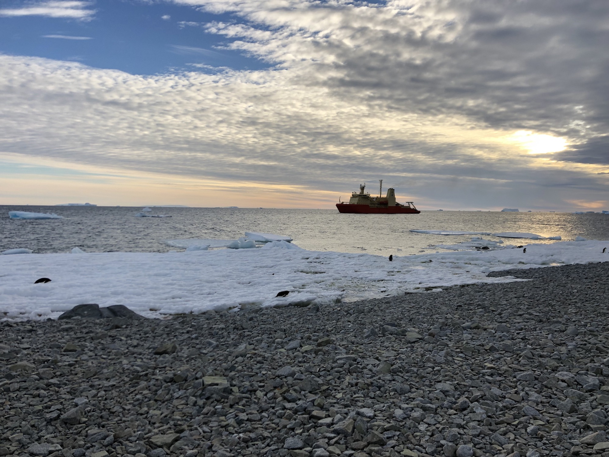
It takes about 2 hours to go from Marguerite Bay to the small cove called Ryder Bay where Rothera station sits, nestled on the point of a low exposure of glacially carved volcanic rock in the shadow of Sheldon glacier. Within what seems like minutes ofour arrival, a small craft departs the wharf (which is under construction, preventing the Palmer’s berth, and why there is a ferry rescue operation).

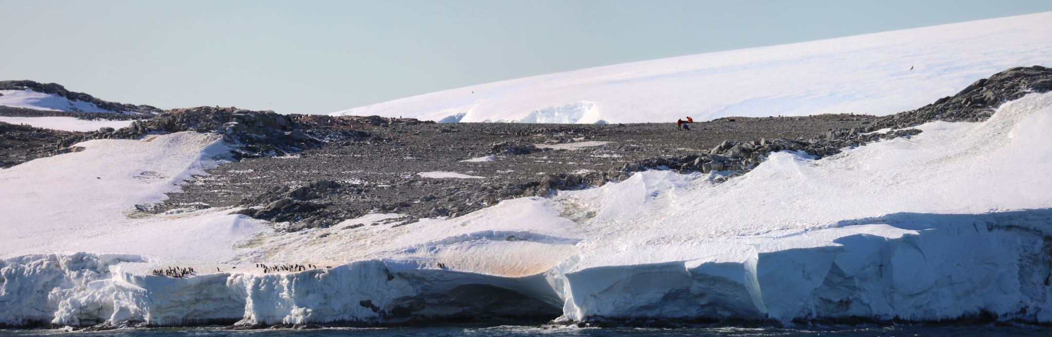
By mid-morning the mood becomes restless with the need to get back to Thwaites. Since there is the better part of two days before the arrival of our new marine technician, a practice collection of a multi-core (known as a MEGACORE) as well as a possible Hugin deployment is suggested. The Hugin is not ready, so the MEGACORE activities proceed. Opportunities torefine and practice a complicated technique, time permitting, can only increase the probability of success later on. It also allows us to anticipate and plan contingencies when things don’t work out exactly how they are planned.

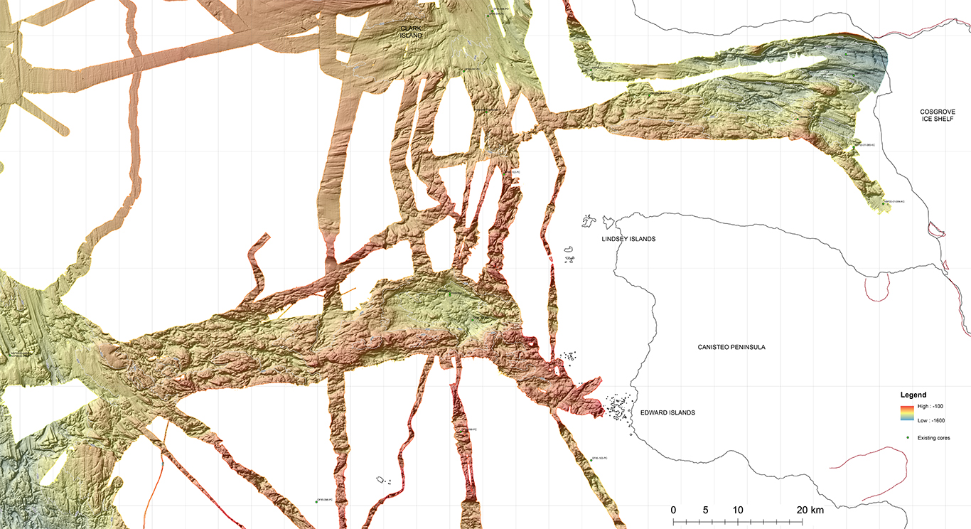
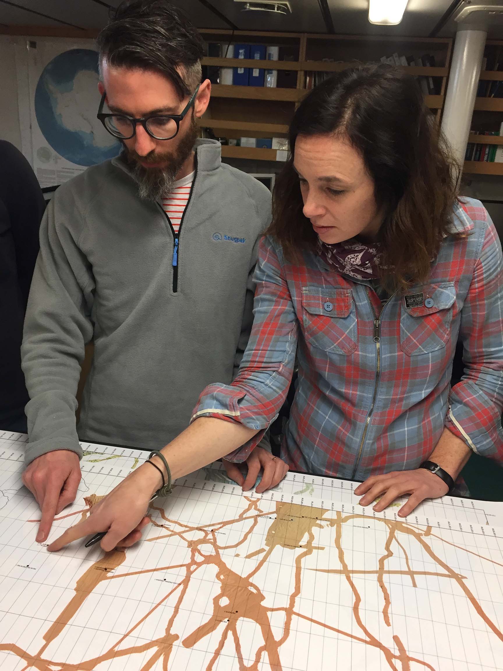
THOR team works with marine technicians to assemble the MEGACORE and to practice extracting the tubes.
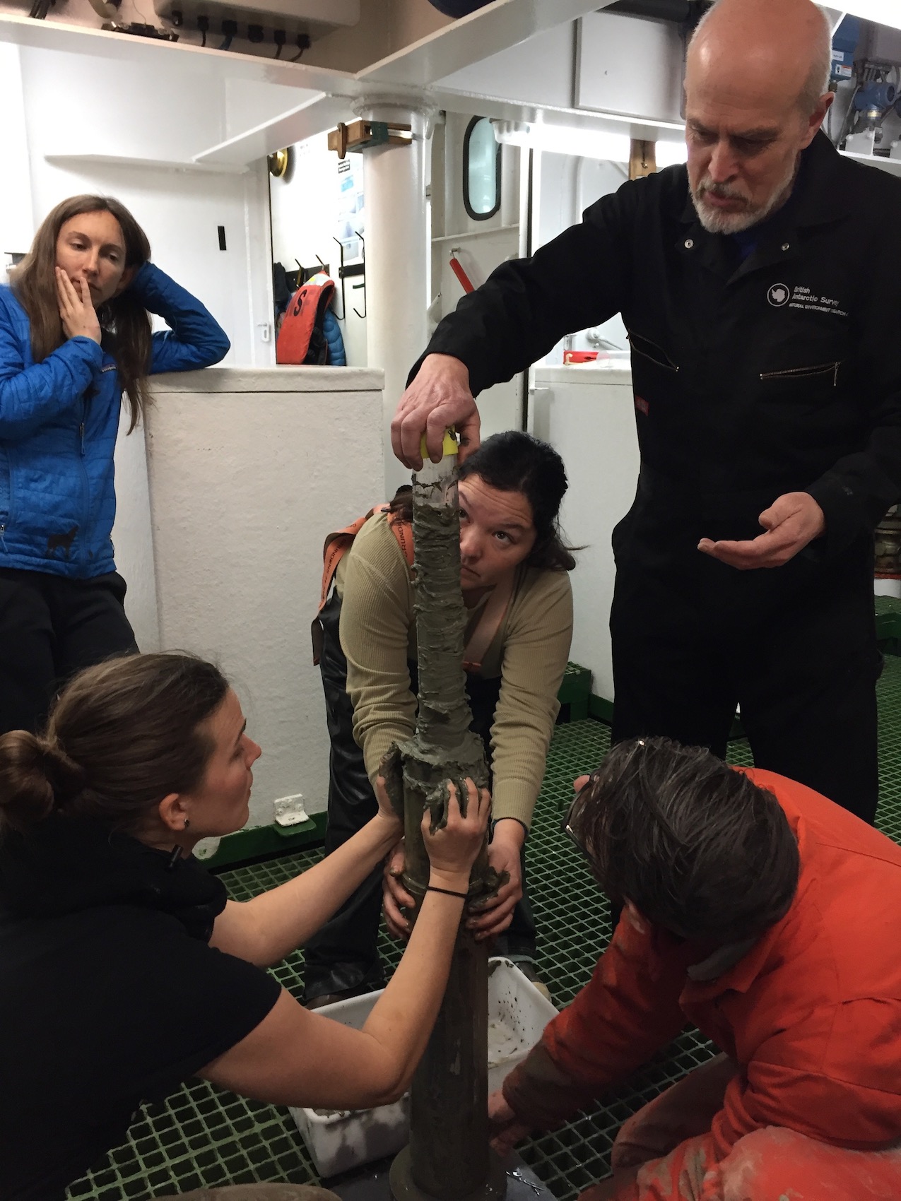
NBP1902 Chief Scientist and THOR PI Rob Larter caps off the archive sediment core extracted from a MEGACORE tube
The next morning brings two pieces of news. The first, and most important, is that the mission succeeded; the patient has safely arrived in Punta Arenas, Chile, and will even be able to make it back home for treatment. The second is that we are stuck for another day. The weather in Punta Arenas prevented the return flight until tomorrow (the 21st). A possible visit to the station is also negated by 30+ knot winds, which frustratingly die down just after mid-morning. By this time the Hugin is ready for a test. The sea is amazingly flat and the air a balmy 2-3 degrees above freezing. Serendipity.
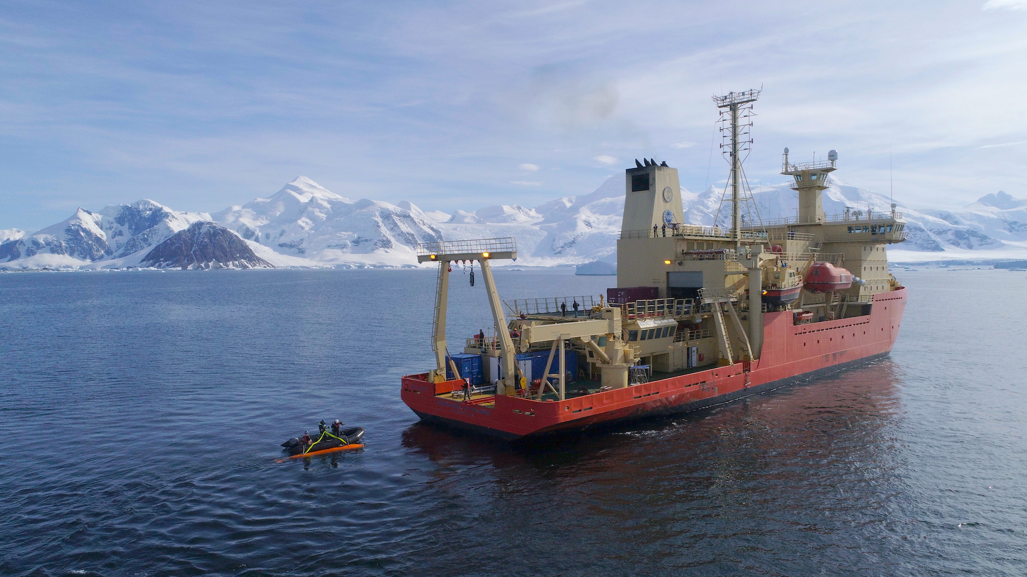
Image courtesy of Aleksandra Mazur and the TARSEN Hugin Team.
Unplanned events, planned contingencies and serendipity are expected when conducting Antarctic science. The next serendipity comes as a follow-up invitation from Rothera. We would be able to walk on land, tour the facility and send mail to our loved ones, but more importantly, our media experts will provide outreach for the British Antarctic Survey (BAS) by interviewing and reporting the work of other International Thwaites Glacier Collaboration scientists who just happen to be on station.

Halley research station will be closing as a result of the breakup of the Brunt Ice Shelf
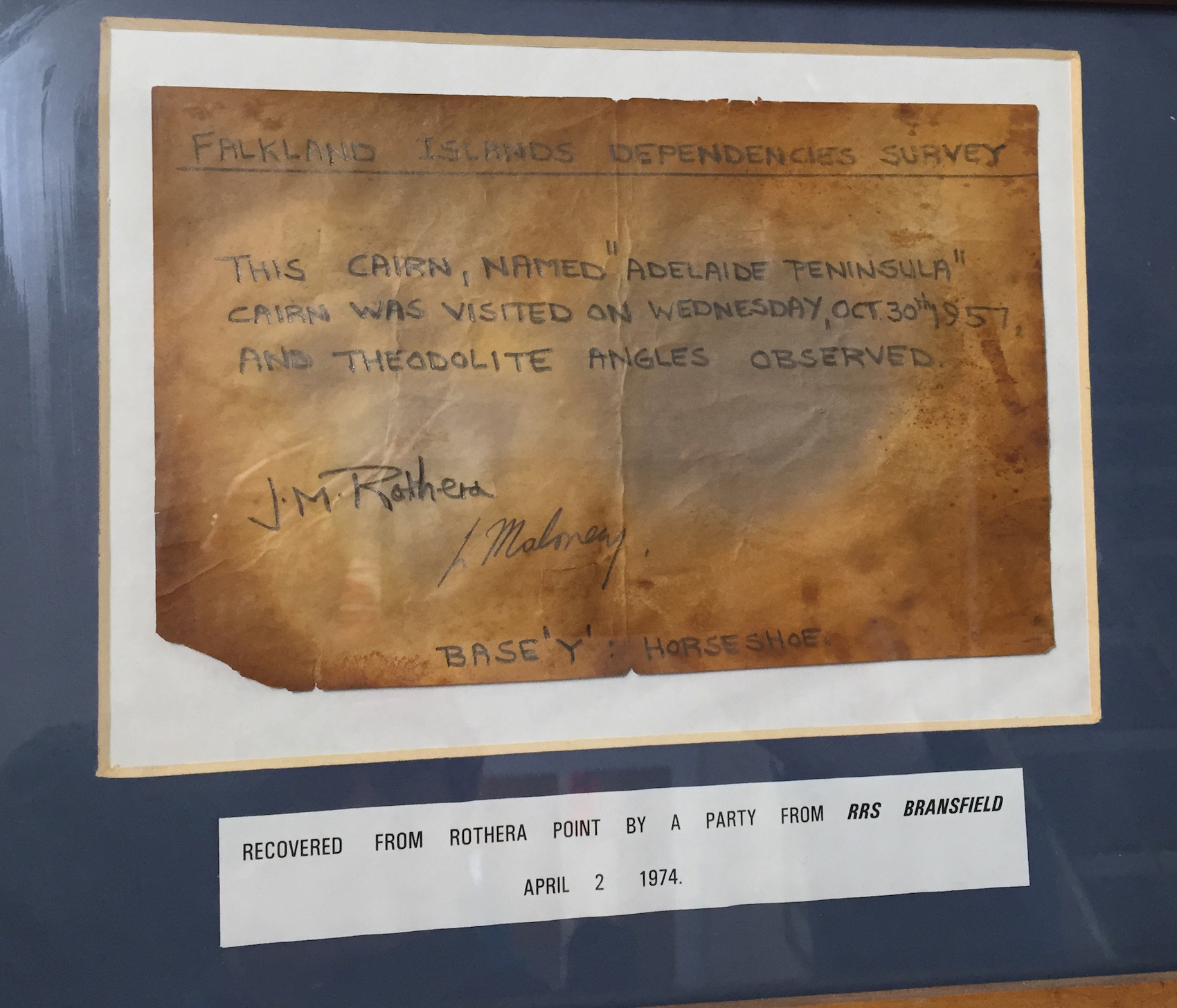
A note left in a cairn in 1957 by J.M. Rothera, namesake of Rothera Station.
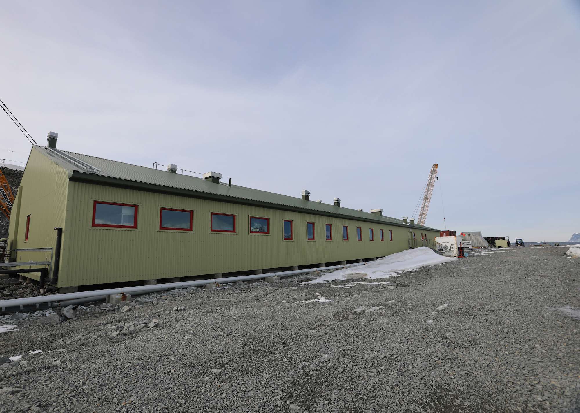
Rothera Point has been home to the BAS research station since 1975 and is the largest British research facility in Antarctica. It houses approximately 140 people, from staff scientists to the construction workers that are currently expanding the wharf. They maintain four Twin Otter research science planes and one Dash 7, the latter of which is solely for transport of people and supplies from Antarctica. The Dash flies to and from the station to South America and the Balkans 1-2 times per week. Rothera Station is one of seven bases the BAS maintains in Antarctica, plus smaller field stations used to depot fuel and supplies for field activities around the continent.

Onshore, we are met by BAS’ Mairi Simms, Rothera Physical Sciences Co-Ordinator and meteorologist, who will guide us through two laboratories: the Bonner laboratory from which all the Antarctic marine research is conducted, and the Bransfield House where much of the glaciologic and geologic research is conducted.
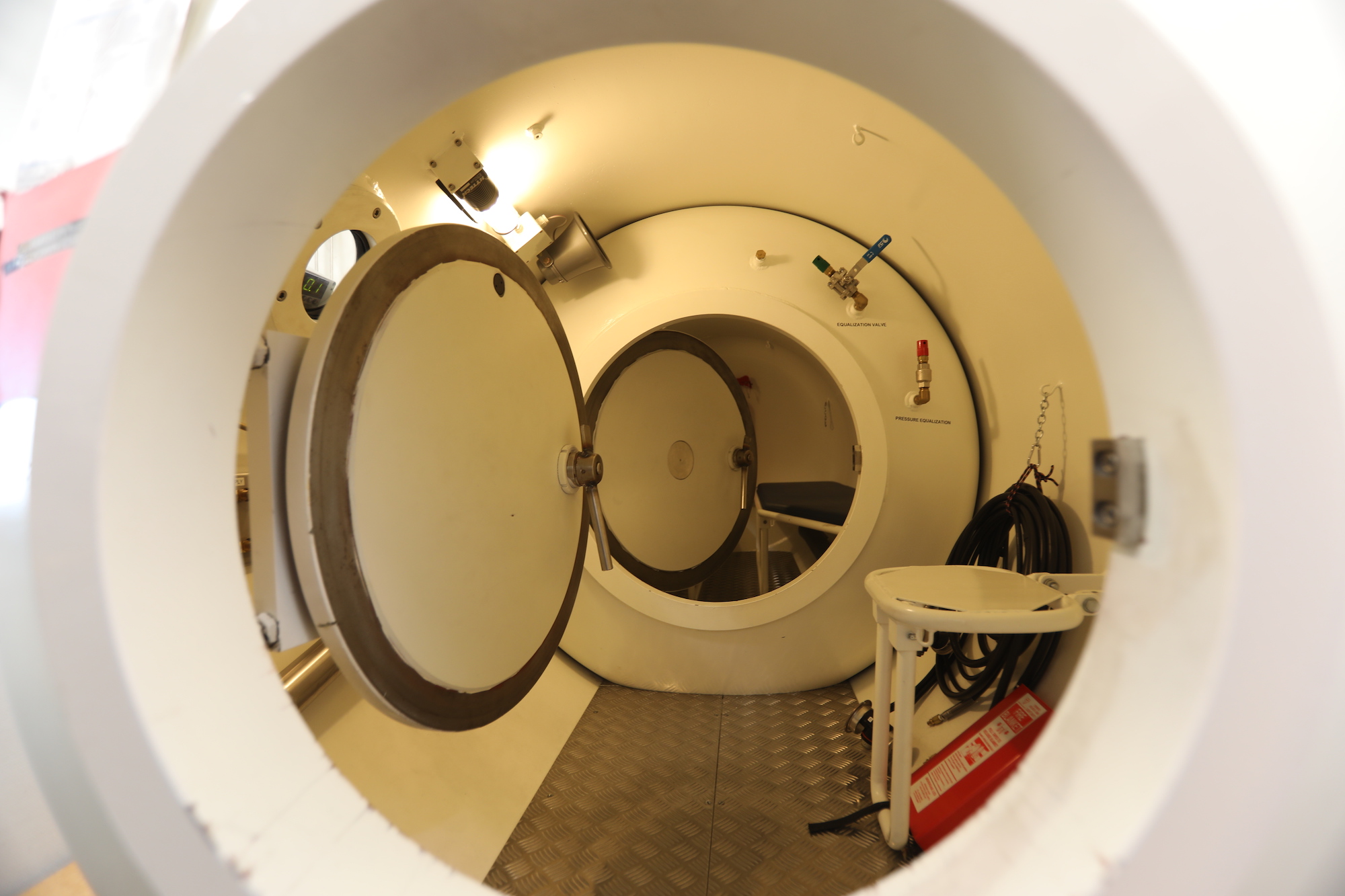
The Bonner laboratory is one story and, like most of the buildings of the station, is metal skinned and painted green. It is located close to the bay where samples collected by the science divers are easily transferred to special aquariums. We are met by Ali Massey, who is the lab manager. She shows us the pressure chamber used to decompress divers (when needed) and then leads us on to the experimental aquarium laboratory to talk to Dr. Melody Clark, who studies marine animals’ genetic evolution in response to climate change.


The lab is smaller than one might expect, but has not only her research charges (clams, snails and brachiopods), but a number of other Antarctic residents, from the many legged starfish of the genus Labidiaster, or the Antarctic sun star (and yes I thought it was an octopus too!), to the Sea Lemon (snail with a very interesting protective layer that looks like a lemon) sharing space with a sea spider and seaweeds (all of which are red!)

 We go on to talk to Dr. Amber Annett, NERC Independent Research Fellow, and Sam Coffin, postgraduate and BAS Cambridge Research Scientist, who study the chemistry and sedimentary materials within glacial melt water that comes from the Sheldon glacier, and how it impacts the ecosystems of Ryder bay.
Back outside, we have to walk along the airplane runway (because of the construction) to cross into the heart of the station and over to Bransfield House, where we will meet up with Dr. Andy Smith, glaciologist who recently arrived from the field, to talk about preparations for next seasons Thwaites Glacier GHOST project. We also chat with Carl Robinson, head of BAS Airborne Sensor Technology, who is just back from flying a month of geophysical surveys along Thwaites Glacier.
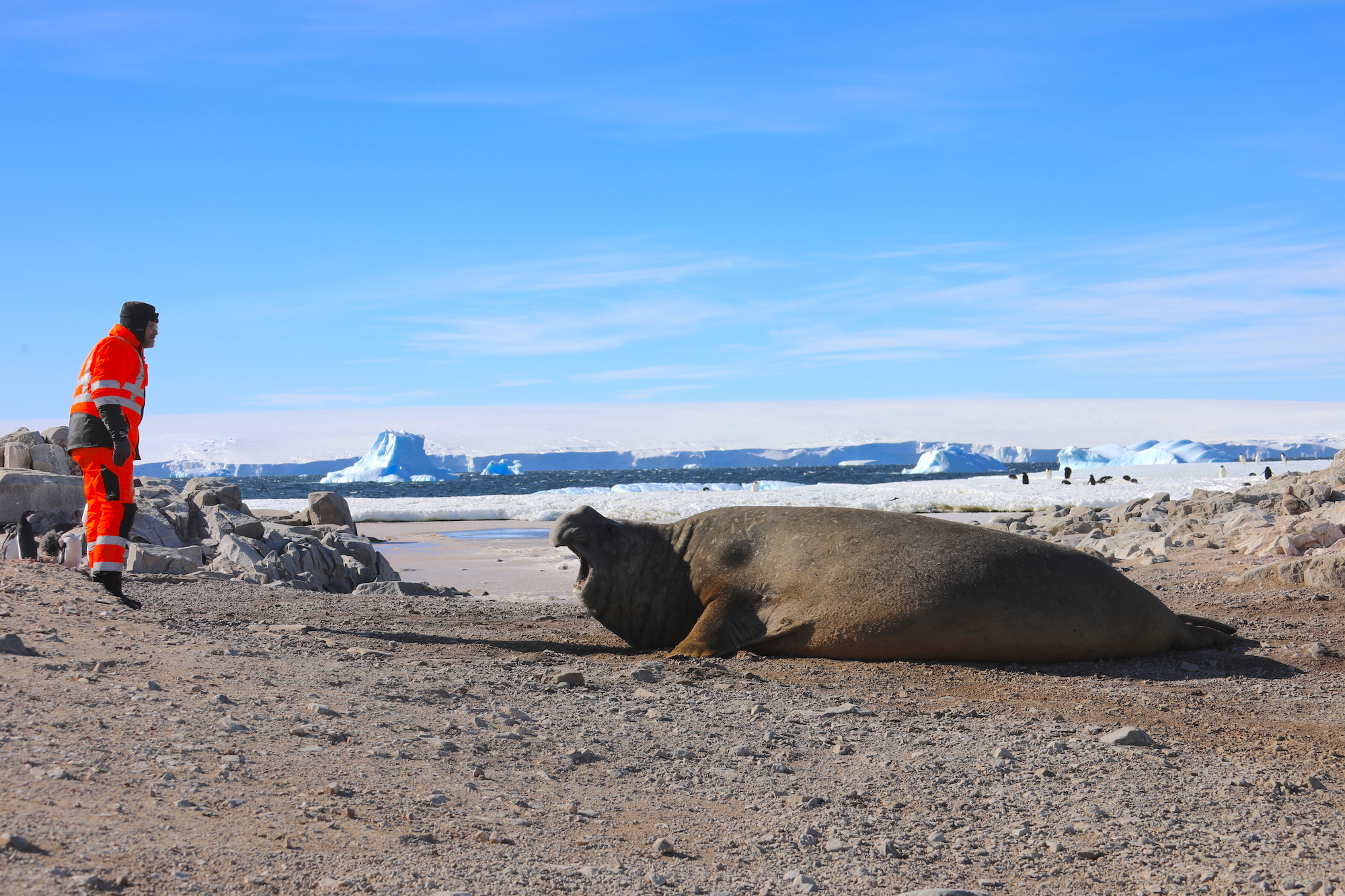
Heading up the hill from the airstrip, we face an unlikely sight- a sleeping Elephant seal parked in the middle of a bridge. We are told that they adopted this spot many years ago, and Antarctic treaty regulations prevent interfering with the natives, so they get to stay; the BAS get to use a second bridge built a bit further away from the coast for thru traffic.

At Bransfield House, a large weathered wooden door with a metal bar as the latch looks out of place in the modern green metal skin. Also out of place on the new metal is a mounted wooden sign with pealing read paint and the  letters of the station name carved into it. We enter into a vestibule common to all Antarctic buildings, meant to buffer the cold. Through two more doors, we meet Dr. Andy Smith, his own measure of weathering apparent being fresh out of the field. In an upstairs conference room, we settle down to talk about Thwaites Glacier science.
Dr. Andy Smith, one of the PI’s for International Thwaites Glacier Collaboration (ITGC) GHOST project, is just back from the 2018-19 BEAMISH field site where they conducted seismic profiling and hot-water ice drilling of the Rutford Ice Stream to characterize the bed below. The Rutford effort, like ITGC’s GHOST project, is part of a broader effort seeking to illuminate the past behavior of the entire West Antarctic Ice Sheet (WAIS) system.
His wiry frame is a testament to the 20+ years he’s been working in Antarctica. “Drilling is grueling work. You have to assemble and operate large heavy equipment for 24 hours over many days. Once we start, we have to keep going 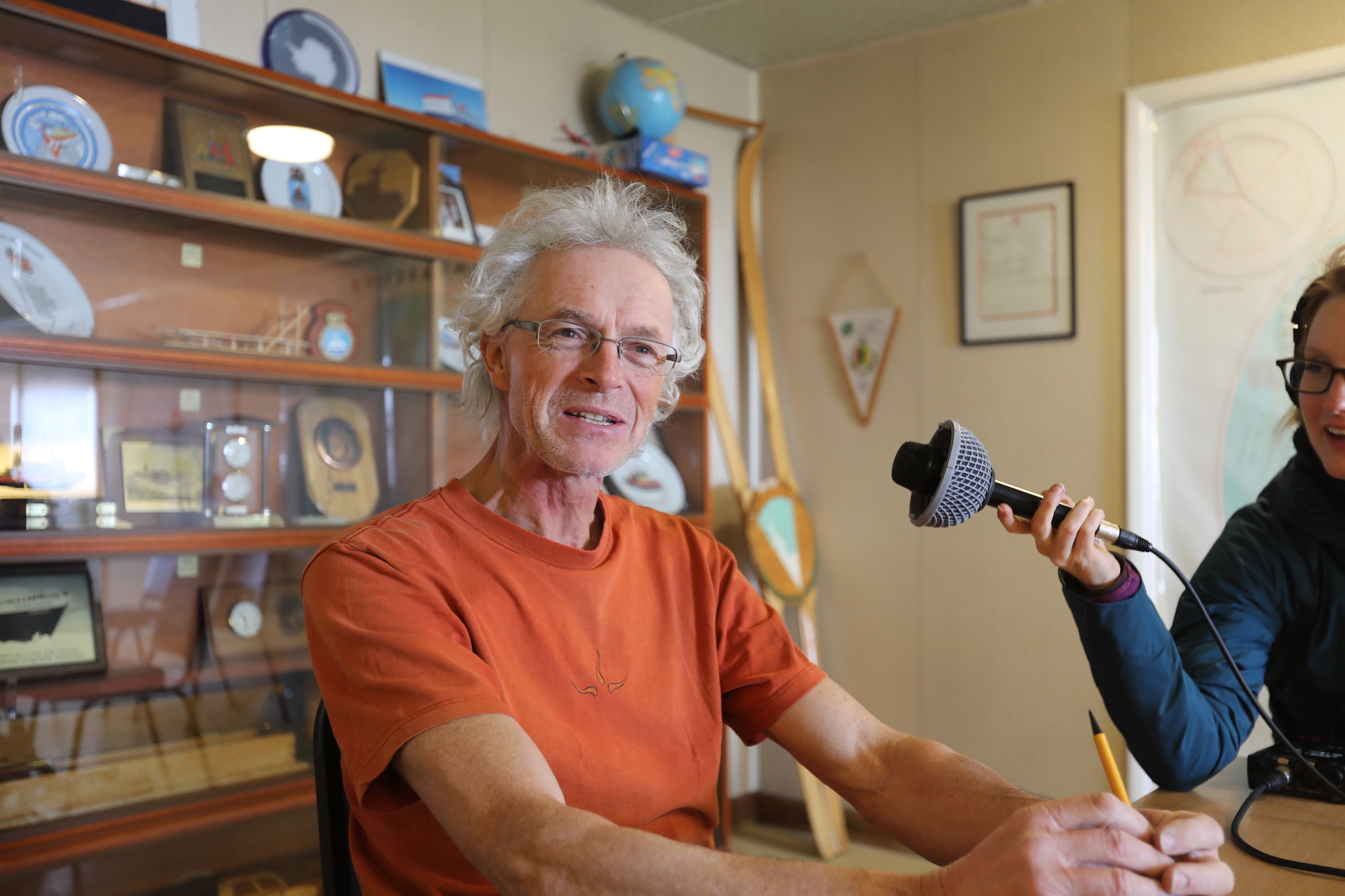 regardless of the weather,” Smith says of the field work they just completed. The ice cores show the structure of the ice to help identify the processes operating from the base to the surface, but also captures the rock at the bottom, the type of which has been a mystery. They set explosive charges that create localized shock- waves (like mini-ice quakes) that penetrate the rock below. When asked if these explosions might destabilize the ice, the response is that the charge is part of a well-tested technique that only produces a “small kick” to the ice. Seismic instruments measure the waves that bounce off the rock layers below, showing both the structure and makeup of the rock. Rutford is smaller than Thwaites, but is similar in thickness at two kilometers. Information from Rutford will provide similar information to what they expect to extract from Thwaites in during the 2020 field season using the same techniques.
The GHOST project will focus on the physics of how ice works- how it flows, what allows it to speed up, what holds it back. “THOR is looking at ice behavior in the past, we on the GHOST project are looking at how the ice works presently, particularly at the bed; what happens at the bed is a big factor of control over how it flows. We want to know the detailed bed topography, the places where its rough or smooth.” Prior work at Pine Island Glacier (PIG), which has been a main focus of the BAS, suggests that PIG and Thwaites (and their proximal boundaries) work together.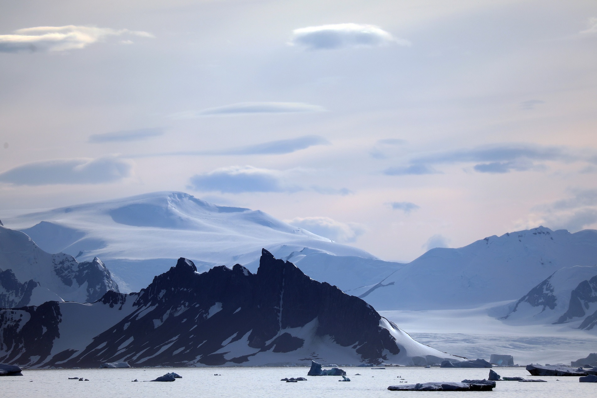 As one changes, it will affect the other. They will also look for evidence that can be used to model future glacier behavior. For example, in a situation where the material below the ice sheet is soft and smooth, and wet and deformable, the glacier could move easily and speed up. Conversely if the topography is rugged, models may say that the glacier is better grounded.
“A rise in the topography under the glaciers is a good thing because they tend to stick there. But the bad side is that once they retreat from those points they tend to retreat quite quickly.” They want to try and understand at what stage the glacier might remain pinned there and then quantify the time scales for how long it will stay there. “At around 70 kilometers, which is not that far inland, it is a critical bit of information to know,” emphasized Smith.
With Thwaites Glacier, there is a time factor involved. “We think [Thwaites] has the greatest potential to surprise us in a not so good way. Part of the problem is that Thwaites has been hard to access, and thus far has been ignored because of that. Little information exists earlier than 25 years ago, so this collaboration should provide a large amount of the missing information,” says Smith.

When asked how the world at large can learn from the research and the challenges of gathering this information, Andy’s parting advice is to make the best plans you can. But also make sure you have contingencies to that plan.
“The secret to the work we do, in many ways, is to keep asking yourself ‘what if, what if, what if….’You can have a wonderful plan on paper, and it will change completely when you actually try to achieve it. Get used to change, work with it rather than fight against it. And hope you have enough contingencies to be able to know what the next best thing is to do…”
Lapsing into a thoughtful distant gaze, Andy mentions Scott and Shackleton. “Shackleton especially – his methods and leadership are used and put forward as good ways to deal with difficult situations. The principles and approaches of his leadership are also applicable elsewhere.” This, of course, makes me think of frontiers beyond Antarctica, such as space.
As a compliment to Smith’s research at BEAMISH, Carl Robinson, head of BAS Airborne Survey Technology, is just back from a month of flying geophysical surveys over Thwaites Glacier. 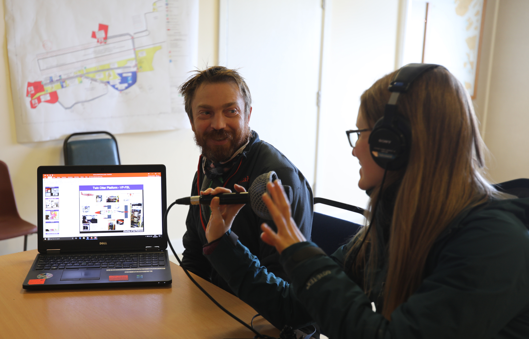 His team uses a remarkable suite of remote sensing instruments, radars that cover a range of shallow snow to deep depth-sounding radar (which can see just below the rock-ice contact) as well as gravity and magnetic sensors that also look at the geology below the ice.
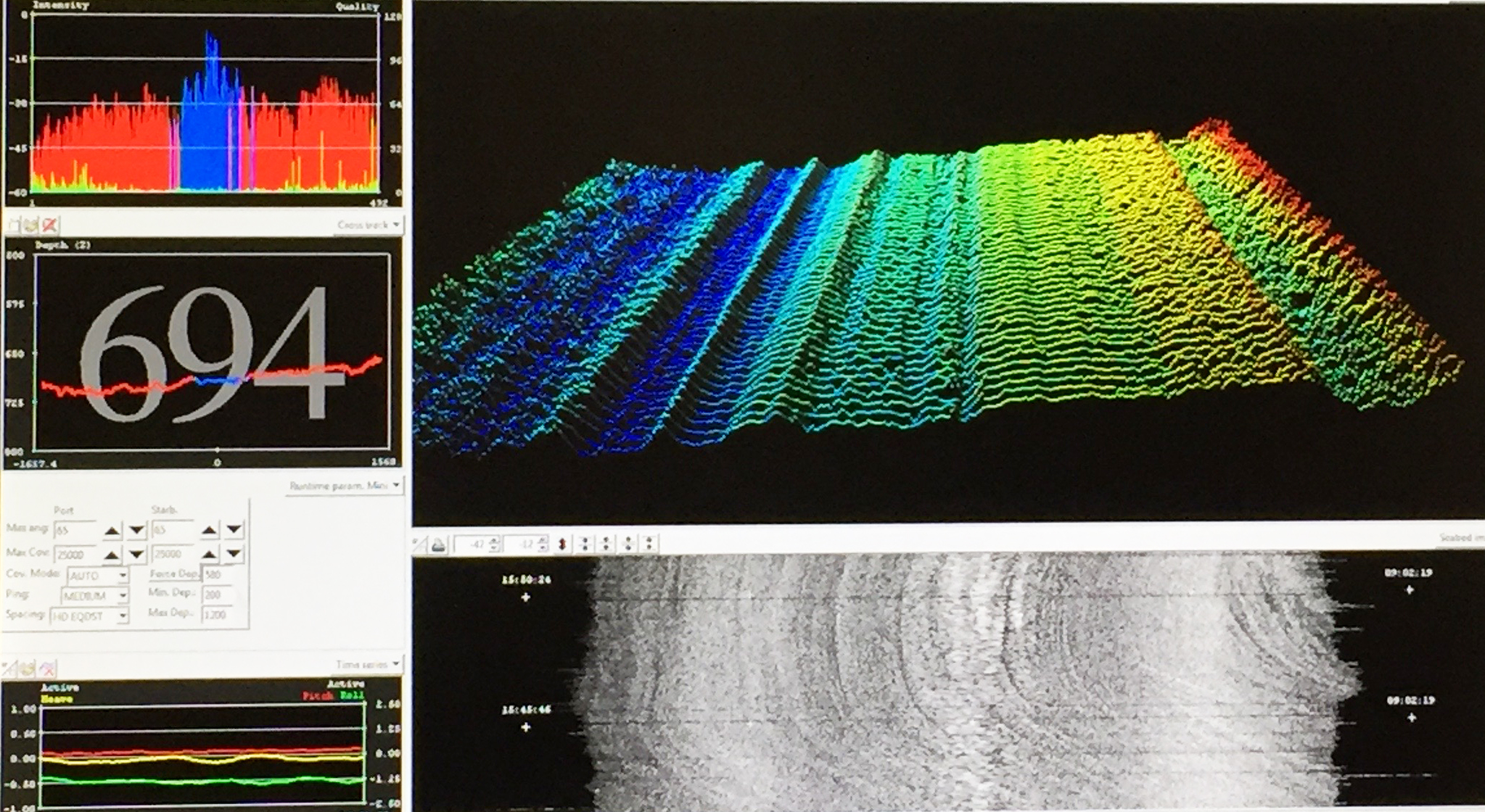
Robinson and his crew use Twin Otter aircraft, which need refueling before reaching the Thwaites Glacier field camp. After stops at BAS’s Sky-Blu and then BEAMISH sites, they actually begin their systematic surveys en route, similar to how NBP1902 takes continuous bathymetry during transit. Surveying requires good weather to allow for up to 4-hour flights at 1,000 feet, sometimes retracing a path to re-cross certain features like grounding lines (places where the ice shelf is fixed to the seafloor). “When we get close to the coast, the glacier features look more dramatic. You see heavy crevassing and bergs forming, reflecting the different processes that are happening internally, where the ice is moving over mountain ranges buried under the ice,” says Robinson with a smile.
This year’s data should provide a top to bottom look at the entirety of Thwaites Glacier, the effort of which is scheduled to be repeated over the next 5 years. Robinson emphasizes the importance of the multi-year effort. “This is a rare opportunity to see how the glacier changes over the next 5 years. Because of the way most funded grants work, surveys typically are only conducted during a single season.” The information will also be used by Andy Smith and the other GHOST scientists to decide where to take ice cores that will provide the best information about the glacier’s structure to help model Thwaites’s future behavior.

Within two hours of returning to the Palmer, the BAS Dash 7 arrives, delivering our new marine technician. Wasting no time, the Palmer turns her bow south, leaving the beautiful peaks surrounding Ryder Bay behind. Back to Thwaites Glacier we go.


 weather has turned ominous. The skies are heavy, dark and spitting rain. The winds have picked up and the sea surface is rough and rolling. Hugin’s bright orange skin is spotted and Joee and Jennie are off in the zodiac to begin the process of bringing Hugin home.