

ESCI 546 Basin Analysis: Field Trip to Ireland
Overview
ESCI 546 “Advance Topic in Basin Sedimentology and Stratigraphy ” participated in a field trip to County Clare, western Ireland, from May 2nd to May 12th, 2016. The class visited sea-cliff exposures of rocks found in the Western Irish Namurian Basin (WINB), which were deposited during the Upper Carboniferous (326 Ma – 317 Ma). The deposits represent a variety of sedimentary depositional environments, including fluvial-deltaic to deep water turbidites. The rocks were later obscured by fold-thrust related deformation associated with the Variscan (Hercynian) orogeny, brought on by rift-related deformation during the breakup of Pangaea. The WINB is an ideal location to evaluate the interconnectedness of the various sedimentary environments, in particular, linking the physical processes that shape the internal stratigraphy.
The first part of the class trip included a five day “basin overview” led by Professor Jim Best of the University of Illinois at Urbana–Champaign (UIUC), who has 30 years of experience working in the WINB. During this tour, students self-organized to develop research projects for the range of depositional environments. Students were then provided three days to work among the outcrops to pursue their respective projects. On the final day, these students led the class through the outcrops, presenting their specific findings.

Regional map of western Ireland (Lien et al., 2003; Kendall and Haughton, 2006)

Stratigraphic overview of the WINB (Tanner et al. 2011)
Participants
Professors: Jeffrey A. Nittrouer, Jim Best (UIUC)
Post-doc: Hongbo Ma
Students: Andrew Moodie, Brandee Carlson, Sam Zapp, Simon Chan, Garrett Lynch, Brian Demet, Chenliang Wu, Pulkit Singh
Visiting Student: Matthew Czapiga (UIUC)
Teaching Assistant: Tian Dong
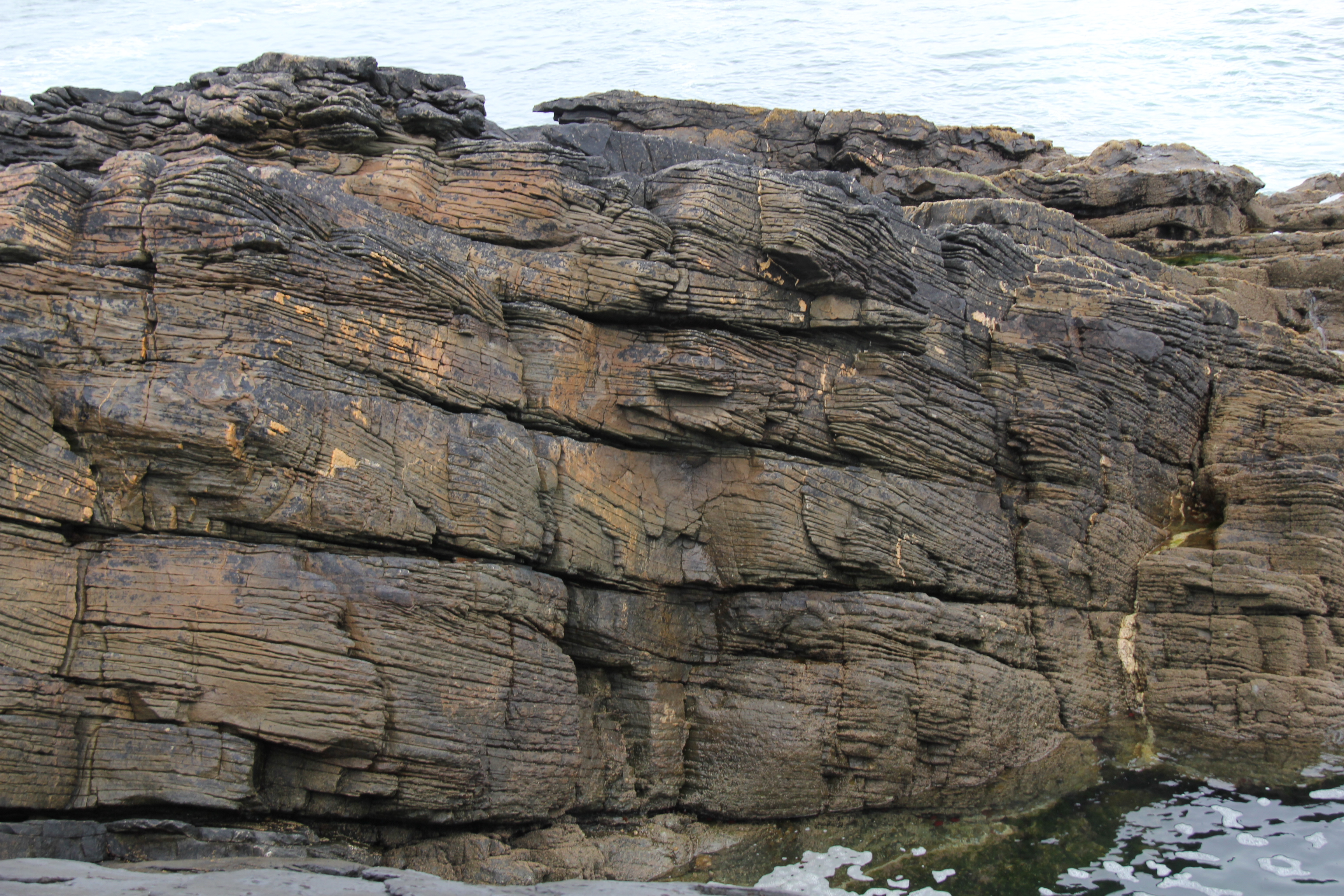
Day 1 Loop Head Cliffs: Ross Fm. (Deep Water Turbidite)

Cliff exposure of Ross Fm. at Loop Head Peninsula (Photo Credit: Matthew Czapiga)
May 3rd
We arrived in Shannon, Ireland, on the morning of May 3rd. In the early afternoon, after settling into our rental home in Kilkee, we visited cliff exposures of the Ross Fm. near the Loop Head lighthouse. The Ross Fm. is a sandstone unit, interpreted as deep-water turbidite fan deposits. Among the lobes are a few channel features higher in the stratigraphic section. The Ross Fm. is the thickest near the Shannon Estuary (~380 m) and thins to the north, in the general direction of paleo flow.
Ross Sandstone at the Bridge of Ross (Photo Credit: Matthew Czapiga)
Day 2 Northern County Clare: Visean Fm. (Basement Limestone) and Clare Shale Fm.(Deep Water Shale)
May 4th

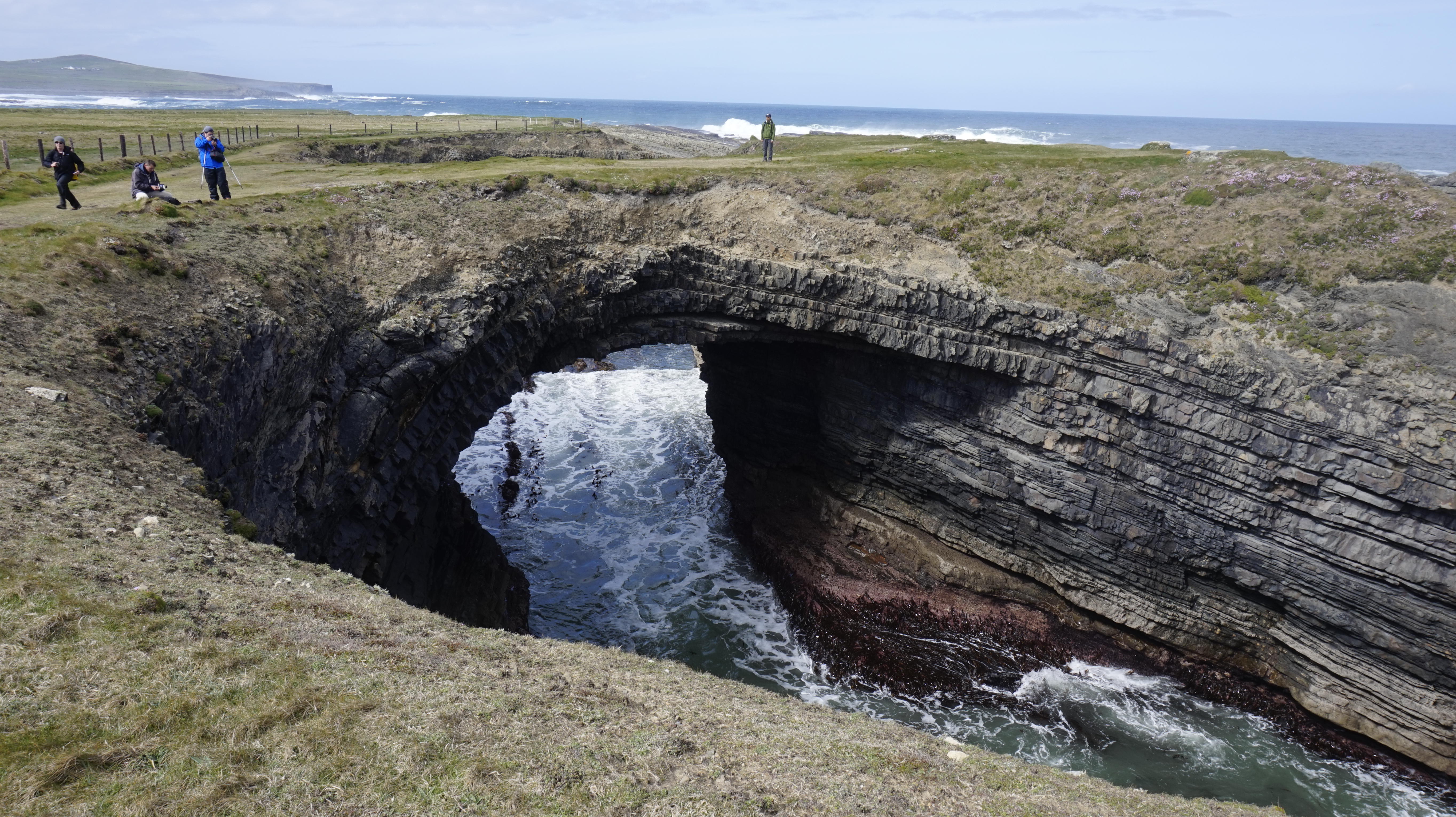
Cliff exposure of Visean Limestone Burren Fm. near Galway Bay (Photo Credit: Matthew Czapiga)
We drove north for 2 hours from Kilkee to the south of Galway Bay at the northern end of County Clare. Here, we visited the Burren Fm., a Visean limestone unit that forms the basement of the WINB. This unit is interpreted to be a shallow-water carbonate deposit, likely associated with a shelf setting. The unit contains variety of fossils, including rugosa corals and brachiopods.
Clare Shale and Visean Limestone contact at St. Brendan’s Well (Photo Credit: Tian Dong)
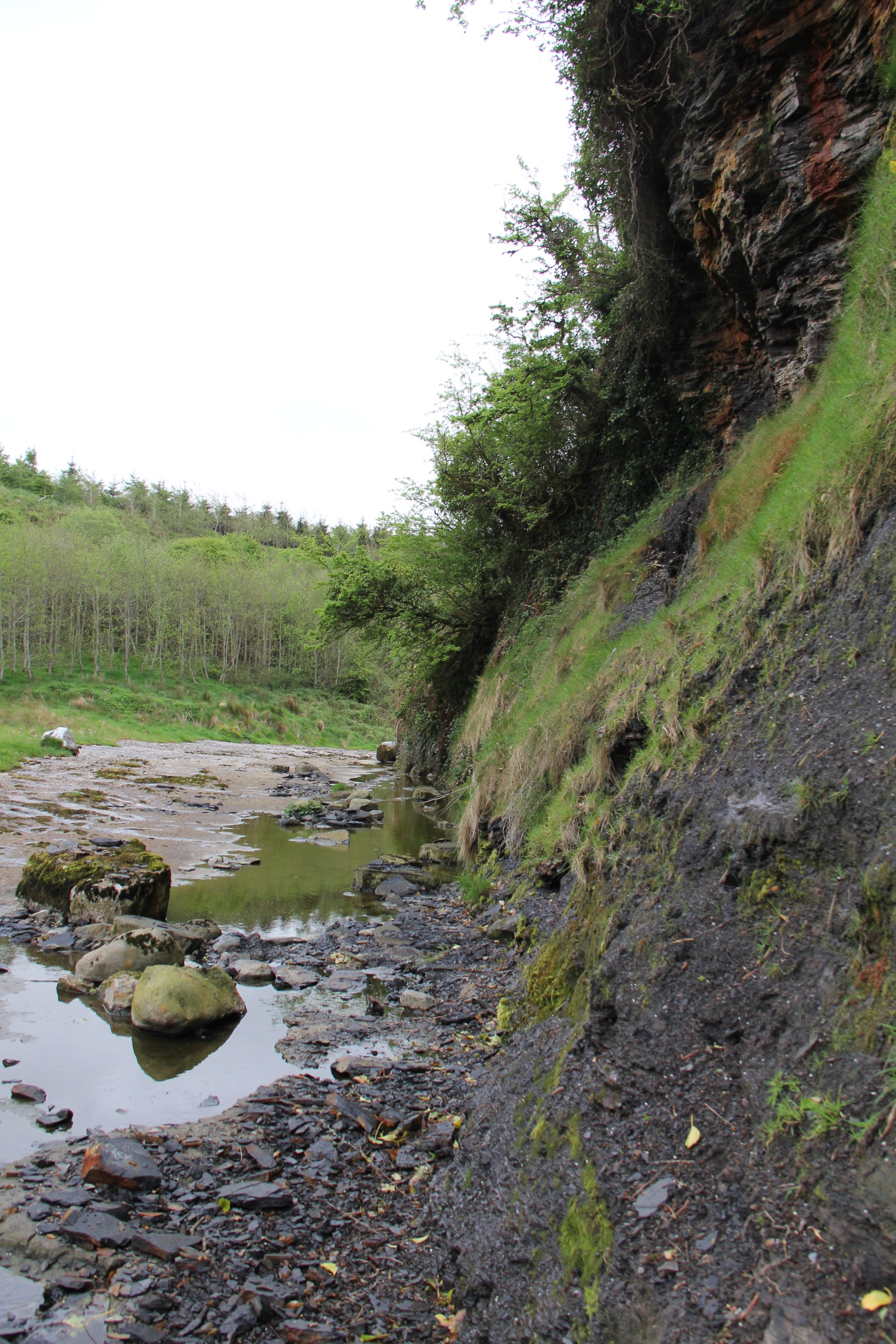
Travelling to the south, we moved upsection to the “St. Brendan’s Well” outcrop to locate the contact between the Visean Limestone and the Clare Shale. The Clare Shale Fm. is the lowest unit of the WINB sedimentary fill, and consists of a deep marine black shale. At the contact of the Clare Shale and Visean Limestone is a phosphate rich bed, ~ 8 cm thick, interpreted to be a condensed section likely associated with an open marine environment, where sedimentation is extremely minimal.
Day 3 Point of Relief: Deep Water Deposit (Ross Sandstone Fm.) and Slope Deposit (Gull Island Fm.)
May 5th
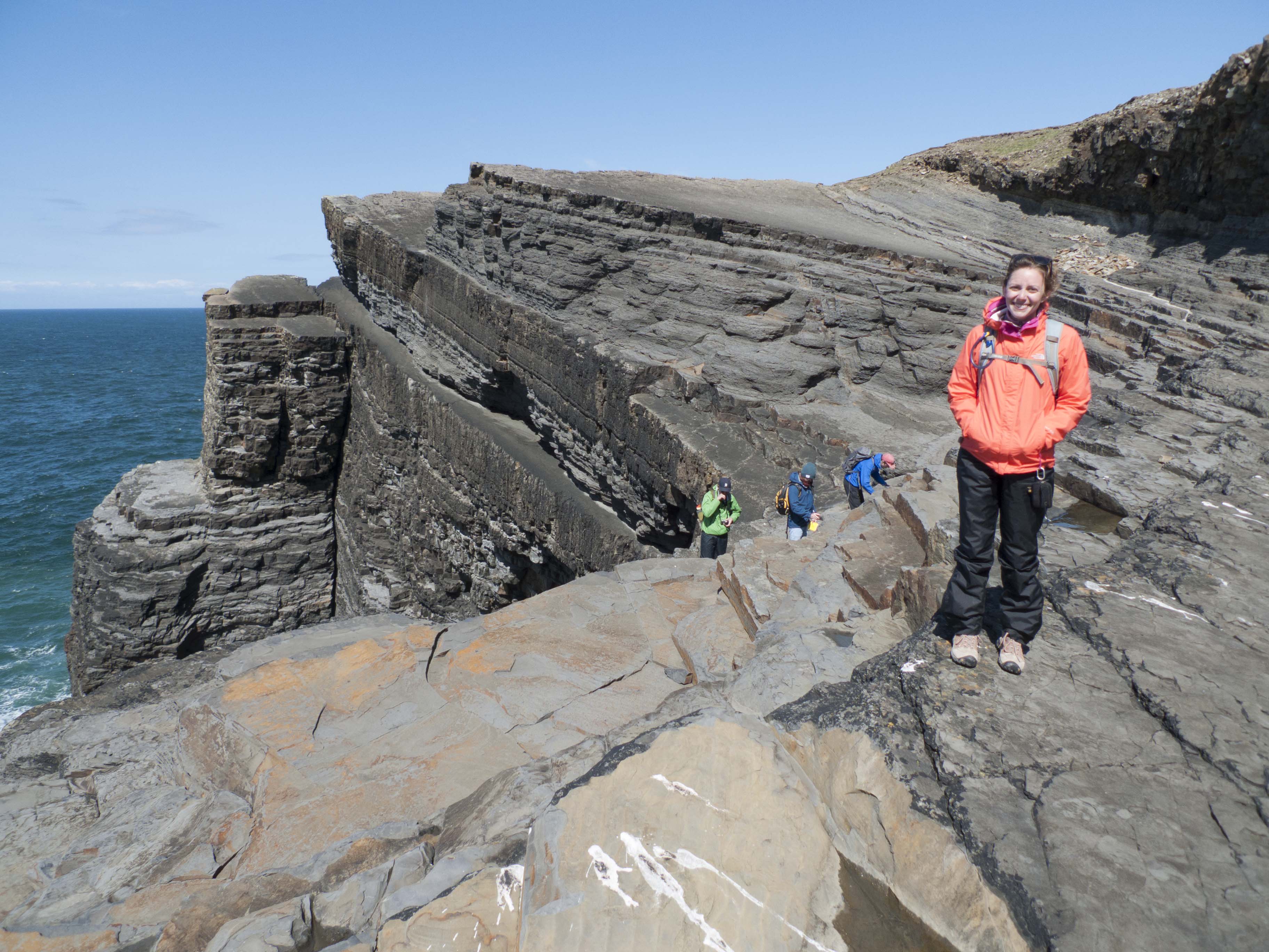
We visited the Bridge of Ross and the Ross Fm. to examine the sedimentary structures found within the turbidite deposits. One of the most famous structures here is the Ross Slide, a highly deformed, inter-bedded mudstone and sandstone unit, which contains various soft sediment deposition features, including sand volcanoes and syndepositional folds. The Ross Slide is more recently interpreted as a slump deposit, whereby external forces caused liquefaction of sand and mud and initiated motion that produced significant folding and deformation. The Ross Slump is very laterally extensive (10’s of kilometers long), and this significant size is considered to be associated with a seismic event as triggering the the deformation.

Ross Slide near the Bridge of Ross (Photo Credit: Matthew Czapiga)
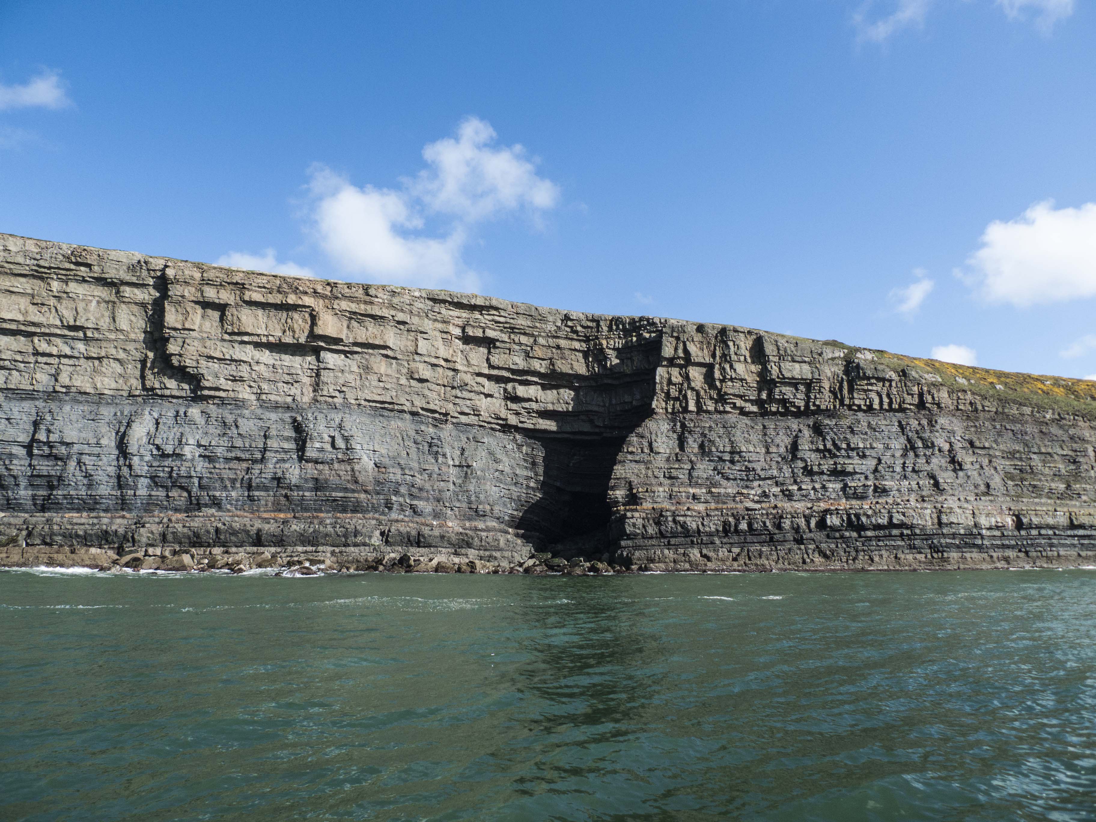
Moving up Section, we examined the contact between the Ross Fm. and the Gull Island Fm., identified by a thin layer of mud with a goniatite (ammonoid) band, which is likely associated with a condensed open-marine section.
The Gull Island Fm. is interpreted as a slope deposit, whereby numerous failures trigger mass transport of sediment that ultimately feed the Ross Fm. turbidite deposits. The Gull Island Fm. contains various styles of soft sediment deformation, including slides, slumps, growth faults, and mud volcanoes.

Ross and Gull Island Contact near Point of Relief (Photo Credit: Matthew Czapiga)
At end of the day, we visited the Tullig Cyclothem, the formation atop the Gull Island. Here, this cyclothem represents alternating sequences of fluvial-delatic and near-shore, shallow marine deposits, indicated by a classic coarsening upward deltaic sequence of interfingering pro delta, interdistributary bay, and fluvial-deltaic deposits. The middle to upper Tullig Cyclothem is characterized by channels of various sizes, and the Upper Tullig sandstone possesses bedforms and terrestrial plant fossils, indicating a fully fluvial depositional setting.

Cliff exposures of Tullig Cyclothem at Point of Relief (Photo Credit: Matthew Czapiga)
Day 4 Trusclieve: Fluvial-Deltaic Deposit (Tullig Cyclothem and Kilkee Cyclothem)
May 6th
We took a boat ride on the Shannon Estuary, in order to observe cliff exposures of the Middle to Upper Ross Fm., and the underlying Clare and and Visean Limestone. The upper Ross Fm. contains numerous feeder channels that routed sediment to the fan lobe deposits of the Ross Fm.
Upper Ross Formation (Photo Credit: Tian Dong)

Large fold within the Ross Fm. (Photo Credit: Tian Dong)
Later, we drove to Trusklieve to visit the Tullig Cyclothem in detail, specifically, the changes in vertical stacking patterns. Stratigraphic Sequences of the Tullig Cyclothem at Trusklieve show that an overall coarsening upward trend is pervasive (as described above). Moving up section, there is an increase in the frequency of amalgamated channels bodies, which possess bedforms, barforms, and terrestrial plant fossils, all of which indicate a land-based fluvial-deltaic environment.
Tullig Cyclothem at Trusklieve (Photo Credit: Tian Dong)
Overlaying this fluvial section is a thick transgressive mudstone that contains various types of marine fossils, including zoophycos, which is a trace fossil left behind by the movement of polychaete worms. Above this mudstone is a marine mud bed, rich with goniatites, and representing the final stage of the Tullig transgression. Overlying this is the Kilkee Cyclothem, which progrades overtop and marks of the onset of a new fluvial-deltaic progradation.

Transgressive package within the Tullig Cyclothem overlain by the Kilkee Cyclothem (Photo Credit: Tian Dong)
Day 5 Killard: Fluvial-Deltaic Deposit (Tullig Cyclothem)
May 7th
We drove several kilometers north of Trusklieve to examine the Tullig Cyclothem at Killard Bay. We observed similar coarsening upward sand bodies, as well as sedimentary structures and plant fossils that are quite similar to those observed at Trusklieve. An interesting question arose regarding this outcrop: Why do the bedform foresets dip at such a shallow angle, much lower than angle of repose? Hongbo Ma is investigating this phenomenon, and has some interesting findings based on ongoing studies in the modern Huanghe River (China) which could be used to compare to the Tullig channel dunes.
Foresets in Upper Tullig Cyclothem (Photo Credit: Tian Dong)

Soft sedimentation deformation at Killard (Photo Credit: Tian Dong)
Day 6-8 Group Project
May 8th – 10th
Students self-organized into four groups of two people each, and pursued independent research projects, conducted at various field sites for the range of depositional environments. On May 10th, each team presented the results of their individual projects to the class. The following list describes the student groups and their respective project depositional environments:
Fluvial-deltaic (Trusklieve and Killard): Brandee and Andrew
Pro-Delta/Shelf (Point of Relief and Killard): Chen and Sam
Slope (Point of Relief): Garrett and Brian
Turbidite (Bridge of Ross): Pulkit and Simon
Day 9 Cliffs of Moher
May 11th
We visited the Cliffs of Moher on the northern end of County Clare. This location is distal part of the WINB, where it contains a condensed section of all the previously visited sedimentary formations. At the highest point of Cliff of Moher, stands the O’Brien’s Tower, an observation tower build by local landlord in the early 1800s. Standing by the tower, we had a spectacular view of the Loop Head peninsula and north Atlantic, which is a great way to conclude this wonderful trip.
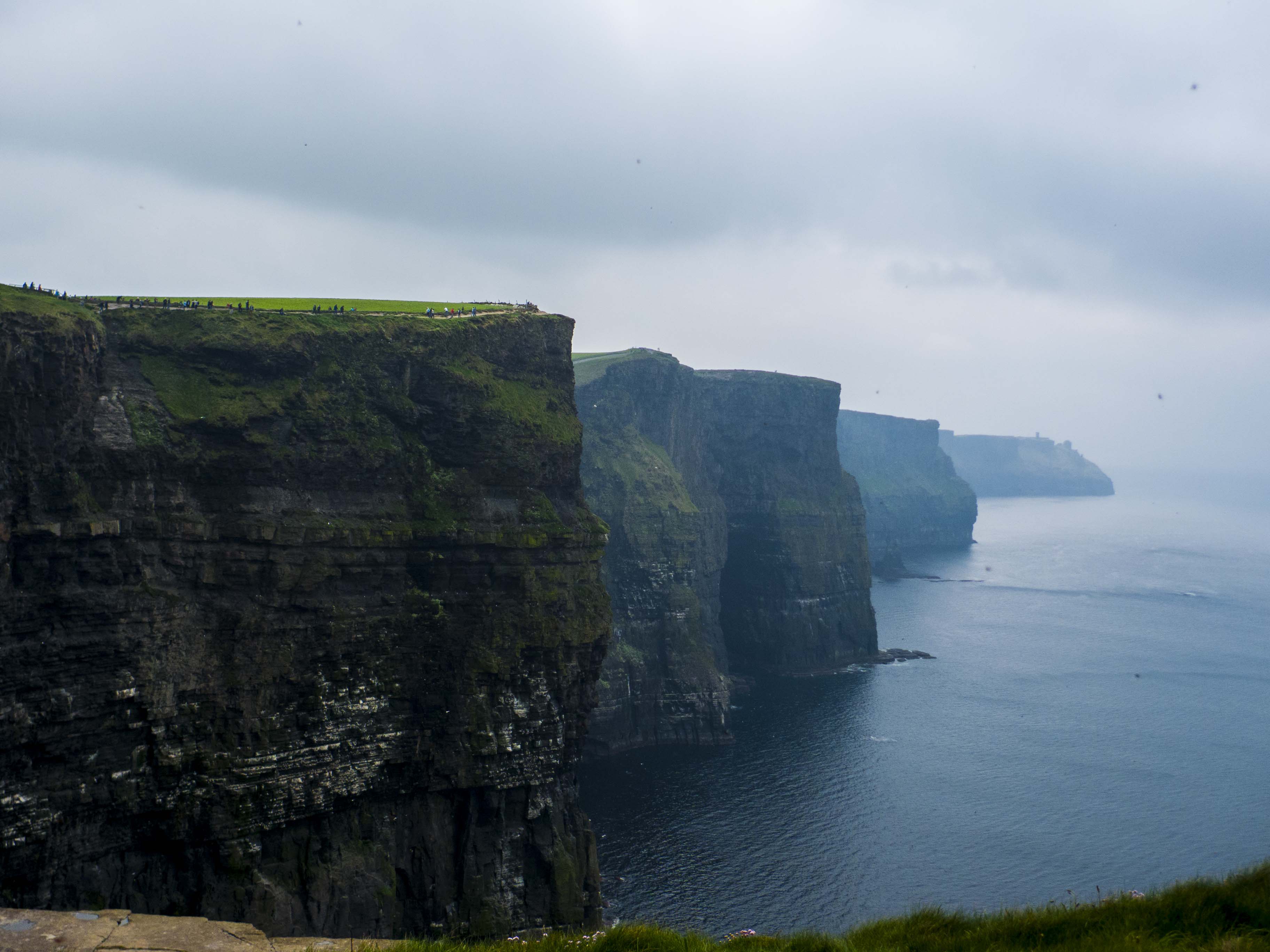
Cliff of Moher (Photo Credit: Tian Dong)

O’Brien’s Tower at Cliff of Moher (Photo Credit: Tian Dong)

Leave a Reply
Want to join the discussion?Feel free to contribute!